MyTopo
Classic USGS Halfmile Shoals Alabama 7.5'x7.5' Topo Map
Couldn't load pickup availability
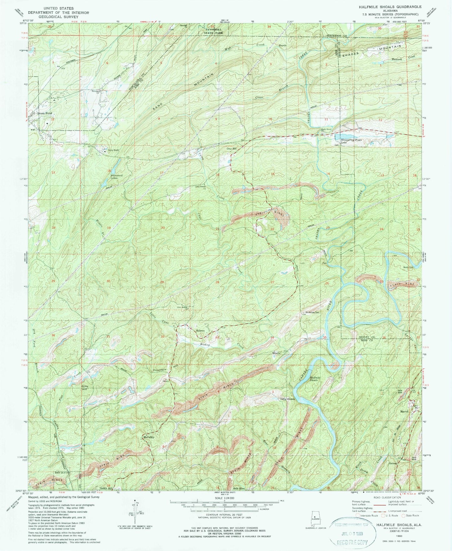
Historical USGS topographic quad map of Halfmile Shoals in the state of Alabama. Map scale may vary for some years, but is generally around 1:24,000. Print size is approximately 24" x 27"
This quadrangle is in the following counties: Bibb, Jefferson, Shelby, Tuscaloosa.
The map contains contour lines, roads, rivers, towns, and lakes. Printed on high-quality waterproof paper with UV fade-resistant inks, and shipped rolled.
Contains the following named places: Bear Branch, Belle Ellen Baptist Church, Bishop Creek, Black Creek, Booth Ford, Brimwood Lakes, Camp Booth, Camp Branch Baptist Church, Camp Branch Cemetery, Camp Creek, Cane Creek, Clear Branch, Coal Branch, Coffee Creek Slope Mine, Daley Creek, Daly Church, Dry Ford Branch, Evans Rock Slope Mine, Farrars Mill, Flat Creek, Fountain Hill, Garnsey, Gray Hill, Gray Hill School, Green Pond Presbyterian Church, Green Pond Volunteer Fire Department Station 3, Halfmile Shoals, Halls Mill, Hebron, Hebron Cemetery, Hebron School, Hickman Chapel Cemetery, Hickman Church, Higganbotham Cemetery, Lilly Shoals, Little Cane Creek, Locke Ford, Marvel, Marvel Church, Marvel Water Tower, Masena, McCulley, McCulley Hill Baptist Church, McKensey Cemetery, McKinney Cemetery, McKnight Lake, McKnight Lake Dam, Middle Branch, Mitchell Ford, Mount Nebo Baptist Church, Mud Creek, New Hebron Baptist Church, Peachtree Slope Mine, Saint Mark Catholic Church, Sand Mountain, Savage Creek, Shades Creek, Shady Grove Baptist Church, Shady Grove Cemetery, Standiford, Tannehill Church, Tannehill Furnace, Tannehill Mill, Whispering Pines Lake, ZIP Code: 35074