
MyTopo
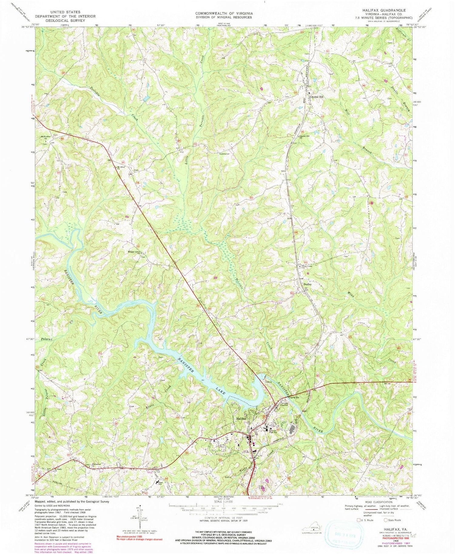
Classic USGS Halifax Virginia 7.5'x7.5' Topo Map
Couldn't load pickup availability
Historical USGS topographic quad map of Halifax in the state of Virginia. Map scale may vary for some years, but is generally around 1:24,000. Print size is approximately 24" x 27"
This quadrangle is in the following counties: Halifax.
The map contains contour lines, roads, rivers, towns, and lakes. Printed on high-quality waterproof paper with UV fade-resistant inks, and shipped rolled.
Contains the following named places: Alternative Education Center, Banister Dam, Banister Lake, Banister Town, Bethune High School, Canterbury Estates, Cowford School, Crystal Hill, Crystal Hill Cemetery, Crystal Hill Church, Crystal Hill Post Office, Crystal Hill School, District 4, Dudley, Emmanuel Church, Halifax, Halifax County, Halifax County Adult Detention Center, Halifax County Career Center, Halifax County Courthouse, Halifax County Sheriff's Office, Halifax Elementary School, Halifax Police Department, Halifax Post Office, Halifax Town Cemetery, Halifax Volunteer Fire Department, Kents Creek, Little Polecat Creek, Little Terrible Creek, McKendree, McKendree Cemetery, McKendree Church, Mount Olive Church, Mountain Road, Mountain Road Census Designated Place, Mountain Road Historic District, Murphy Grove Cemetery, Murphy Grove Church, Murphy Grove School, Patient Transport Systems, Polecat Creek, Riverview Heights, Sinai Elementary School, Terrible Creek, Terrible Creek School, Toots Creek, Town of Halifax, Virginia State Police Division 3 Area 23 Office, Winn Creek, Winn Creek Church, Winns Creek Cemetery, Youngers Store, ZIP Codes: 24539, 24558


