MyTopo
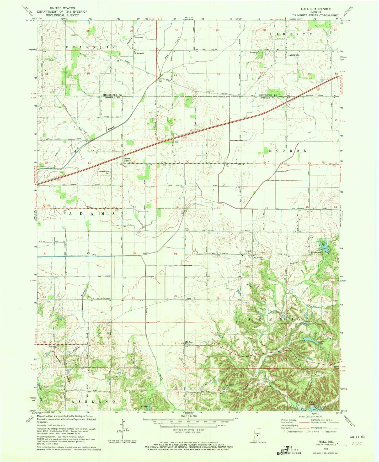
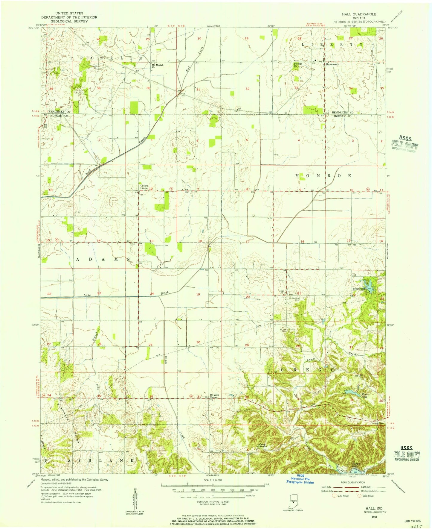
Classic USGS Hall Indiana 7.5'x7.5' Topo Map
Couldn't load pickup availability
Historical USGS topographic quad map of Hall in the state of Indiana. Map scale may vary for some years, but is generally around 1:24,000. Print size is approximately 24" x 27"
This quadrangle is in the following counties: Hendricks, Morgan.
The map contains contour lines, roads, rivers, towns, and lakes. Printed on high-quality waterproof paper with UV fade-resistant inks, and shipped rolled.
Contains the following named places: Briarwood, Briarwood Lake Dam, Camp Berean, Clements and Pate Farm, Crown Center, Crown Center Cemetery, Fire Department of Liberty Township Station 32, Gash Branch, Hall, Hall Elementary School, Hazelwood, Hazelwood Church, Herbamount, J Lake, Kivett Lake, Lake Ditch, Mount Moriah Church, Mount Pleasant Cemetery, Mount Zion Cemetery, Mount Zion Corner, Patrum Field, Shumaker Cemetery, Shumaker Ridge, Snake Creek, Township of Adams, Township of Gregg, Trinity Farm, Walnut Grove Cemetery, Winters Airport, ZIP Codes: 46157, 46180