MyTopo
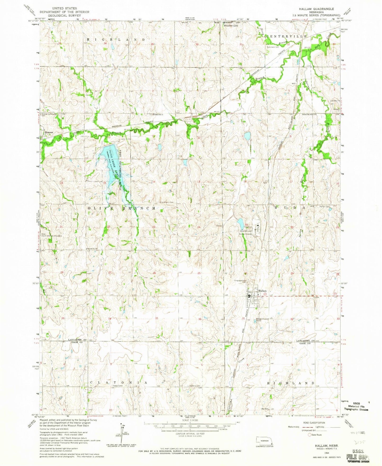
Classic USGS Hallam Nebraska 7.5'x7.5' Topo Map
Couldn't load pickup availability
Historical USGS topographic quad map of Hallam in the state of Nebraska. Map scale may vary for some years, but is generally around 1:24,000. Print size is approximately 24" x 27"
This quadrangle is in the following counties: Gage, Lancaster.
The map contains contour lines, roads, rivers, towns, and lakes. Printed on high-quality waterproof paper with UV fade-resistant inks, and shipped rolled.
Contains the following named places: Area One Campground, Area Two Campground, Buhrmann Cemetery, Clatonia Creek Dam 10-A, Clatonia Creek Reservoir 10-A, Congregational United Church of Christ, Hallam, Hallam Community Cemetery, Hallam Grain Company Elevator, Hallam Post Office, Hallam Volunteer Fire and Rescue Department, Hallam Zion Cemetery, Immanuel Cemetery, KKNB-FM (Crete), Kramer Census Designated Place, KTGL-FM (Beatrice), KUCV-FM (Lincoln), Meadow Lake Number 1, Merganser Lake, Navratil Dam, Olive Branch, Olive Branch Cemetery, Olive Branch Election Precinct, Olive Branch Post Office, Olive Branch Public School, Olive Creek Dam-Site 2 Dam, Olive Creek Lake, Olive Creek Lake State Recreation Area, Salt Creek Dam 13-A, Salt Creek Dam 13-B, Salt Creek Dam 14-1, Salt Creek Dam 14-A, Salt Creek Dam 25-A, Salt Creek Dam 29-5, Salt Creek Dam 5-7, Salt Creek Dam 5-A, Salt Creek Dam 6-4, Salt Creek Dam 6-A, Salt Creek Dam U-36, Salt Creek Reservoir 13-A, Salt Creek Reservoir 13-B, Salt Creek Reservoir 14-1, Salt Creek Reservoir 14-A, Salt Creek Reservoir 25-A, Salt Creek Reservoir 29-5, Salt Creek Reservoir 5-7, Salt Creek Reservoir 6-4, Salt Creek Reservoir 6-A, Salt Creek Reservoir U-36, School Number 11, School Number 61, Sheldon, Spring Branch, Star School, Township of Olive Branch, United Methodist Church of Hallam, Village of Hallam, ZIP Codes: 68368, 68404