MyTopo
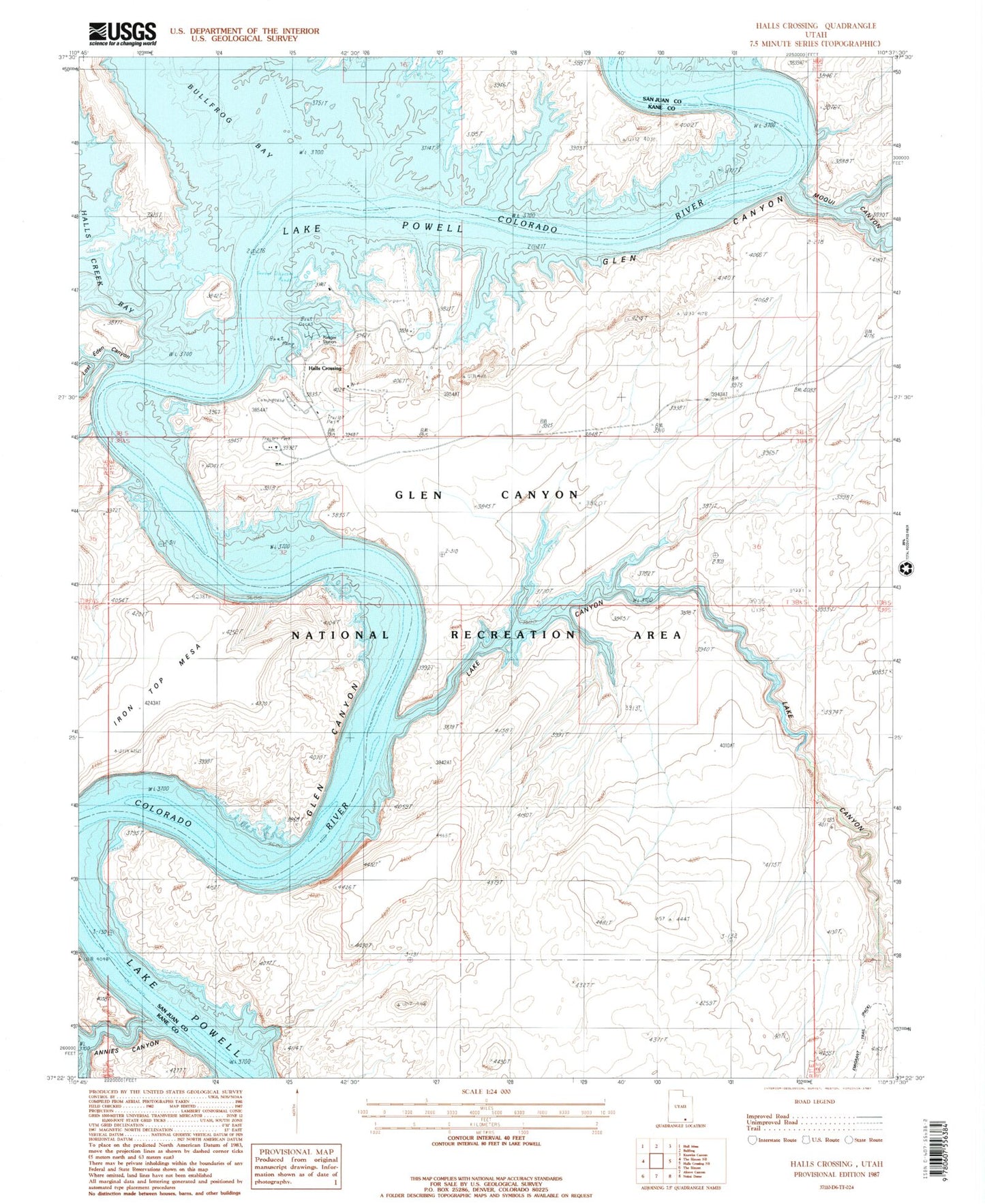
Classic USGS Halls Crossing Utah 7.5'x7.5' Topo Map
Couldn't load pickup availability
Historical USGS topographic quad map of Halls Crossing in the state of Utah. Typical map scale is 1:24,000, but may vary for certain years, if available. Print size: 24" x 27"
This quadrangle is in the following counties: Kane, San Juan.
The map contains contour lines, roads, rivers, towns, and lakes. Printed on high-quality waterproof paper with UV fade-resistant inks, and shipped rolled.
Contains the following named places: Moqui Canyon, Lake Canyon, Halls Crossing Airport (historical), Halls Crossing Campground, Halls Crossing RV Campground, The Hoskaninni Dredge (historical), Schock Rapids (historical), Halls Crossing, The Amphitheater, Amphitheater Bar (historical), Anderson Bar (historical), Anderson Camp (historical), Annies Canyon, Aztec Rapids (historical), Big Bar, Boston Bar (historical), Burro Bar (historical), Camp Stone (historical), Gretchen Bar (historical), Halls Bar (historical), Lost Eden Canyon, New Year Bar (historical), Schock Trail Base (historical), Halls Crossing Marina, Halls Crossing Census Designated Place