MyTopo
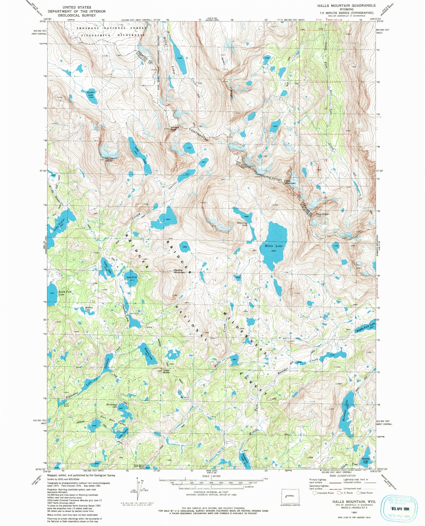
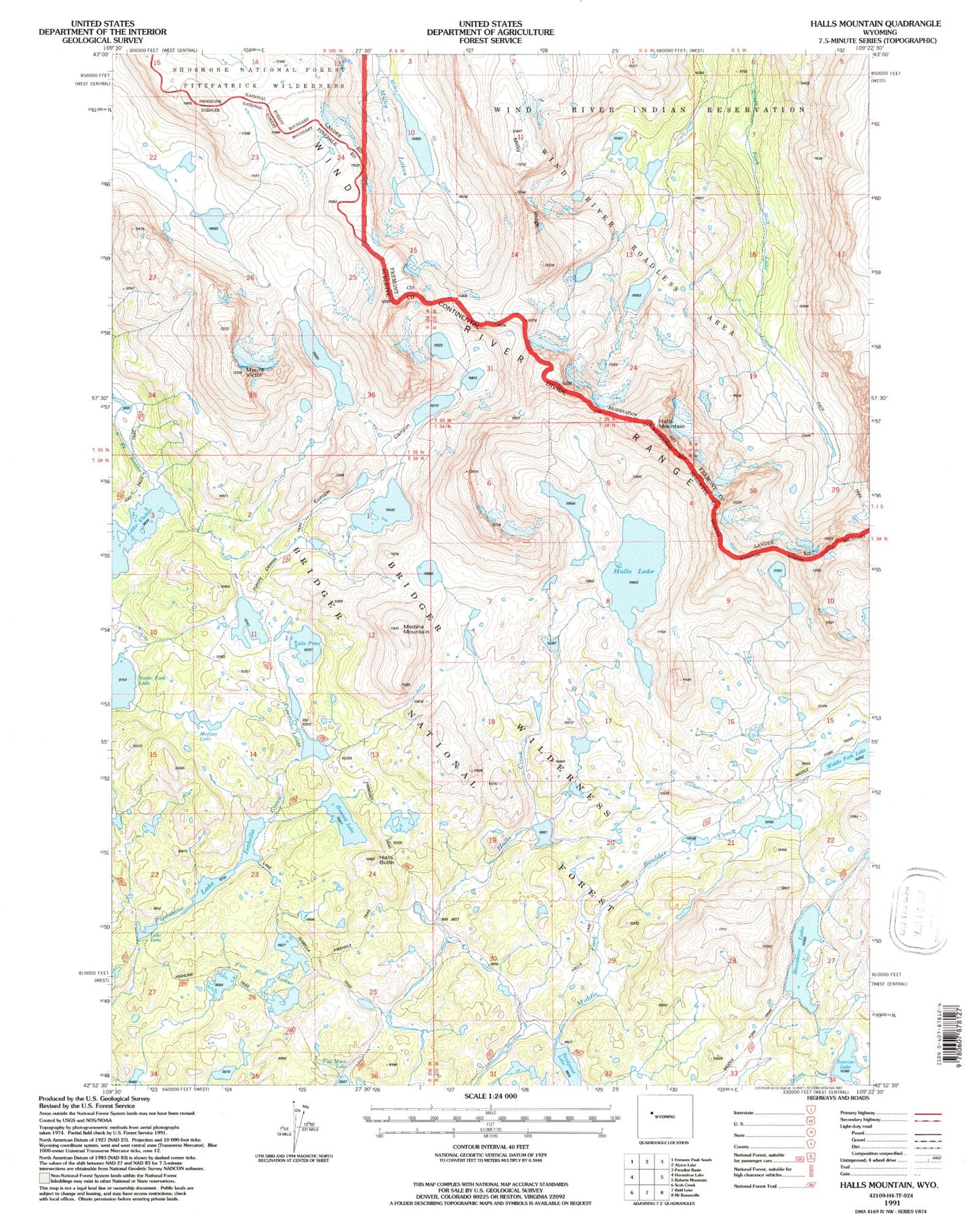
USGS Classic Halls Mountain Wyoming 7.5'x7.5' Topo Map
Couldn't load pickup availability
Historical USGS topographic quad map of Halls Mountain in the state of Wyoming. Scale: 1:24000. Print size: 24" x 27"
This quadrangle is in the following counties: Fremont, Sublette.
The map contains contour lines, roads, rivers, towns, lakes, and grids including latitude / longitude and UTM / MGRS. Printed on high-quality waterproof paper with UV fade-resistant inks.
Contains the following named places: Europe Canyon, Europe Peak, Fire Hole Lakes, Glacier Lake, Halls Butte, Halls Lake, Halls Mountain, Howard Lake, Lake Isabella, Long Lake, Medina Lake, Medina Mountain, Milky Ridge, Photo Pass, Pipe Organ, Pipestone Lakes, Lake Prue, Rainbow Lake, Sandpoint Lake, Sunrise Lake, Lake Susan, Valley Lake, Lake Vera, Lake Victor, Mount Victor, Halls Lake Trail, Europe Canyon Trail, Wilderness Lake, Shoestring Lake, Middle Fork Trail, Lake Isabella Trail, Firehole Trail