
MyTopo
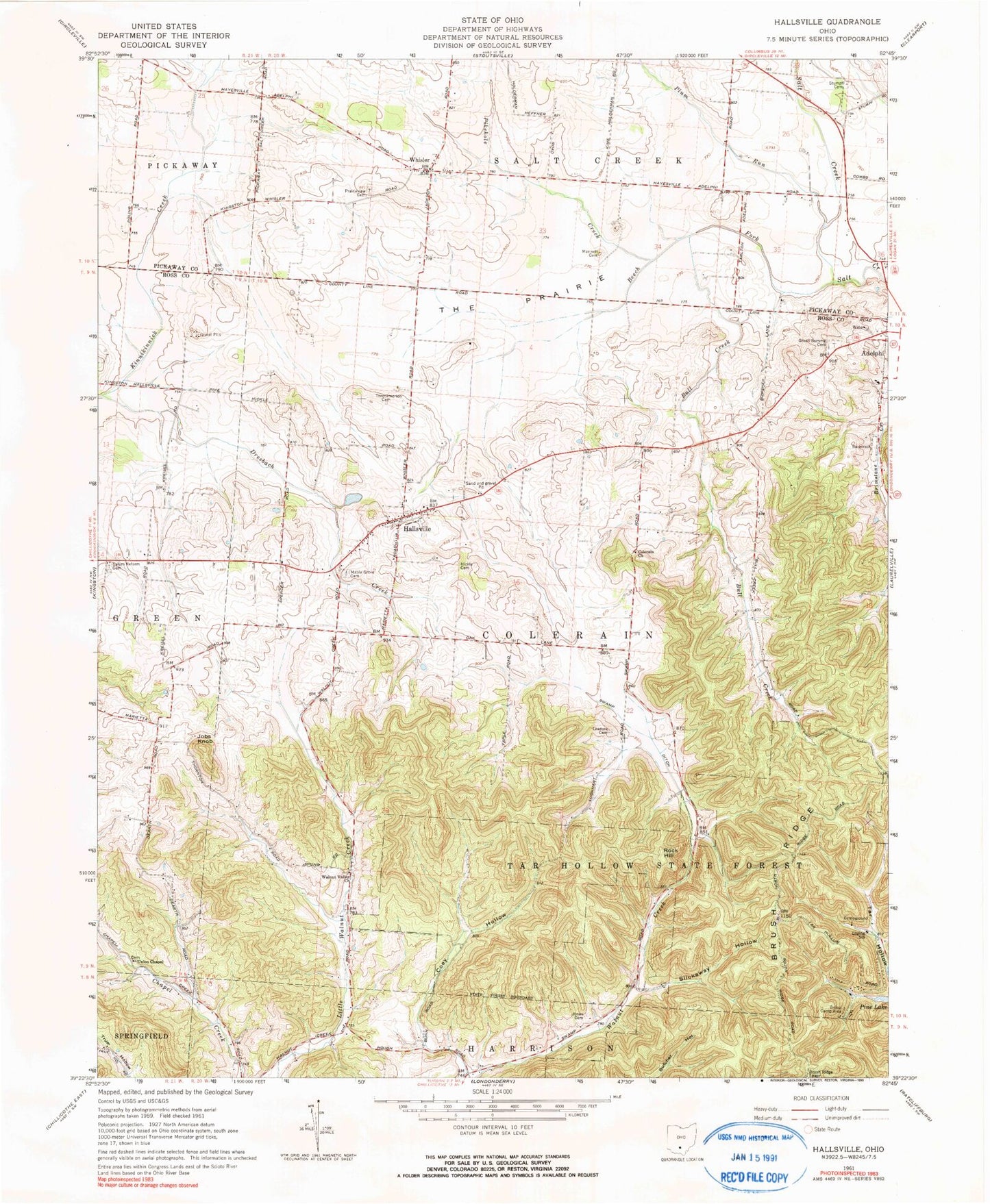
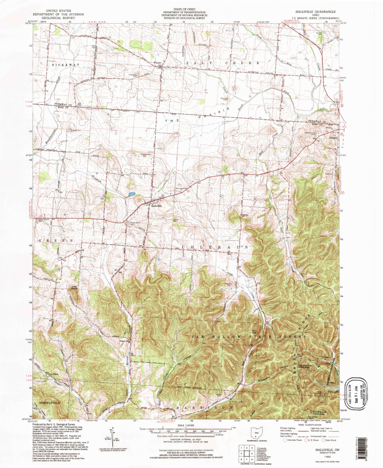
Classic USGS Hallsville Ohio 7.5'x7.5' Topo Map
Couldn't load pickup availability
Historical USGS topographic quad map of Hallsville in the state of Ohio. Typical map scale is 1:24,000, but may vary for certain years, if available. Print size: 24" x 27"
This quadrangle is in the following counties: Pickaway, Ross.
The map contains contour lines, roads, rivers, towns, and lakes. Printed on high-quality waterproof paper with UV fade-resistant inks, and shipped rolled.
Contains the following named places: Beech Fork, Brush Ridge, Bull Creek, Coey Hollow, Colerain Church, Dresbach Creek, Green Summit Cemetery, Hickle Cemetery, Jones Cemetery, Leasure Cemetery, Maple Grove Cemetery, Monnett Cemetery, Pikehole Creek, Plum Run, Prairieview Cemetery, Salem Reform Cemetery, Slickaway Hollow, Stumpf Cemetery, Swamp Ditch, The Prairie, Throckmorton Cemetery, Union Chapel, Walnut Valley Church, Jobs Knob, Rock Hill, Pleasant Valley Church (historical), Swamp School (historical), Oakgrove School (historical), Whisler, Hallsville, Brush Ridge Lookout Tower, Mission Field, Township of Colerain, Salem Reformed Church, Union Chapel Cemetery, Whisler Post Office (historical), Hallsville Post Office, Saltcreek - Tarlton Volunteer Fire Department Station 2, Colerain Township Fire Department