MyTopo
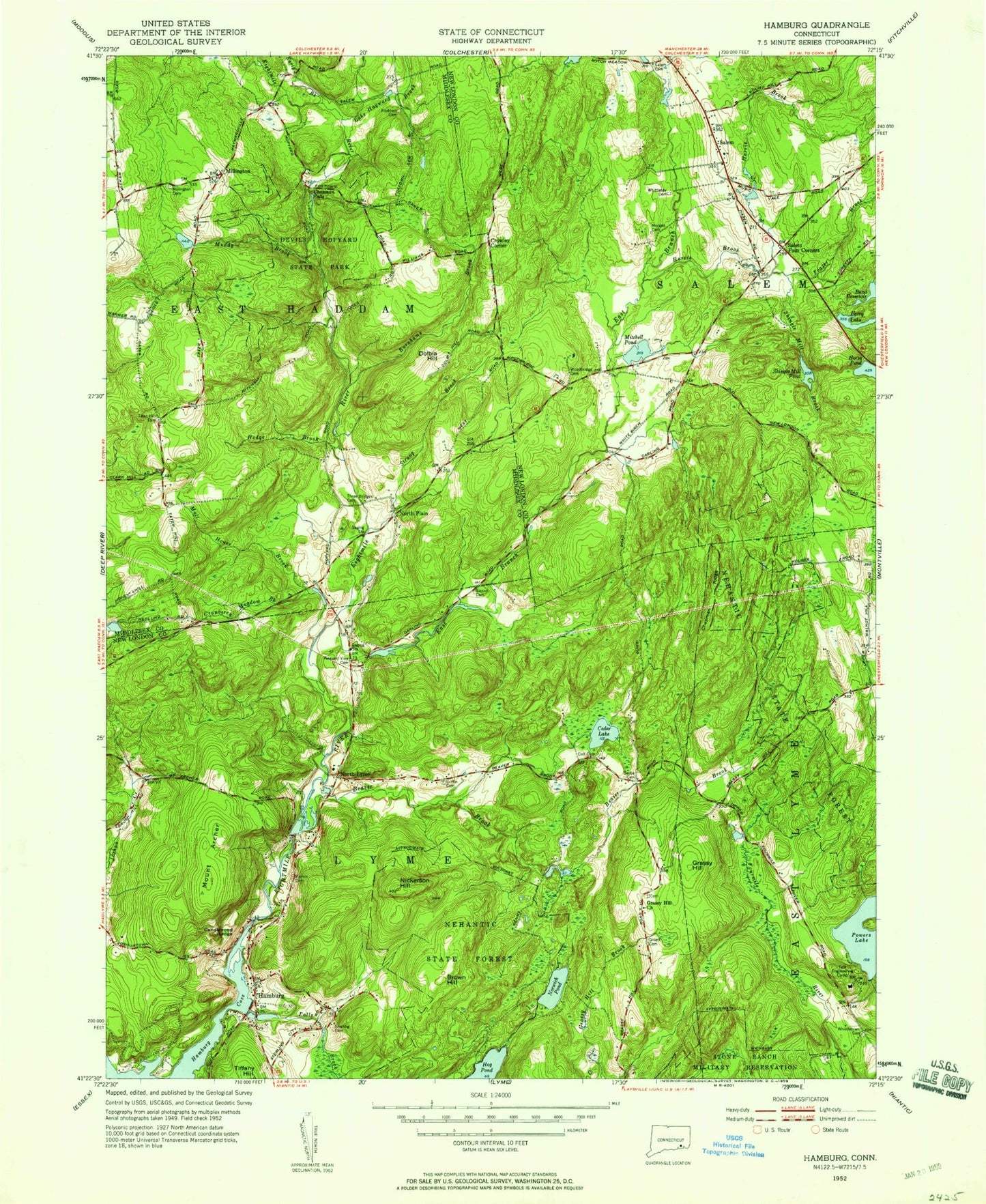
Classic USGS Hamburg Connecticut 7.5'x7.5' Topo Map
Couldn't load pickup availability
Historical USGS topographic quad map of Hamburg in the state of Connecticut. Typical map scale is 1:24,000, but may vary for certain years, if available. Print size: 24" x 27"
This quadrangle is in the following counties: Middlesex, New London.
The map contains contour lines, roads, rivers, towns, and lakes. Printed on high-quality waterproof paper with UV fade-resistant inks, and shipped rolled.
Contains the following named places: Alexander Pond, Mount Archer, Beaver Brook, Beebe Cemetery, Blackwells Pond, Bond Reservoir, Brown Hill, Burnhams Brook, Candlewood Ledge, Cedar Lake, Cedar Pond Brook, Chapman Falls, Chapman Ridge, Coult Cemetery, Cranberry Meadow Brook, Devils Hopyard State Park, Dolbia Hill, Early Brook, East Branch Eightmile River, Ed Bills Pond, Falls Brook, Foxtown Cemetery, Fraser Brook, Gillett Cemetery, Grassy Hill, Grassy Hill Church, Griffin Cemetery, Hamburg, Harris Brook, Hedge Brook, Horse Pond, Lake Hayward Brook, Macks Mill Hill, Malt House Brook, Millington Cemetery, Mitchell Pond, Morgan Cemetery, Moulsons Pond, Muddy Brook, Nehantic State Forest, Nickerson Hill, North Lyme, North Plain, North Plain Cemetery, Norwich Pond, Pleasant View Cemetery, Powers Lake, Salem Cemetery, Salem Four Corners, Shingle Mill Brook, Shingle Mill Pond, Sisson Cemetery, Square Ranch, Sterling Cemetery, Strongs Brook, Tater Hill Cemetery, Tiffany Hill, Tisdale Brook, Urbanik Pond, Wagner Pond, Whistletown Cemetery, Whittlesey Cemetery, Will Cone Pond, Woodbridge Cemetery, Yale Engineering Camp, Crowley Corner, Millington, Salem, Devils Hopyard Field, Fetske Seaplane Base, Town of Lyme, Town of Salem, Powers Lake Dam, Dodson Pond Dam, Dodson Pond, Zemko Pond Dam, Zemko Pond, E A Whitford Pond Dam, E A Whitford Pond, Mitchell Pond Dam, Shingle Mill Pond Dam, Witch Meadow Pond, Jewitt Corner, Tater Hill, Beebe Corner, Cedar Hill, Congregational Church of Salem Cemetery, Grassy Hill (historical), Hamburg Bridge, Hamburg Bridge Historic District, Honey Hill, Lyme Consolidated School, Lyme Public Library, Lyme Town Hall, Salem Congregational Church, Salem Elementary School, Salem Historical Society Building, Salem Post Office, Salem Town Hall, Sterling City, Wheatfield Ridge, Lyme Volunteer Fire Department, Lyme Ambulance Association, Salem Resident State Patrol Office, Eightmile Wild and Scenic River