MyTopo
Classic USGS Hamilton East Texas 7.5'x7.5' Topo Map
Couldn't load pickup availability
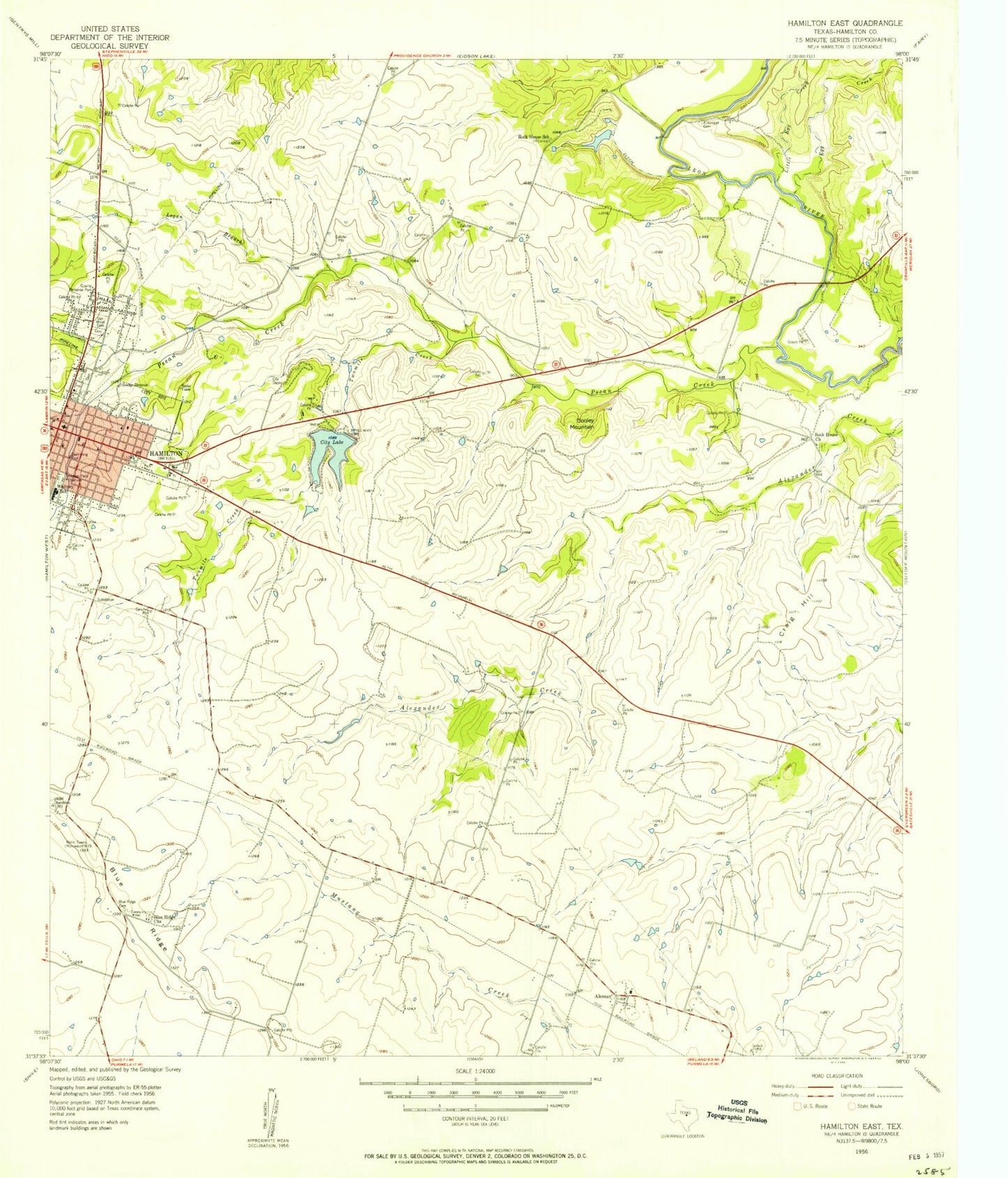
Historical USGS topographic quad map of Hamilton East in the state of Texas. Map scale may vary for some years, but is generally around 1:24,000. Print size is approximately 24" x 27"
This quadrangle is in the following counties: Hamilton.
The map contains contour lines, roads, rivers, towns, and lakes. Printed on high-quality waterproof paper with UV fade-resistant inks, and shipped rolled.
Contains the following named places: Aleman, Blue Ridge, Blue Ridge Cemetery, Blue Ridge Church, City Lake, City of Hamilton, City of Hamilton Dam, Craig Hill, Dooley Mountain, Egg Creek, First Baptist Church, First Presbyterian Church, Hamilton, Hamilton City Hall, Hamilton County, Hamilton County Historical Museum, Hamilton General Hospital, Hamilton Post Office, Hamilton Volunteer Fire Department, Independent Order of Odd Fellows Cemetery, Kirkendall Cemetery, Kooken Field Stadium, Little Egg Creek, Logan Branch, Muxworthy Airport, Oak Wood Cemetery, Pecan Creek, Rock House Church, Rock House School, Saint Pauls School, Twomile Creek, Whitney School, Yacht Club Airport