MyTopo
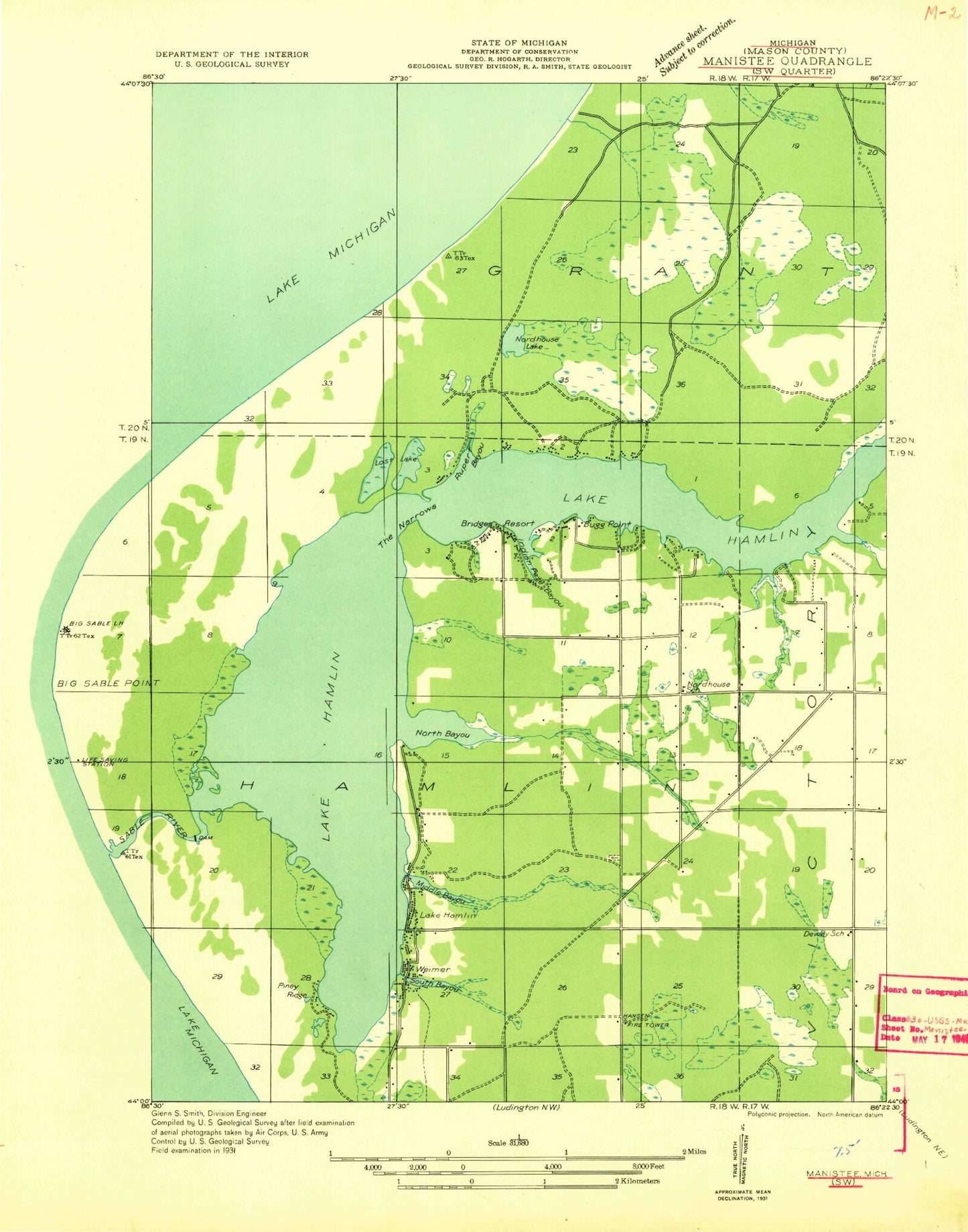
Classic USGS Hamlin Lake Michigan 7.5'x7.5' Topo Map
Couldn't load pickup availability
Historical USGS topographic quad map of Hamlin Lake in the state of Michigan. Typical map scale is 1:24,000, but may vary for certain years, if available. Print size: 24" x 27"
This quadrangle is in the following counties: Mason.
The map contains contour lines, roads, rivers, towns, and lakes. Printed on high-quality waterproof paper with UV fade-resistant inks, and shipped rolled.
Contains the following named places: Lost Lake, Ludington State Park, Middle Bayou, Nordhouse School, Piney Ridge, Rupert Bayou, South Bayou, Weimer, Bugg Point, Dennis Creek, Hamlin Lake, Hamlin Lake, Indian Pete Bayou, Lost Lakes, North Bayou, Porter Creek, Sacred Heart Church, The Narrows, Victory Memorial Park, Grant Lookout Tower, Bridges Resort, WKLA-FM (Ludington), Township of Hamlin, Weimer Post Office (historical), Nordhouse Dunes Wilderness, Powell Memorial Park, Sacred Heart Cemetery, Hamlin Village Cemetery, Piney Ridge, Nordhouse Lake, Lake Michigan Recreation Area, Tamarac Village Mobile Home Park, Hamlin Town Hall, Lakeview Campsite, Hamlin Dam, Ludington State Park Beechwood Campground, South Bayou Park, Sacred Heart Catholic Cemetery, Wilson Township Wilson Hill Park, Hamlin Township Fire Department