MyTopo
Classic USGS Hamlin New York 7.5'x7.5' Topo Map
Couldn't load pickup availability
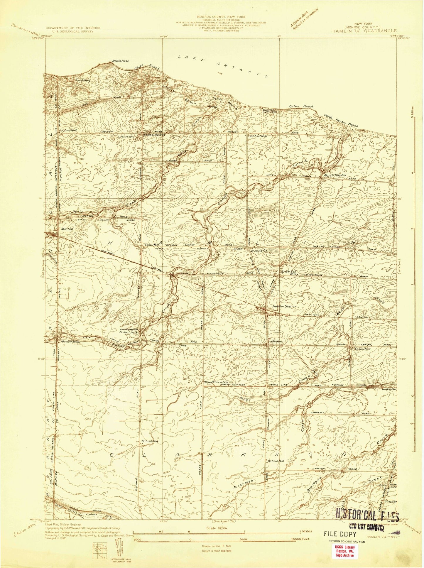
Historical USGS topographic quad map of Hamlin in the state of New York. Map scale may vary for some years, but is generally around 1:24,000. Print size is approximately 24" x 27"
This quadrangle is in the following counties: Monroe, Orleans.
The map contains contour lines, roads, rivers, towns, and lakes. Printed on high-quality waterproof paper with UV fade-resistant inks, and shipped rolled.
Contains the following named places: Bluff Beach, Breslawski Farms, Brick School, Brockport Waterworks, Brockport Waterworks Pumping Station, Brockport Yacht Club, Christ Chapel Wesleyan Church, Clarkson Union Cemetery, Devils Nose, Doan Family Farms, Hamlin, Hamlin Beach State Park, Hamlin Census Designated Place, Hamlin Fire Department, Hamlin Post Office, Hamlin Public Library, Hamlin Veterans of Foreign Wars and Senior Center, Hamlin Volunteer Ambulance Corps, Harper Park, Heberle Farms, Hurd Orchards, Kendall Mills, Kirbys Farm, Lakeside Cemetery, Lakeside School, Leverenz Farms, Morton, Morton Fire Company, Morton Post Office, Morton Union Cemetery, Mount Olive Missionary Baptist Church, North Hamlin, Olive Branch School, Onteo Beach, Otis, Para-Tech Airport, Partyka Farms, Reis Farms, Saint John Child Care Center, Saint Johns School, Sandy Creek, Sandy Harbour Beach, School Number 12, School Number 13, School Number 2, School Number 4, School Number 7, School Number 8, Town of Clarkson, Town of Hamlin, Troutburg, Yanty Creek, Yanty Marsh, ZIP Code: 14464