MyTopo
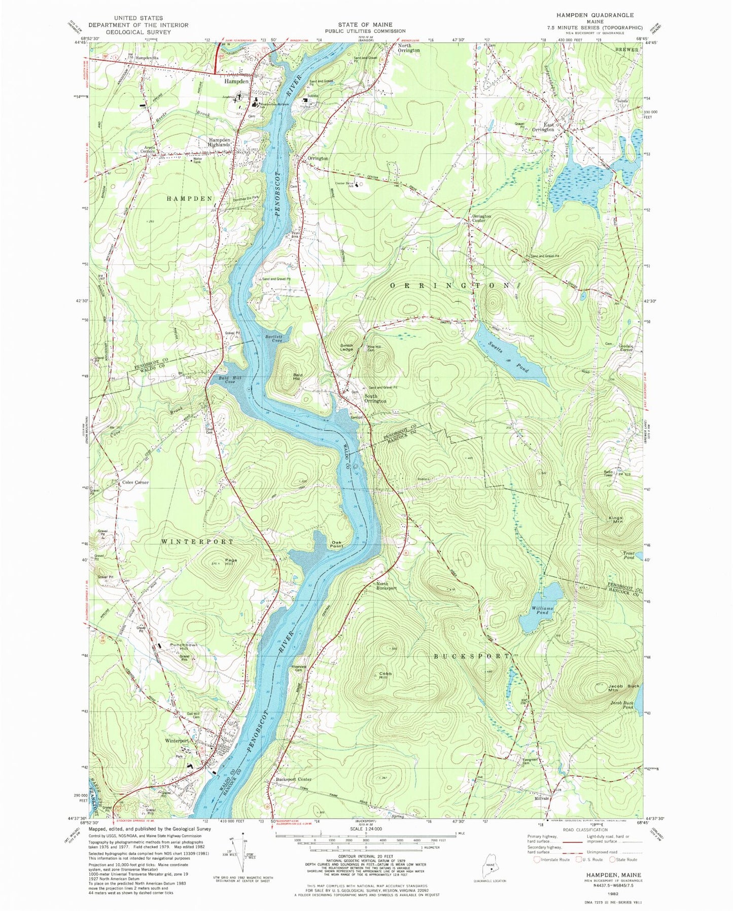
Classic USGS Hampden Maine 7.5'x7.5' Topo Map
Couldn't load pickup availability
Historical USGS topographic quad map of Hampden in the state of Maine. Map scale may vary for some years, but is generally around 1:24,000. Print size is approximately 24" x 27"
This quadrangle is in the following counties: Hancock, Penobscot, Waldo.
The map contains contour lines, roads, rivers, towns, and lakes. Printed on high-quality waterproof paper with UV fade-resistant inks, and shipped rolled.
Contains the following named places: Arey, Areys Corners, Bald Hill, Bald Hill Cove, Bald Hill Reach, Bartlett Cove, Bucksport Center, Center Drive School, Cobb Hill, Coles Corner, Cove Brook, Cove Cemetery, Creative Playground, Dean Hill Cemetery, Dorothea Dix Park, Earl C McGraw School, East Orrington, East Orrington Congregational Church, East Orrington Dam, Evergreen Hill Cemetery, First Congregational Church, George B Weatherbee School, Goodale Cemetery, Goodale Corner, Hampden, Hampden Academy, Hampden Census Designated Place, Hampden Emergency Medical Services, Hampden Fire Department, Hampden Highlands, Hampden Highlands United Methodist Church, Hampden Police Department, Hampden Post Office, Hampden Station, Jacob Buck Mountain, Kings Mountain, Leroy H Smith School, Locust Grove Cemetery, Lura E Hoit Pool, Mill Creek, Millvale, North Bucksport, North Orrington, North Winterport, Oak Hill Cemetery, Oak Point, Orrington, Orrington Center, Orrington Fire Station and Rescue Department, Orrington Police Department, Orrington Post Office, Orrington Public Library, Page Hill, Pine Hill Cemetery, Punchbowl Hill, Reeds Brook, Reeds Brook Middle School, Riverview Cemetery, Saint Matthews Catholic Church, Samuel L Wagner Middle School, Smith Ledge, Snub Point, Souadabscook Dam, Souadabscook Stream, Souadabscook Stream Reservoir, South Orrington, Swetts Pond, Town of Orrington, Weatherbee McGraw School, Williams Pond, Winterport, Winterport Census Designated Place, Winterport Memorial Library, Winterport Post Office, Winterport Volunteer Fire Department, WKIT-FM (Brewer), ZIP Code: 04474