MyTopo
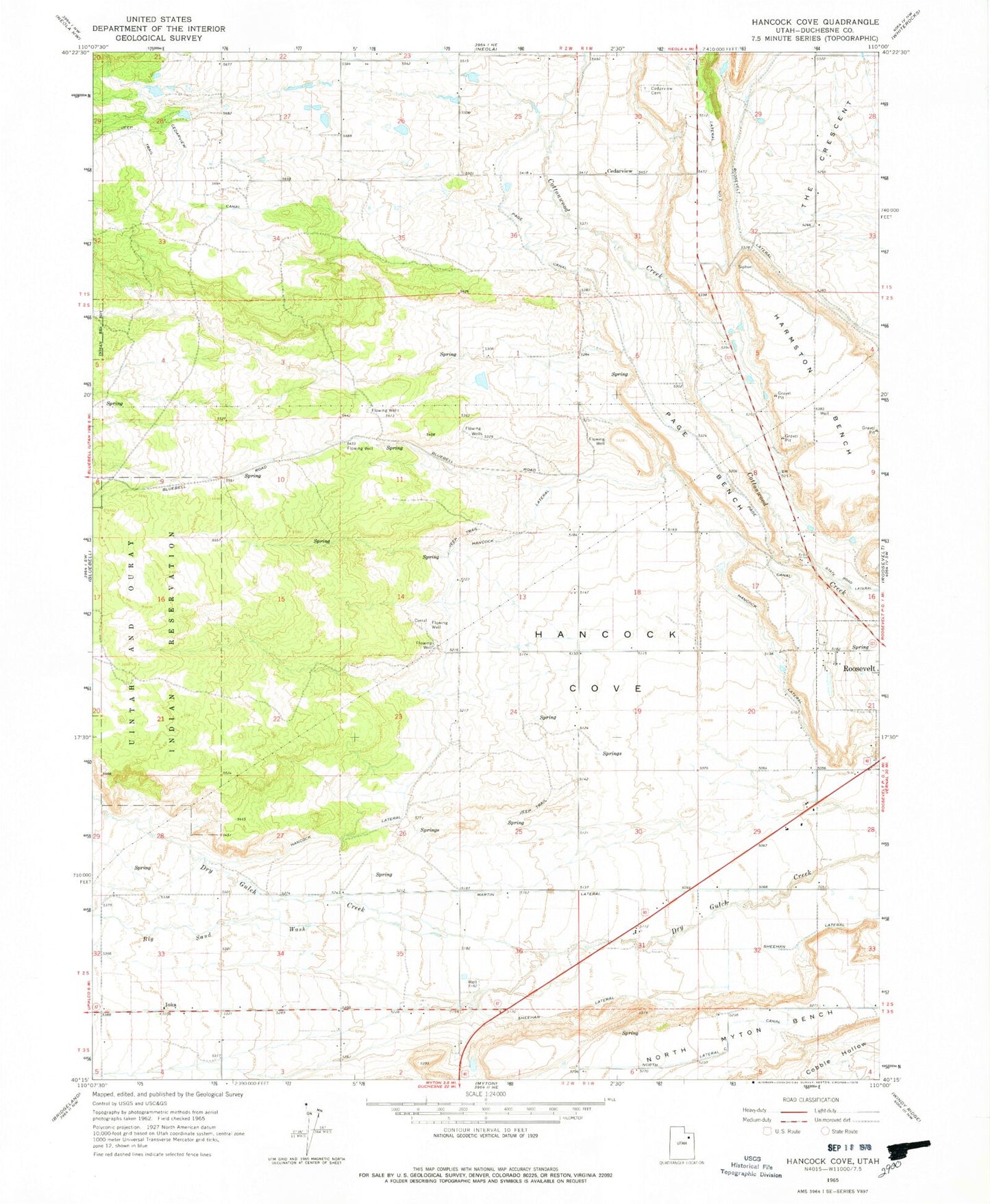
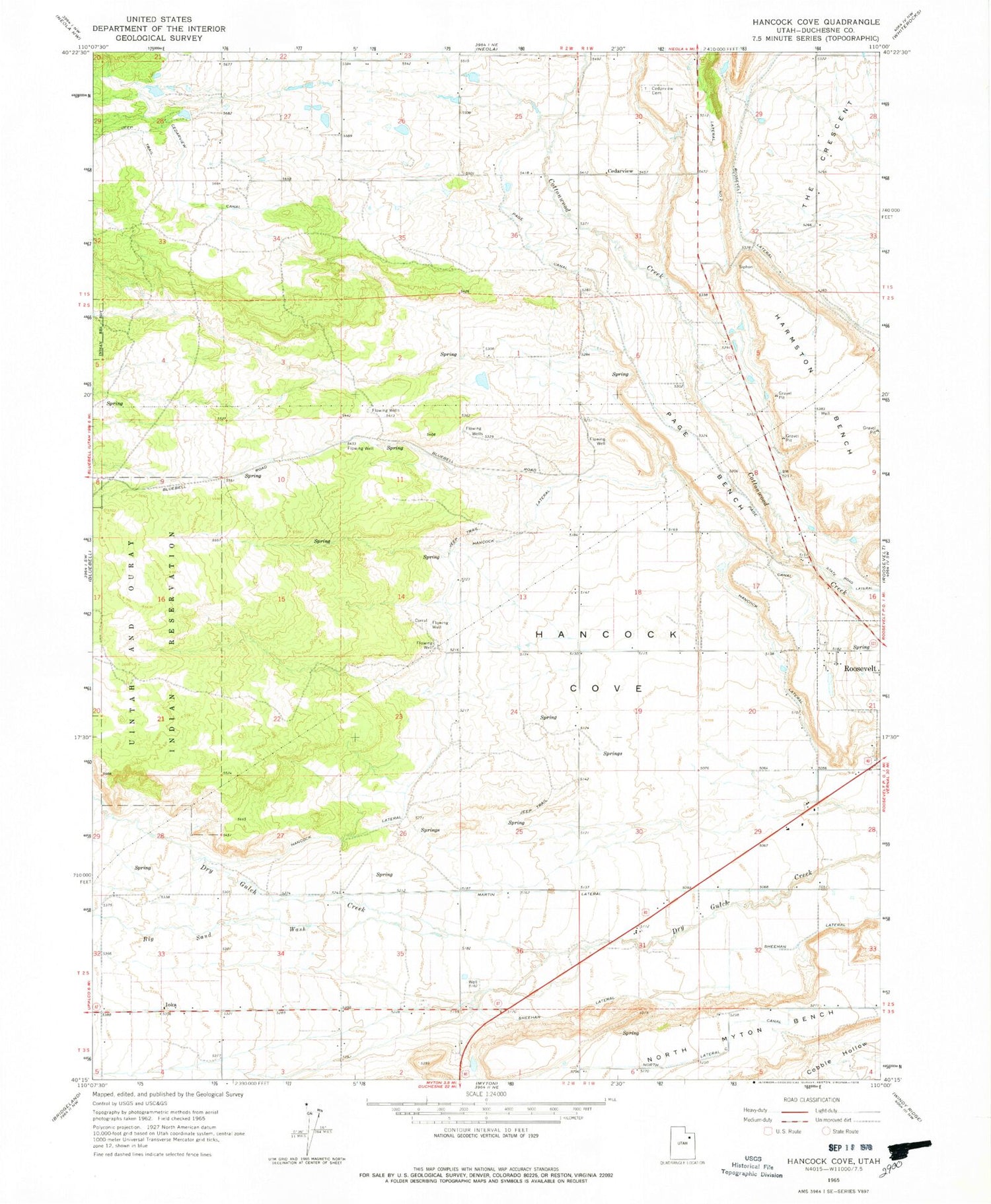
Classic USGS Hancock Cove Utah 7.5'x7.5' Topo Map
Couldn't load pickup availability
Historical USGS topographic quad map of Hancock Cove in the state of Utah. Map scale may vary for some years, but is generally around 1:24,000. Print size is approximately 24" x 27"
This quadrangle is in the following counties: Duchesne.
The map contains contour lines, roads, rivers, towns, and lakes. Printed on high-quality waterproof paper with UV fade-resistant inks, and shipped rolled.
Contains the following named places: Big Sand Wash, Cedarview, Cedarview Cemetery, City of Roosevelt, Duchesne County Hospital Heliport, Hancock Cove, Hancock Lateral, Harmston Bench, Ioka, Martin Lateral, Page Bench, Page Canal, Roosevelt Baptist Church, Roosevelt Lateral, Roosevelt Municipal Airport, Sheehan Lateral, The Church of Jesus Christ of Latter Day Saints, The Crescent, ZIP Code: 84066