MyTopo
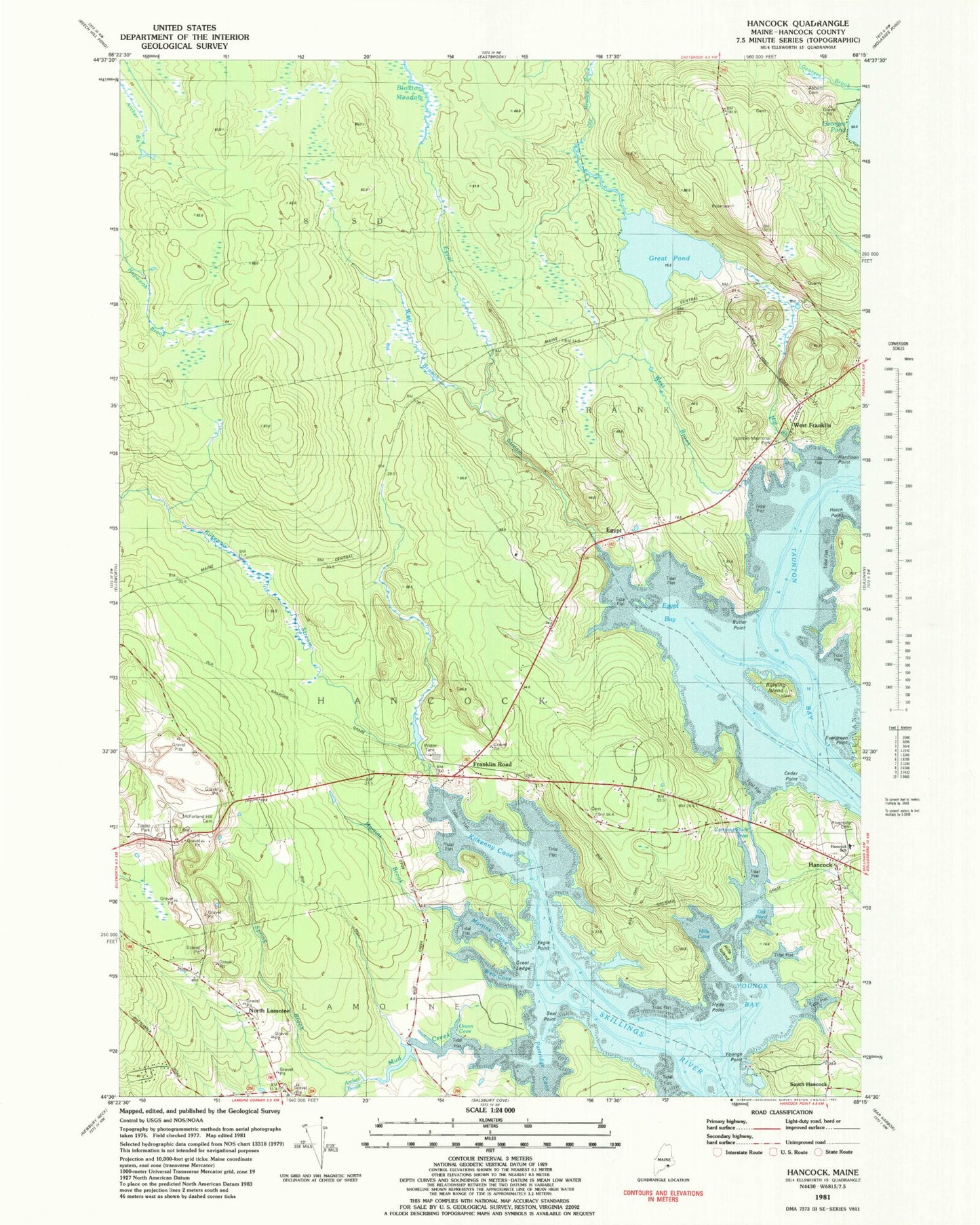
Classic USGS Hancock Maine 7.5'x7.5' Topo Map
Couldn't load pickup availability
Historical USGS topographic quad map of Hancock in the state of Maine. Map scale may vary for some years, but is generally around 1:24,000. Print size is approximately 24" x 27"
This quadrangle is in the following counties: Hancock.
The map contains contour lines, roads, rivers, towns, and lakes. Printed on high-quality waterproof paper with UV fade-resistant inks, and shipped rolled.
Contains the following named places: Abbott Field Cemetery, Archer Brook, Burying Island, Butler Point, Carrying Place Inlet, Cedar Point, Church of Christ, Eagle Point, Egypt, Egypt Bay, Egypt Stream, Fletchers Landing Township, Franklin Memorial Park, Franklin Road, Great Ledge, Great Pond, Hancock, Hancock County, Hancock Grammar School, Hancock Police Department, Hancock Volunteer Fire Department Station 1, Hancock Volunteer Fire Department Station 2, Hardison Point, Hatch Point, Hills Cove, Hills Island, Hyde Point, Kilkenny Cove, Kilkenny Stream, Martins Brook, Martins Cove, McFarland Hill Cemetery, Mill Brook, Mill Pond, Mud Creek, North Lamoine, Old Meadow Brook, Old Pond, Partridge Cove, Riverside Cemetery, Seal Point, South Hancock, Spring Brook, Town of Hancock, Unorganized Territory of Central Hancock, Urann Cove, Weir Cove, West Branch Egypt Stream, West Brook, West Franklin, WPRG-FM (Bar Harbor), Youngs Bay, Youngs Point, ZIP Code: 04640