MyTopo
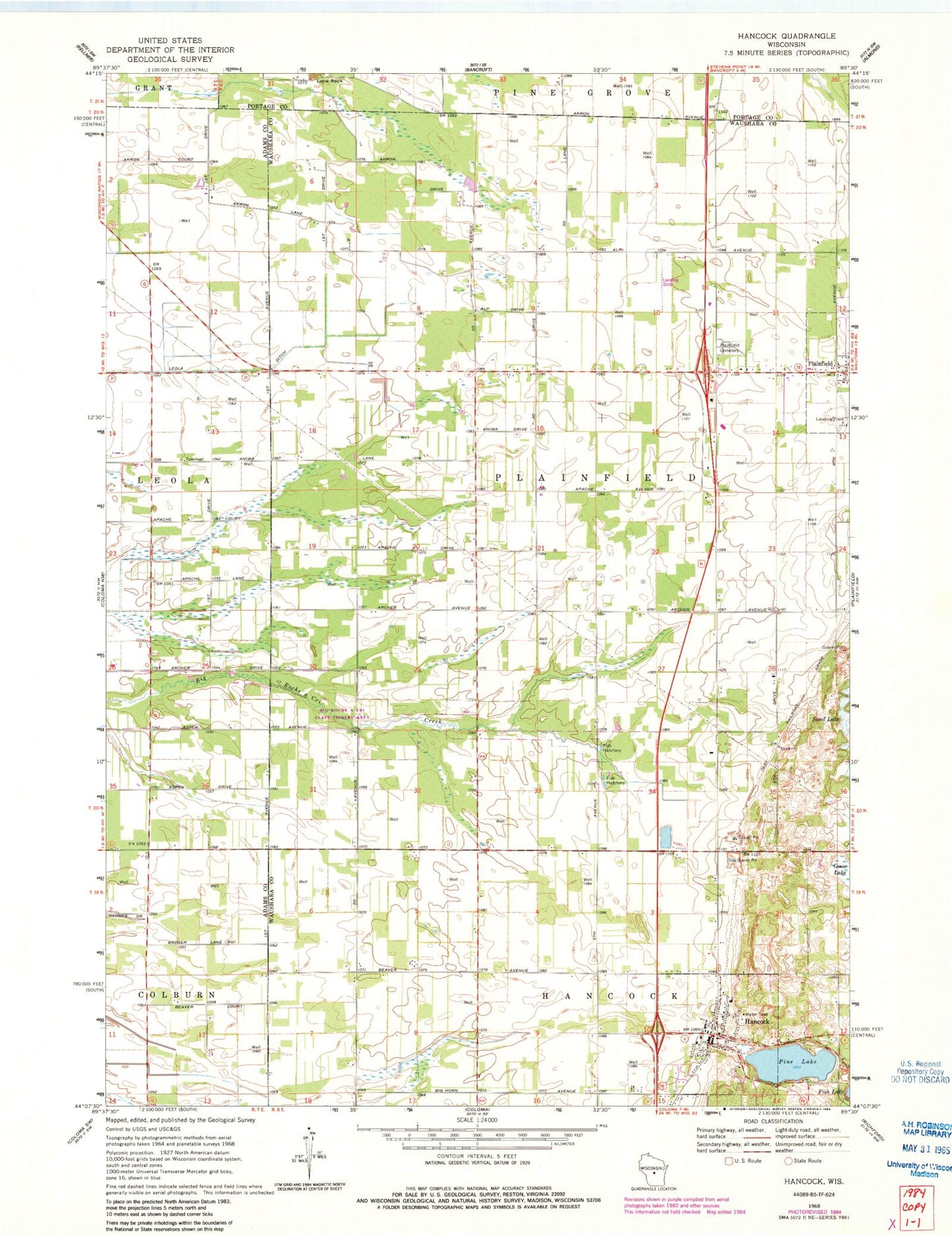
Classic USGS Hancock Wisconsin 7.5'x7.5' Topo Map
Couldn't load pickup availability
Historical USGS topographic quad map of Hancock in the state of Wisconsin. Map scale may vary for some years, but is generally around 1:24,000. Print size is approximately 24" x 27"
This quadrangle is in the following counties: Adams, Portage, Waushara.
The map contains contour lines, roads, rivers, towns, and lakes. Printed on high-quality waterproof paper with UV fade-resistant inks, and shipped rolled.
Contains the following named places: Bucky's Airpark, Goose Lake, Hancock, Hancock Post Office, Hancock Volunteer Fire Department, Leola Ditch, Pine Lake, Plainfield Cemetery, Pole Bridge School, Rathermel School, Runway Leasing Inc Number 1 Airport, Town of Plainfield, Village of Hancock, ZIP Codes: 54943, 54966