MyTopo
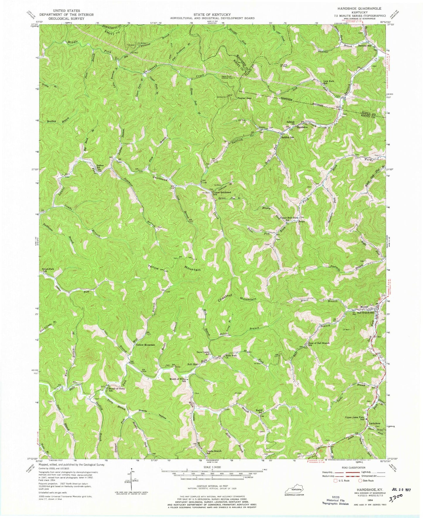
Classic USGS Handshoe Kentucky 7.5'x7.5' Topo Map
Couldn't load pickup availability
Historical USGS topographic quad map of Handshoe in the state of Kentucky. Map scale may vary for some years, but is generally around 1:24,000. Print size is approximately 24" x 27"
This quadrangle is in the following counties: Breathitt, Floyd, Knott, Magoffin.
The map contains contour lines, roads, rivers, towns, and lakes. Printed on high-quality waterproof paper with UV fade-resistant inks, and shipped rolled.
Contains the following named places: Ball Branch, Ball Branch Old Regular Baptist Church, Ball Branch School, Ball Creek Community Park, Ball Creek Fire Department, Balls Fork Church, Balls Fork Old Regular Baptist Church, Big Bend Branch, Big Firecoal Branch, Bolen Branch, Bolen Cemetery, Bolyn, Bruce Branch, Brushy Fork, Bucks Branch, Chestnut Mountain, Click Cemetery, Combs Branch, Combs Branch School, Dave Conley School, Dismal Branch, Elmrock Post Office, Estill Smith Cemetery, Fitch Branch, Flat Rockhouse Branch, Handshoe, Handshoe Post Office, Head of Ball Branch School, Hicks Branch, House Seat Branch, Jones Fork Fire Department, Jones Fork School, Joshua Branch, Joshua School, Knob Bottom Branch, Larkslane, Lick Branch, Lick Fork, Lick Fork School, Little Branch, Little Firecoal Branch, Long Branch, Long Fork, Lower Twin Branch, Mill Branch, Mine Branch, Mousie, Mousie Baptist Church, Mousie Division, Mousie Post Office, Mouth of Terry School, Mouth of Wiley School, Newman Branch, Oldhouse Branch, Patten Fork School, Patton Fork, Plum Branch, Plummer Branch, Pond Branch, Poplar Gap, Quicksand School, Raccoon Branch, Raccoon School, Ratliff School, Right Fork Fourmile Branch, Rock Fork, Rockford United Christian Baptist Church, Rockhouse Branch, Saltlick Church, Saltlick Pentecostal Church, Saltlick School, Saltlick United Baptist Church, Sandlick Branch, Scaffd and Lacy Ridge, School Number Thirteen, Shanty Hollow, Short Fork, Signal Knob Lookout Tower, Snag Fork, Soft Shell, Soft Shell Post Office, Spruce Pine Branch, Stewart Fork, Sycamore Fork, Terry Branch, Terry Fork, The House of Prayer for All People, Trace Fork, Turtle Branch, Upper Jones Fork School, Upper Quicksand School, Upper Rock Fork School, Upper Twin Branch, Valley View Mennonite Church, White Oak Flat Branch, Wiley Branch, Yellow Mountain, Yellow Mountain Post Office, ZIP Codes: 41831, 41839