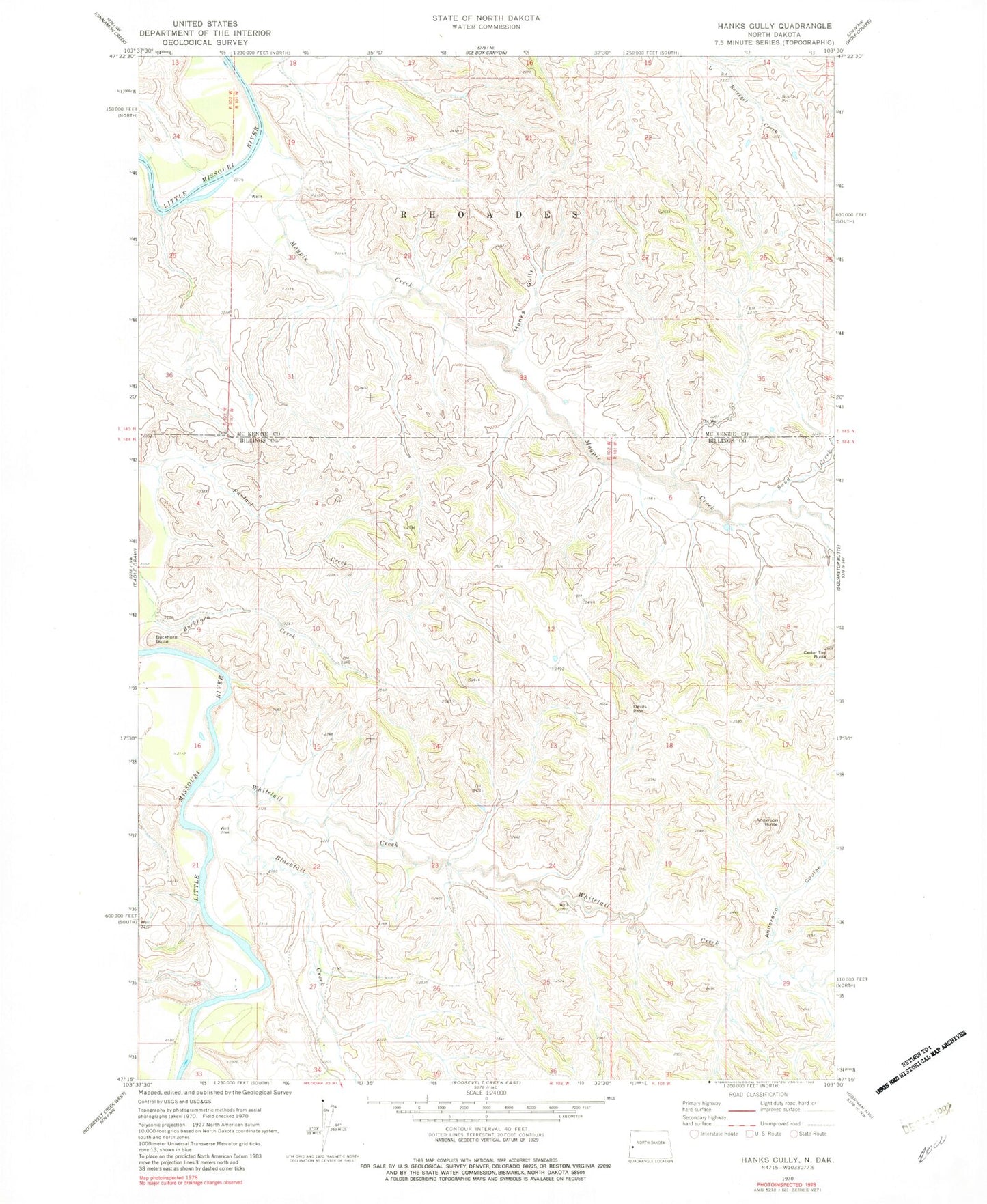
MyTopo
Classic USGS Hanks Gully North Dakota 7.5'x7.5' Topo Map
Couldn't load pickup availability
Historical USGS topographic quad map of Hanks Gully in the state of North Dakota. Map scale may vary for some years, but is generally around 1:24,000. Print size is approximately 24" x 27"
This quadrangle is in the following counties: Billings, McKenzie.
The map contains contour lines, roads, rivers, towns, and lakes. Printed on high-quality waterproof paper with UV fade-resistant inks, and shipped rolled.
Contains the following named places: Anderson Butte, Anderson Coulee, Blacktail Creek, Buckhorn Butte, Buckhorn Oil Field, Cedar Top Butte, Devils Pass, Devils Pass Oil Field, Elkhorn Ranch Oil Field, Elkhorn Ranch State Historic Site, Hanks Gully, J Tescher Ranch, L Connell Ranch, Magpie Creek, Rough Rider Oilfield, Roughrider Substation, Sand Creek, Whitetail Creek