MyTopo
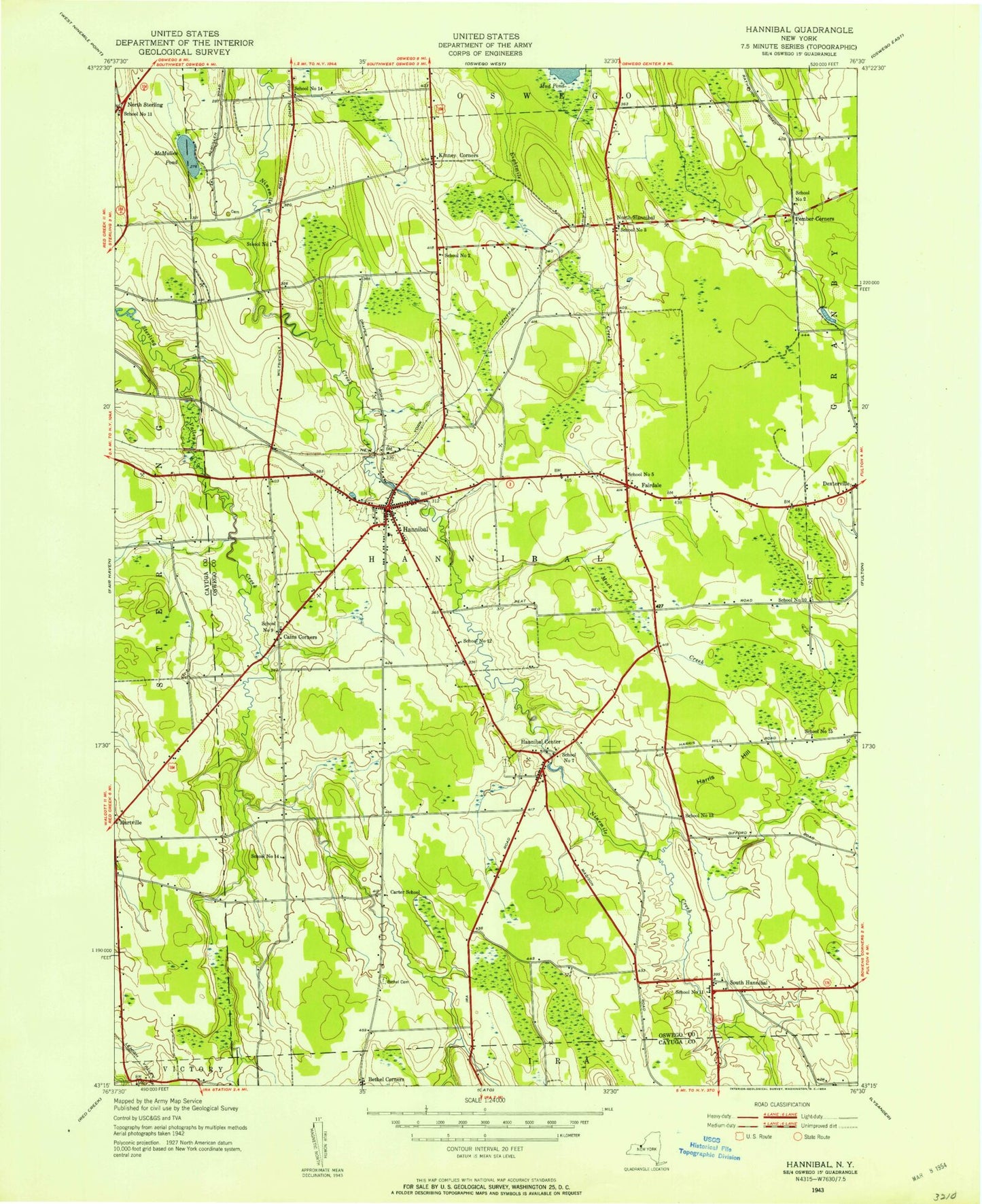
Classic USGS Hannibal New York 7.5'x7.5' Topo Map
Couldn't load pickup availability
Historical USGS topographic quad map of Hannibal in the state of New York. Map scale may vary for some years, but is generally around 1:24,000. Print size is approximately 24" x 27"
This quadrangle is in the following counties: Cayuga, Oswego.
The map contains contour lines, roads, rivers, towns, and lakes. Printed on high-quality waterproof paper with UV fade-resistant inks, and shipped rolled.
Contains the following named places: Bethel Cemetery, Cains Corners, Carter School, Country Haven Mobile Home Park, Crestview Mobile Home Park, Dexterville, Enchantment Acres Flower Farm, Fairdale, Fairdale Rural Cemetery, Fairley School, Hannibal, Hannibal Cemetery, Hannibal Center, Hannibal Center Cemetery, Hannibal Community Church, Hannibal Free Library, Hannibal High School, Hannibal Hills Mobile Home Park, Hannibal Post Office, Hannibal Volunteer Fire Company, Harris Hill, Harris Hill Brook, Kenney Middle School, Kinney Corners, Locus Grove Mobile Home Park, McMullen Pond, Meadowbrook Manor Assisted Living Facility, Metcalf Siding, Mosher Cemetery, Muck Creek, North Hannibal, North Sterling, Our Lady of the Rosary Church, Pember Corners, Powell Mobile Home Park, School Number 1, School Number 10, School Number 11, School Number 12, School Number 13, School Number 14, School Number 15, School Number 2, School Number 3, School Number 5, School Number 7, School Number 9, South Hannibal, Town of Hannibal, Village of Hannibal, Wiltse's Fruit Farm, Woodland Mobile Home Park, ZIP Codes: 13074, 13111