MyTopo
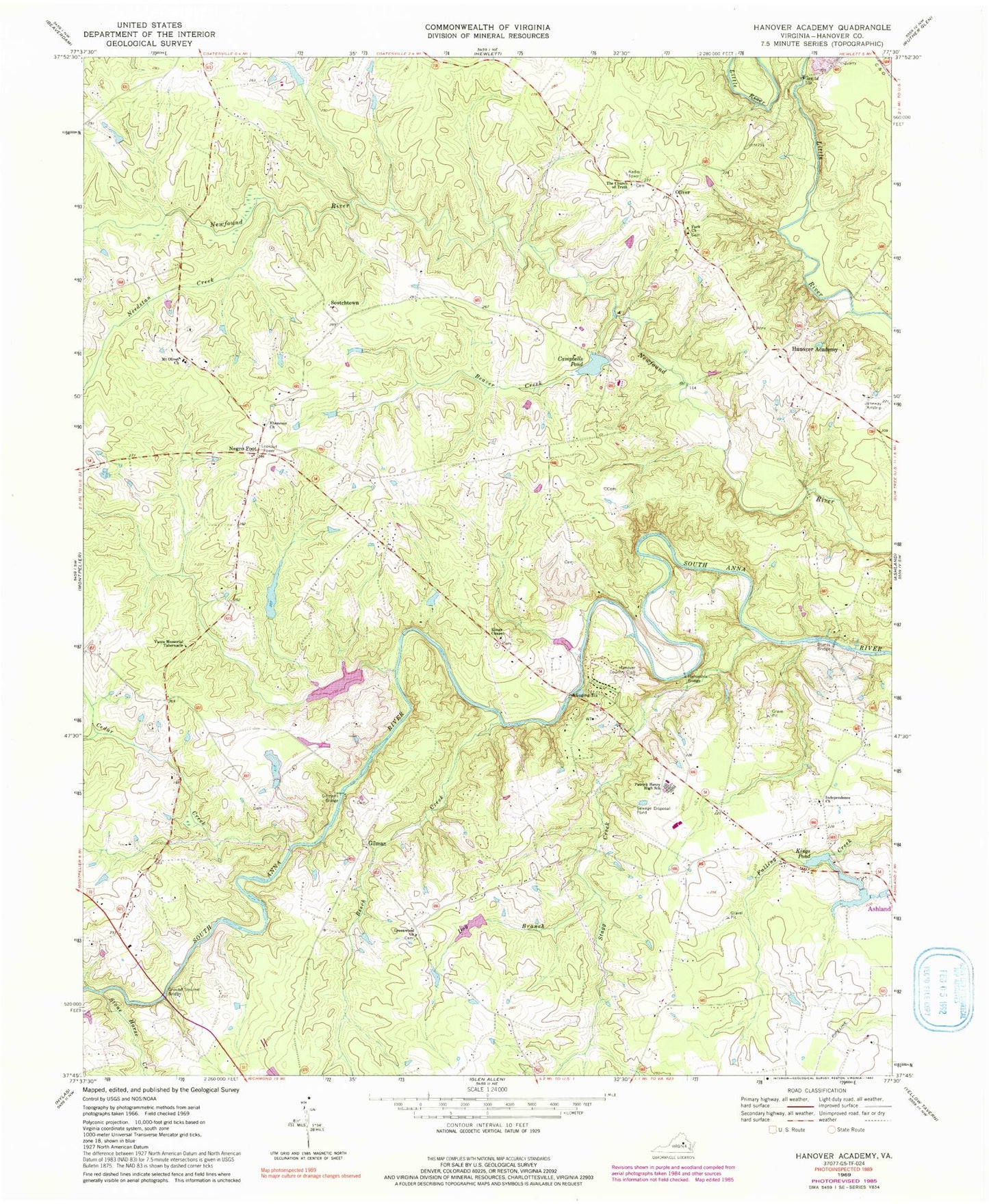
Classic USGS Hanover Academy Virginia 7.5'x7.5' Topo Map
Couldn't load pickup availability
Historical USGS topographic quad map of Hanover Academy in the state of Virginia. Typical map scale is 1:24,000, but may vary for certain years, if available. Print size: 24" x 27"
This quadrangle is in the following counties: Hanover.
The map contains contour lines, roads, rivers, towns, and lakes. Printed on high-quality waterproof paper with UV fade-resistant inks, and shipped rolled.
Contains the following named places: Beaver Creek, Beech Creek, Blunts Bridge, Cedar Creek, Dog Branch, Ebenezer Church, Fork Church, Gilmans Bridge, Greenwood Church, Ground Squirrel Bridge, Hanover Academy, Horseshoe Bridge, Independence Church, Kings Chapel, Mount Olivet Church, Needstan Creek, Negro Foot, Patrick Henry High School, Yates Memorial Tabernacle, Young Creek, Stagg Creek, Stone Horse Creek, The Church of Truth, Oliver, Holstrum Dam, Holstrum Pond, Pollards Dam, Pollards Pond, Lucks Dam, Lucks Pond, Campbell Dam, Campbells Pond, Jones Dam Number One, Jones Lake, Kings Pond Dam, Stanley Dam, Hanover Country Club, Gilman, Scotchtown, Kings Pond, Cross Mill (historical), Janeway Airstrip (historical), Rocketts Mills (historical), Sneeds Mill (historical), Beaverdam District, Liberty Middle School, Federal Club, Hanover County Fire / Emergency Medical Services Headquarters / Training Center, Cool Water Airport, Brookmeade Sod Farm