MyTopo
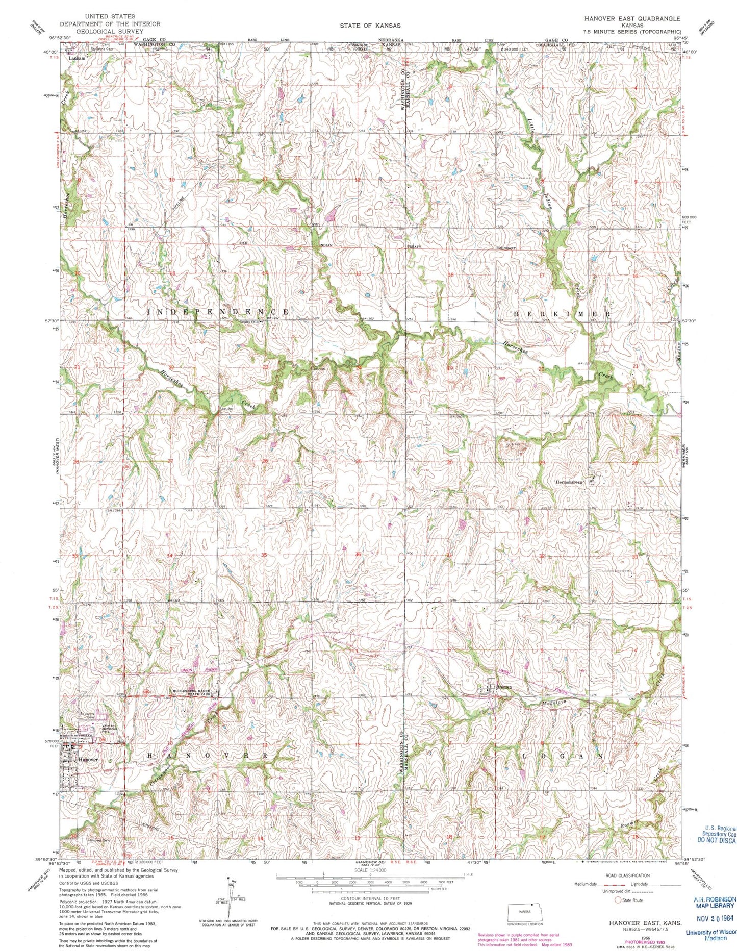
Classic USGS Hanover East Kansas 7.5'x7.5' Topo Map
Couldn't load pickup availability
Historical USGS topographic quad map of Hanover East in the state of Kansas. Map scale may vary for some years, but is generally around 1:24,000. Print size is approximately 24" x 27"
This quadrangle is in the following counties: Marshall, Washington.
The map contains contour lines, roads, rivers, towns, and lakes. Printed on high-quality waterproof paper with UV fade-resistant inks, and shipped rolled.
Contains the following named places: Bremen, Bremen Census Designated Place, Bremen Post Office, Hanover Cemetery, Hanover Fire Department, Hanover High School, Hanover Public Library, Hanover Schools, Hermansberg, Hollenberg Pony Express Station, Hollenberg Ranch State Park, Immanuel Lutheran Church, Little Indian Creek, Logan Township Volunteer Fire Department - Bremen, Saint John's Catholic Church, Saint Johns Cemetery, Saint John's School, Township of Independence, Trinity Lutheran Church, Veterans Memorial Park, Zion Lutheran Church, ZIP Code: 66412