MyTopo
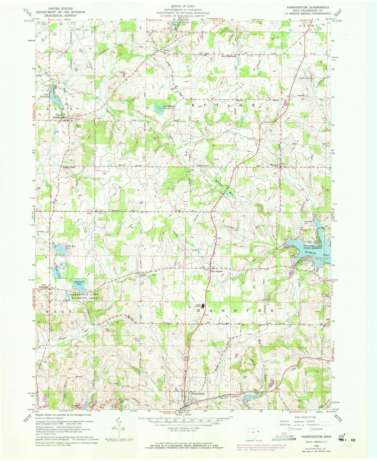
Classic USGS Hanoverton Ohio 7.5'x7.5' Topo Map
Couldn't load pickup availability
Historical USGS topographic quad map of Hanoverton in the state of Ohio. Map scale may vary for some years, but is generally around 1:24,000. Print size is approximately 24" x 27"
This quadrangle is in the following counties: Columbiana.
The map contains contour lines, roads, rivers, towns, and lakes. Printed on high-quality waterproof paper with UV fade-resistant inks, and shipped rolled.
Contains the following named places: Adair, Adair Post Office, Aegerter Farms, Bridgewater, Burch Dairy Farm, Conser Run Lake, Crist Dairy Farm, Dutton Cemetery, Figley Cemetery, Guilford Lake, Guilford Lake Census Designated Place, Guilford Lake State Park, Hanover Township Volunteer Fire Department, Hanoverton, Hanoverton Canal Town Historic District, Hanoverton Post Office, Huckleberry Swamp, King Cemetery, Lake Placentia, Lake Placentia Dam, Lake P'na, Lake P'na Dam, New Alexander, New Alexander Cemetery, New Garden, New Middleton, Newgarden Post Office, North Georgetown, North Georgetown Cemetery, North Georgetown Post Office, North Georgetown Volunteer Fire Department, Paradise Lake Dam, Sevakeen Lake, Slates Dam, Slates Reservoir, Township of Butler, Township of Hanover, United Elementary School, United High School, United Schools, Valley, Valley Post Office, Village of Hanoverton, Vincents Orchards, Watercress Marsh, Winona, Winona Butler Fire Department, Winona Evangelical Friends Church, Winona Post Office, Woodsdale Cemetery, WSOM-AM (Salem), Zepernick Lake, Zepernick Lake Dam, Zepernick Lake Wildlife Area, ZIP Code: 44493