MyTopo
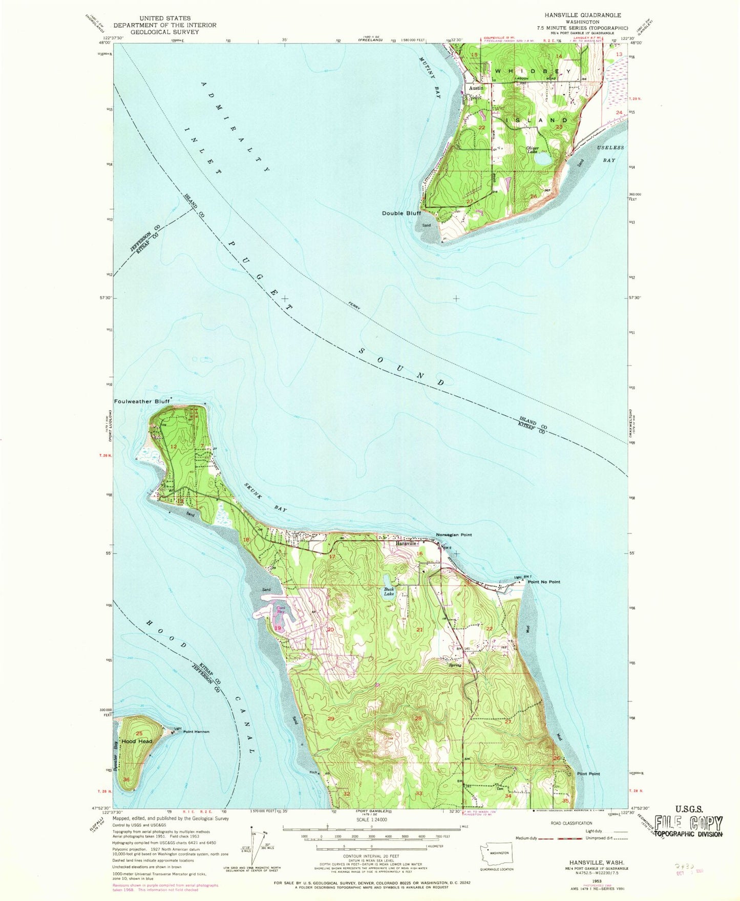
Classic USGS Hansville Washington 7.5'x7.5' Topo Map
Couldn't load pickup availability
Historical USGS topographic quad map of Hansville in the state of Washington. Map scale may vary for some years, but is generally around 1:24,000. Print size is approximately 24" x 27"
This quadrangle is in the following counties: Island, Jefferson, Kitsap.
The map contains contour lines, roads, rivers, towns, and lakes. Printed on high-quality waterproof paper with UV fade-resistant inks, and shipped rolled.
Contains the following named places: Austin, Buck Lake, Coon Bay, Dahlman Dam, Double Bluff, Double Bluff Light, Eglon Cemetery, Foulweather Bluff, Hansville, Hansville Cemetery, Hansville Census Designated Place, Hansville Community Church, Hansville Post Office, Hood Head, Manette Penninsula, Mirth Airport, Mutiny Bay, Mutiny Bay Boat Launch, North Kitsap Fire and Rescue Station 89 Hansville, Norwegian Point, Oliver Lake, Pilot Point, Pilots Cove, Point Hannon, Point Hannon Light, Point No Point, Point No Point Light, Races Cove, Raden Dam, Skunk Bay, Skunk Bay Light, Tahoma One Drop Zen Monastery, Twin Spits, Twin Spits Marina, ZIP Code: 98340