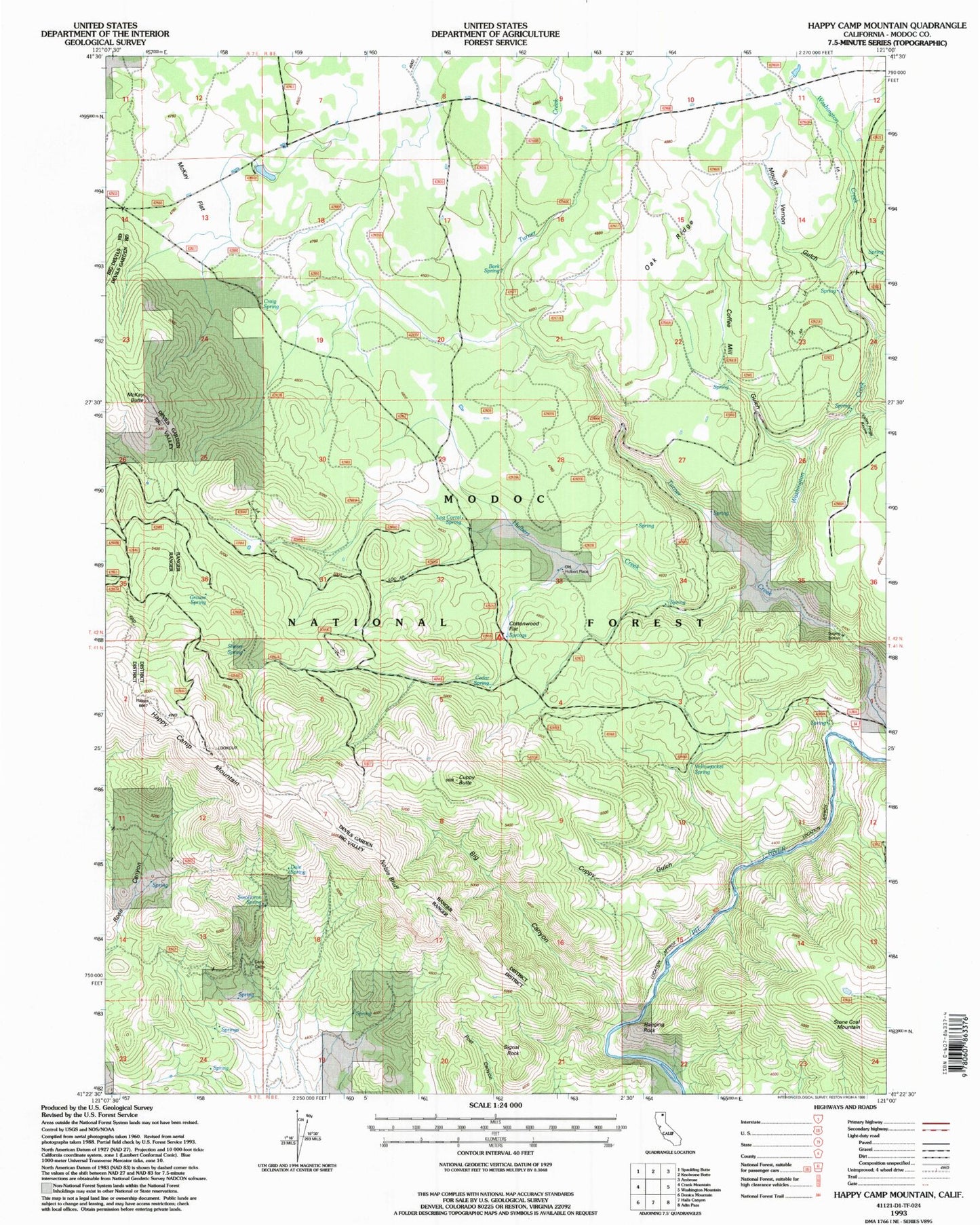
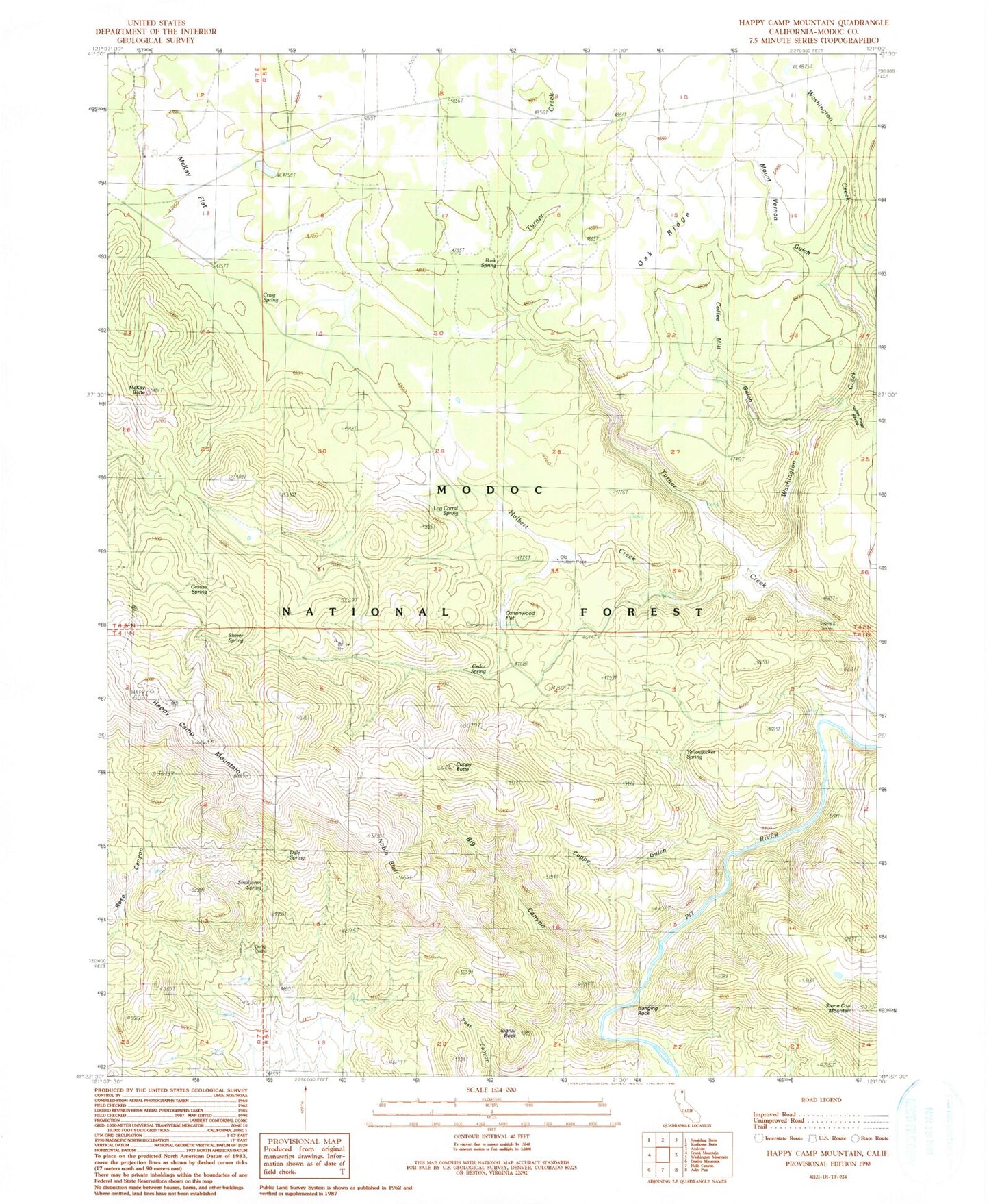
MyTopo
Classic USGS Happy Camp Mountain California 7.5'x7.5' Topo Map
Couldn't load pickup availability
Historical USGS topographic quad map of Happy Camp Mountain in the state of California. Map scale may vary for some years, but is generally around 1:24,000. Print size is approximately 24" x 27"
This quadrangle is in the following counties: Modoc.
The map contains contour lines, roads, rivers, towns, and lakes. Printed on high-quality waterproof paper with UV fade-resistant inks, and shipped rolled.
Contains the following named places: Bark Spring, Big Canyon, Cedar Spring, Coffee Mill Gulch, Cottonwood Flat, Cottonwood Flat Campground, Craig Spring, Cuppy Butte, Cuppy Gulch, Dale Spring, Gerig Camp, Grouse Spring, Hanging Rock, Happy Camp Mountain, Hulbert Creek, Log Corral Spring, McKay Butte, McKay Flat, Mount Vernon Gulch, Negro Gulch, Noble Bluff, Old Hulbert Place, Sherer Spring, Signal Rock, Smolloron Spring, Stone Coal Mountain, Valley Forge Ravine, Washington Creek, Yellowjacket Spring