MyTopo
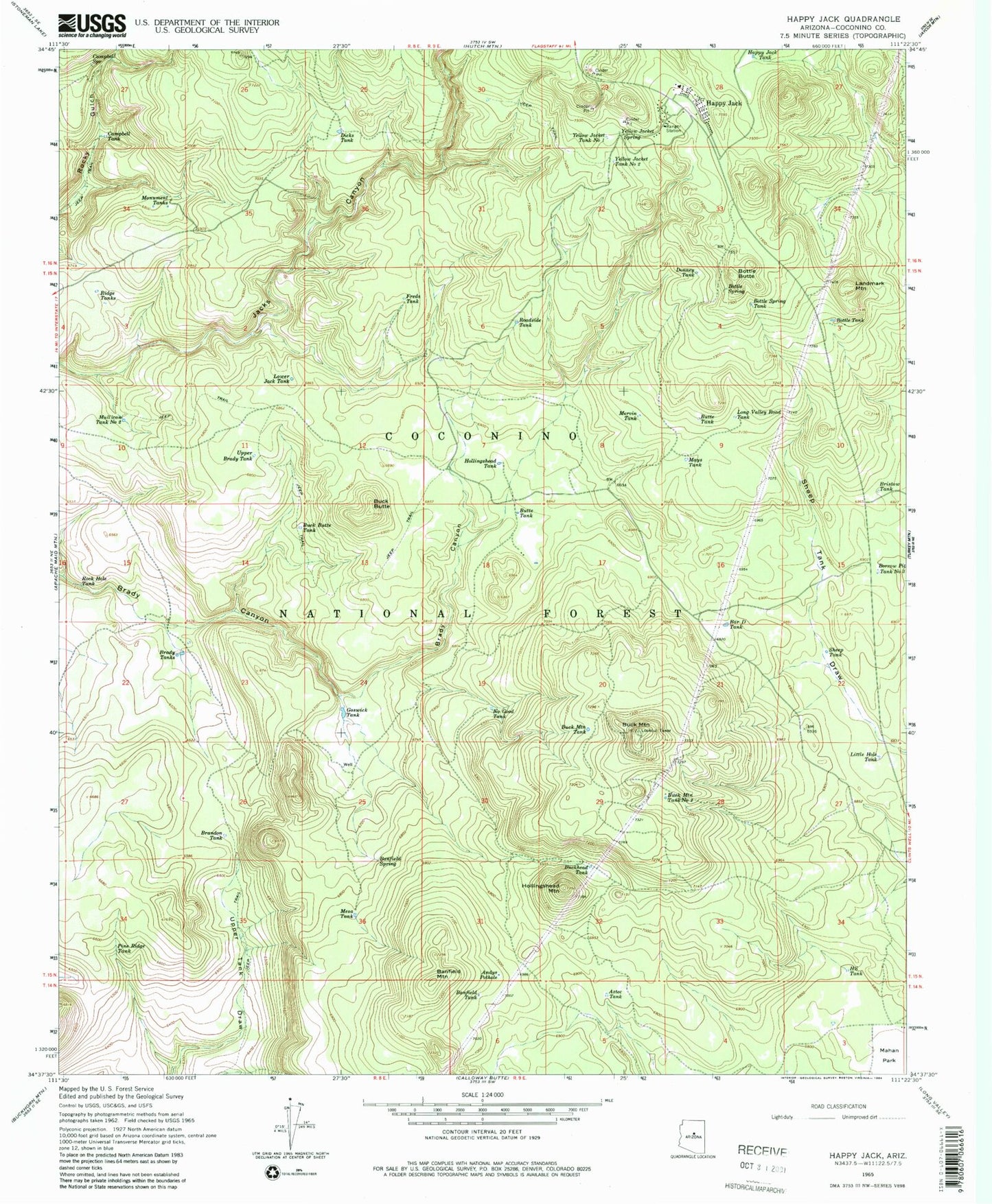
Classic USGS Happy Jack Arizona 7.5'x7.5' Topo Map
Couldn't load pickup availability
Historical USGS topographic quad map of Happy Jack in the state of Arizona. Typical map scale is 1:24,000, but may vary for certain years, if available. Print size: 24" x 27"
This quadrangle is in the following counties: Coconino.
The map contains contour lines, roads, rivers, towns, and lakes. Printed on high-quality waterproof paper with UV fade-resistant inks, and shipped rolled.
Contains the following named places: Marana Auxillary Landing Field (historical), Picacho Peak State Park, Andys Pothole, Aztec Tank, Banfield Mountain, Banfield Spring, Banfield Tank, Bar D Tank, Bottle Butte, Bottle Spring, Bottle Spring Tank, Bottle Tank, Brady Tanks, Brandon Tank, Bristow Tank, Buck Butte, Buck Butte Tank, Buck Mountain, Buck Mountain Tank, Buck Mountain Tank Number Two, Buckhead Tank, Butte Tank, Butte Tank, Campbell Spring, Campbell Tank, Dicks Tank, Donney Tank, Freds Tank, Goswick Tank, H S Tank, Happy Jack, Happy Jack Tank, Hollingshead Mountain, Hollingshead Tank, Landmark Mountain, Little Hole Tank, Long Valley Road Tank, Lower Jack Tank, Mahan Park, Mays Tank, Mervin Tank, Mesa Tank, Monument Tanks, Mullican Tank Number Two, No Good Tank, Pine Ridge Tank, Ridge Tanks, Roadside Tank, Rock Hole Tank, Sheep Tank, Upper Brady Tank, Yellow Jacket Spring, Yellow Jacket Tank Number One, Yellow Jacket Tank Number Two, Big Hole Tank, Bill Dick Tank, Borrow Pit Number Three Tank, Buck Mountain Lookout Tower, Casner Park, Long Valley Administrative Site, John Tank, Kitty Pan Tank, Little Rocky Tank, Pine Ridge Two Tank, Pitchfork Tank, Power Tank, Sink Hole Tank, West Tank, Wildhorse Tank, Borrow Pit Number Two Tank, Happy Jack Post Office (historical), Long Valley Ranger District