MyTopo
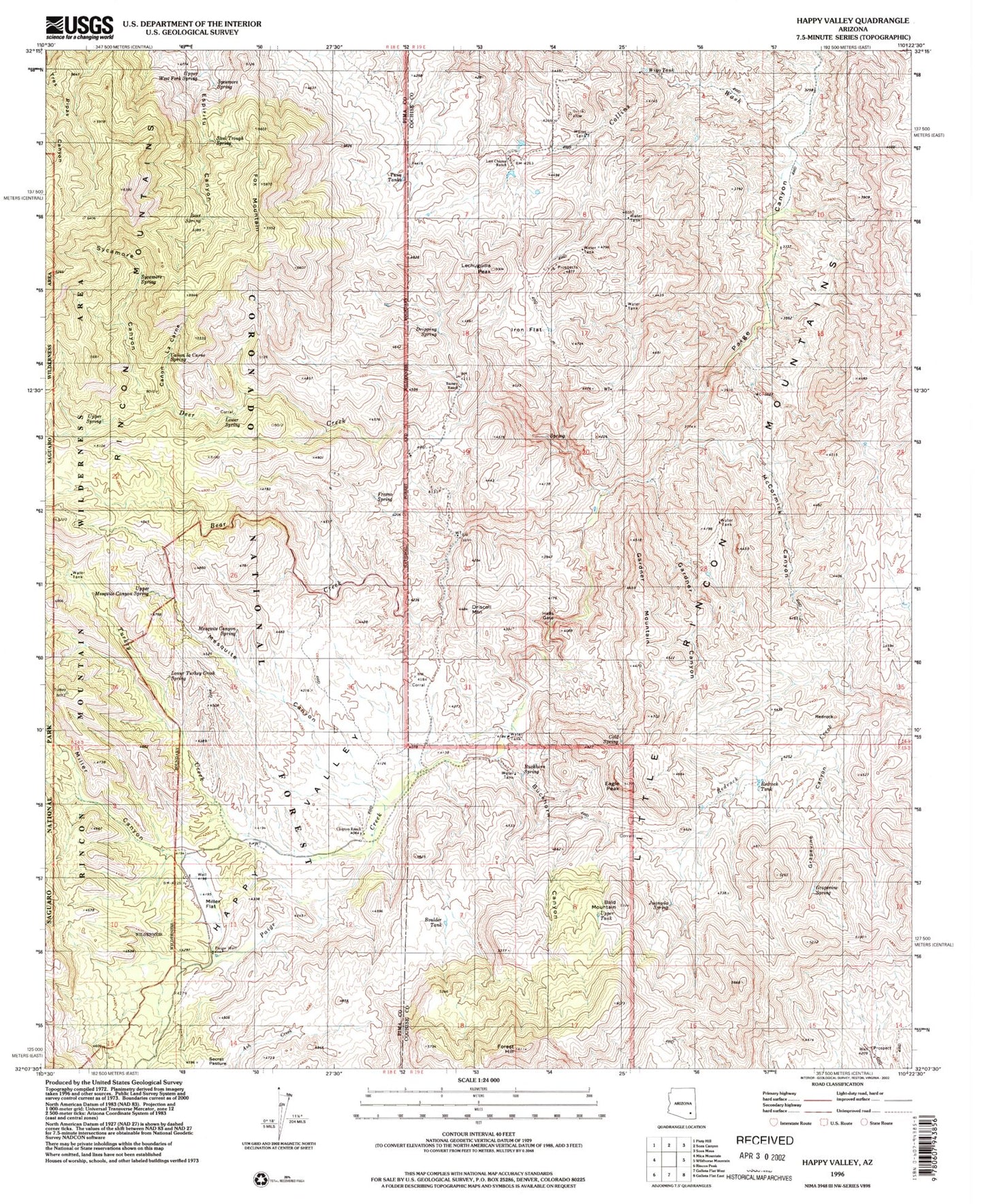
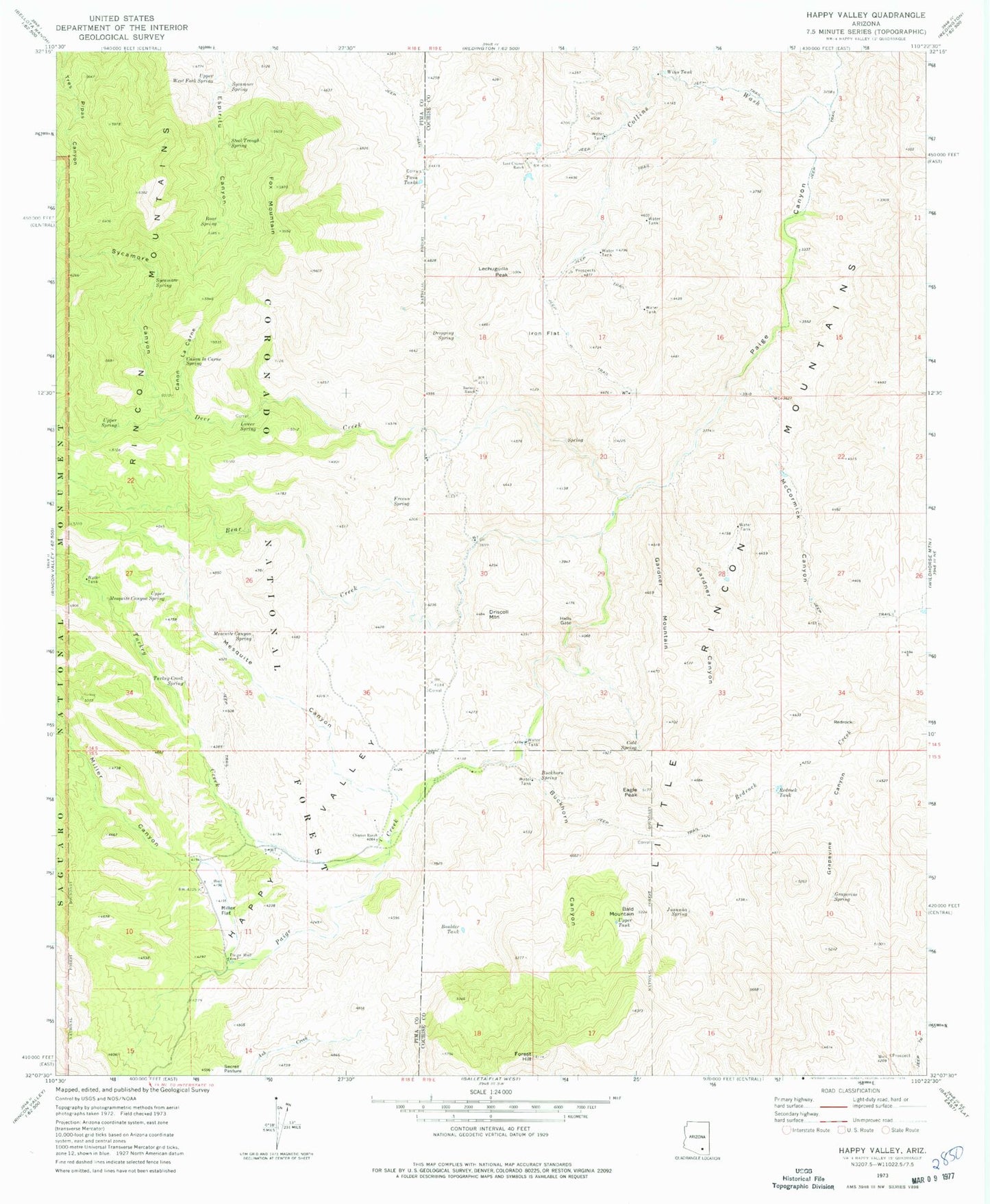
Classic USGS Happy Valley Arizona 7.5'x7.5' Topo Map
Couldn't load pickup availability
Historical USGS topographic quad map of Happy Valley in the state of Arizona. Map scale may vary for some years, but is generally around 1:24,000. Print size is approximately 24" x 27"
This quadrangle is in the following counties: Cochise, Pima.
The map contains contour lines, roads, rivers, towns, and lakes. Printed on high-quality waterproof paper with UV fade-resistant inks, and shipped rolled.
Contains the following named places: Bald Mountain, Barney Ranch, Bear Creek, Bear Spring, Boulder Tank, Buckhorn Canyon, Buckhorn Spring, Canon la Carne, Canon la Carne Spring, Cement Dam, Cement Dam Tank, Clopton Ranch, Cold Spring, Collins Wash, Deer Creek, Dripping Spring, Driscoll Mountain, Eagle Peak, Forest Hill, Fox Mountain, Fresno Spring, Gardner Canyon, Gardner Mountain, Grapevine Canyon, Grapevine Spring, Happy Valley, Hells Gate, Iron Flat, Juanuna Spring, Last Chance Ranch, Lechuguilla Peak, Little Rincon Mountains, Lower Spring, Lower Turkey Creek Spring, McCormick Canyon, Mesquite Canyon, Mesquite Canyon Spring, Miller Canyon, Miller Creek Trailhead, Miller Flat, Miller Ranch, Paige Well, Redrock, Redrock Tank, Secret Pasture, Steel Trough Spring, Sycamore Canyon, Sycamore Spring, Turkey Creek, Turkey Creek Trailhead, Twin Tanks, Upper Mesquite Canyon Spring, Upper Spring, Upper West Fork Spring, Wino Tank, ZIP Code: 85602