MyTopo
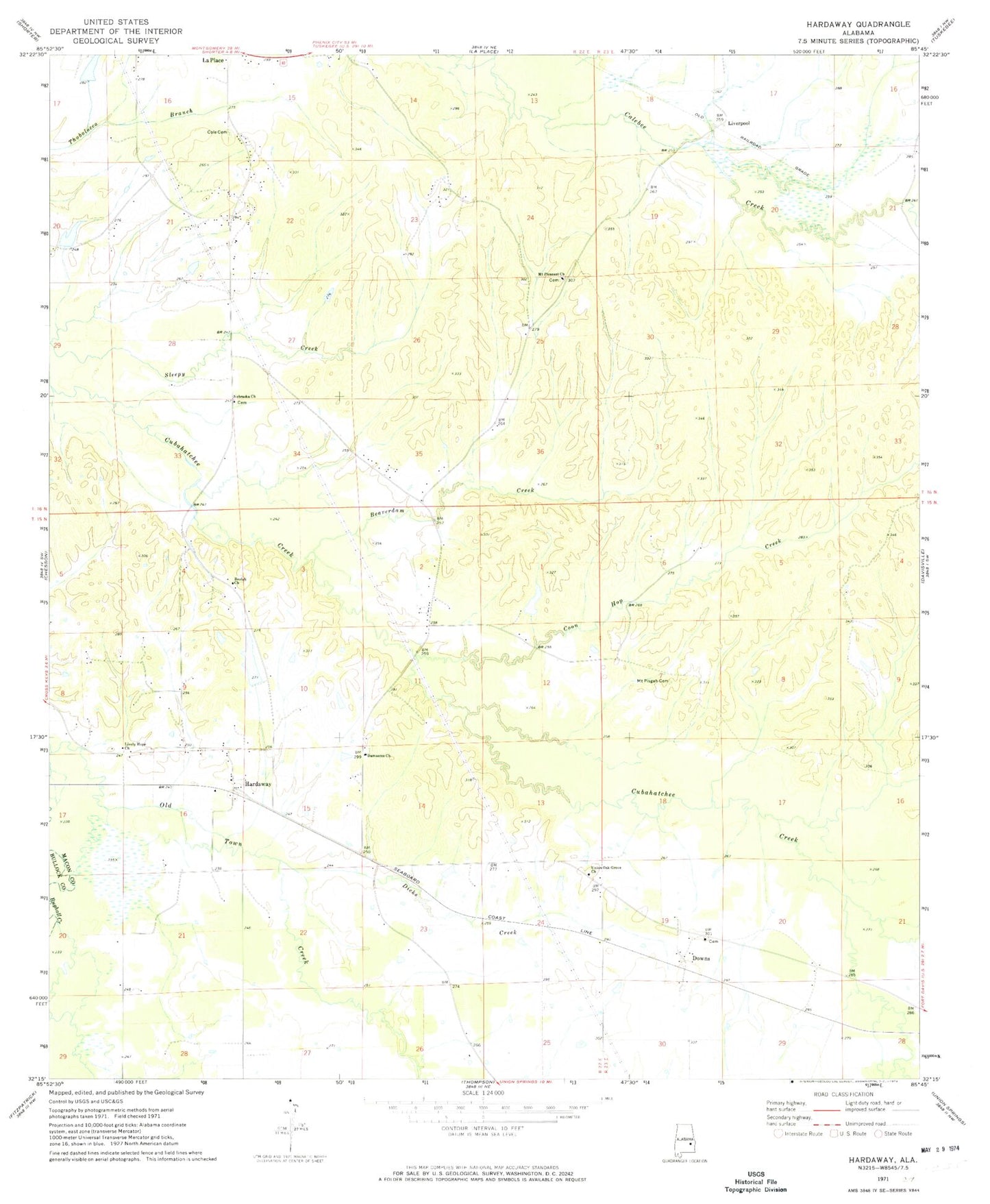
Classic USGS Hardaway Alabama 7.5'x7.5' Topo Map
Couldn't load pickup availability
Historical USGS topographic quad map of Hardaway in the state of Alabama. Map scale may vary for some years, but is generally around 1:24,000. Print size is approximately 24" x 27"
This quadrangle is in the following counties: Bullock, Macon.
The map contains contour lines, roads, rivers, towns, and lakes. Printed on high-quality waterproof paper with UV fade-resistant inks, and shipped rolled.
Contains the following named places: Ambers Cemetery, Beaverdam Creek, Beulah Church, Cole Cemetery, Coon Hop Creek, Damascus Church, Damascus School, Dicks Creek, District 3 Volunteer Fire Department, Downs, Edwards, Greater Wesley Chapel, Grimm Cemetery, Hardaway, Hardaway Baptist Church, Hardaway Cemetery, Hardaway Post Office, Jack Lacey Number 1 Dam, John Frank Moorer Dam, Laceys Lake Number One, Lively Hope Church, Liverpool, Moorers Lake, Mount Aaran Church, Mount Pisgah Cemetery, Mount Pisgah Church, Mount Pleasant Cemetery, Mount Pleasant Church, Nebraska Church, Pisgah School, Sweet Gum Church, Sweet Gum School, Union Oak Grove Church, ZIP Code: 36039