MyTopo
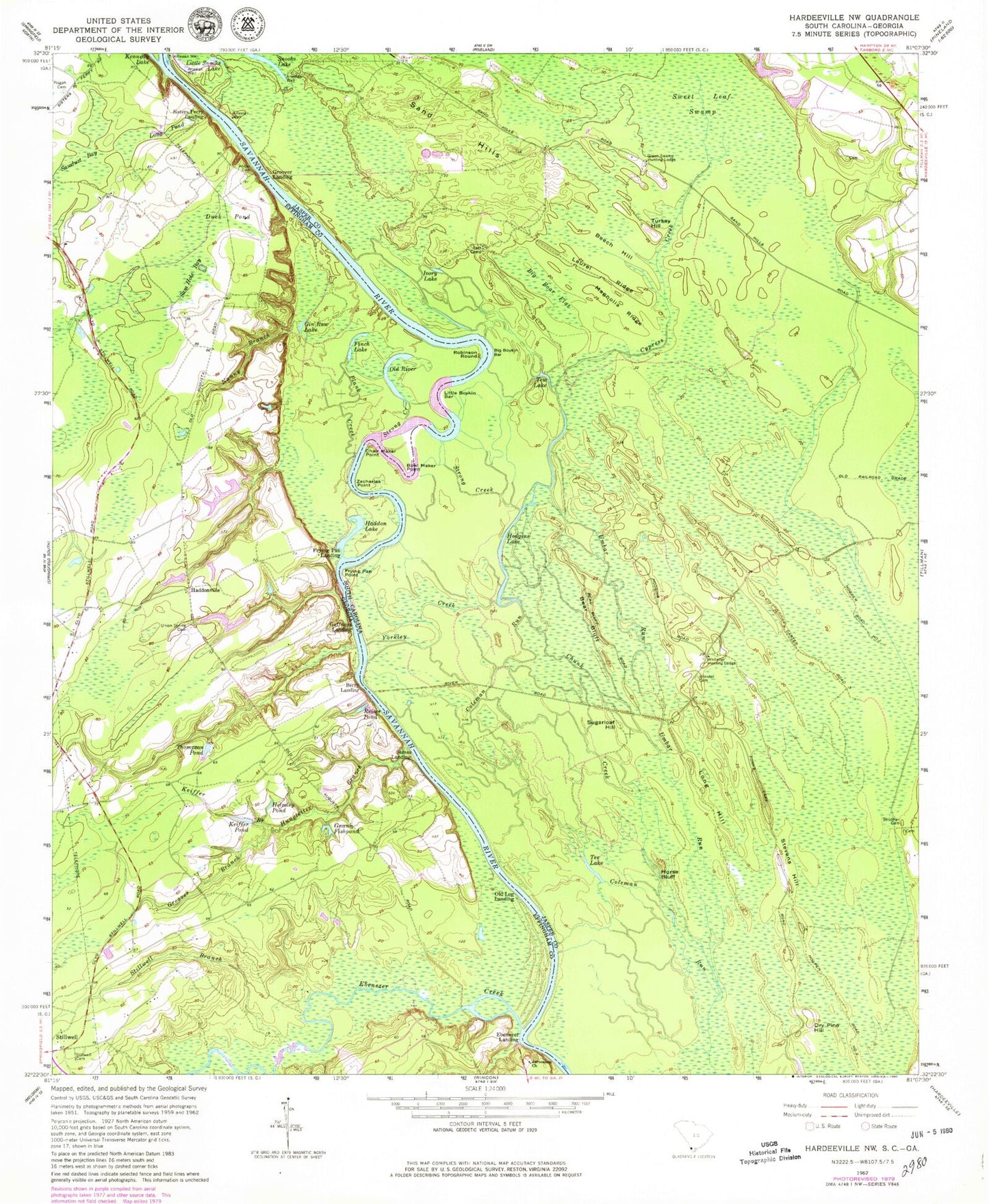
Classic USGS Hardeeville NW South Carolina 7.5'x7.5' Topo Map
Couldn't load pickup availability
Historical USGS topographic quad map of Hardeeville NW in the states of South Carolina, Georgia. Map scale may vary for some years, but is generally around 1:24,000. Print size is approximately 24" x 27"
This quadrangle is in the following counties: Effingham, Jasper.
The map contains contour lines, roads, rivers, towns, and lakes. Printed on high-quality waterproof paper with UV fade-resistant inks, and shipped rolled.
Contains the following named places: Bear Bluff, Beech Hill, Berry Landing, Berrys Landing, Big Boar Flat, Big Boykin Bar, Bowl Maker Point, Chair Maker Point, Chunk Creek, Cypress Creek, Cypress Creek Bridge, Dry Pine Hill, Duck Pond, Ebenezer, Ebenezer Creek, Ebenezer Landing, Finch Lake, Frying Pan Landing, Frying Pan Point, Gaffneys Landing, Gin Raw Lake, Gnann Fishpond, Green Swamp Hunting Lodge, Groover Branch, Groover Landing, Haddon Lake, Haddonville, Helmley Pond, Hodgins Lake, Hoover Plantation Dam D-2592, Horse Bluff, Hungleiter Branch, Ivory Lake, Jerusalem Lutheran Church, Keiffer Branch, Keiffer Pond, Laurel Ridge, Little Boykin Bar, Little Snooks Lake, Long Hill, Long Pond, Magnolia Ridge, Nanny Branch, Old Log Landing, Old River, Pisgah Cemetery, Plank Creek, Porter Cemetery, Rath Camp, Reiser Pond, Robinson Round, Sam Hole Bay, Sawdust Bay, Seines Landing, Sisters Ferry, Sisters Ferry Landing, Snooks Lake, South Carolina Noname 27005 D-2588 Dam, Stevens Hill, Stillwell Branch, Stillwell Cemetery, Strobhar Cemetery, Strong Creek, Sugarloaf Hill, Sweet Leaf Swamp, Tee Lake, Tew Lake, Thompson Pond, Turkey Hill, Umbar Run, Union Spring Cemetery, Whitener Hunting Lodge, Willow Swamp, Winkler Cemetery, Yorkley Creek, Zacharias Point, ZIP Code: 29943