MyTopo
Classic USGS Hardeeville South Carolina 7.5'x7.5' Topo Map
Couldn't load pickup availability
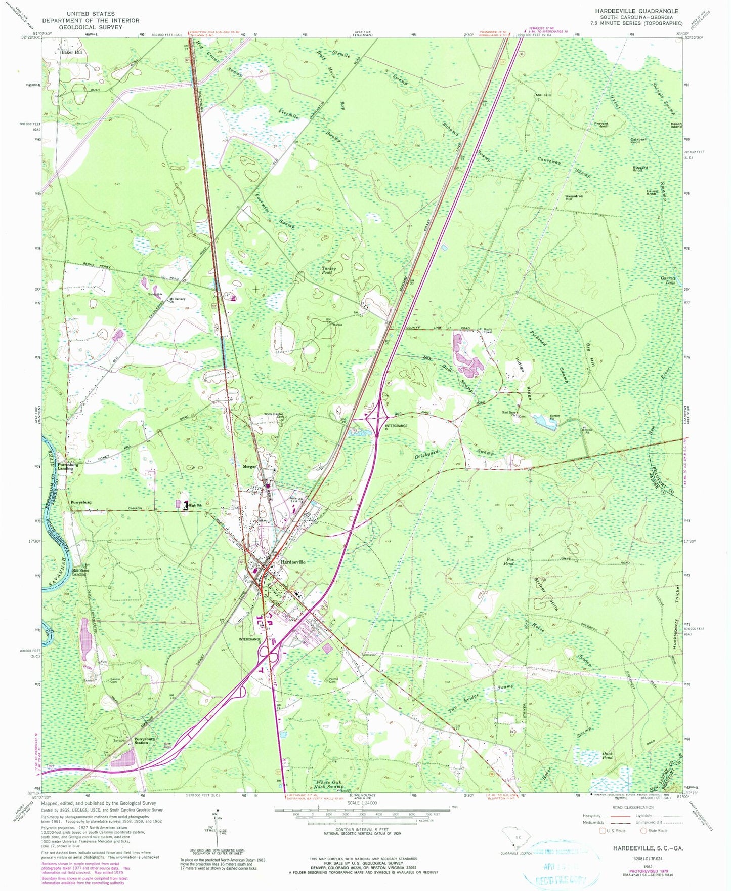
Historical USGS topographic quad map of Hardeeville in the state of South Carolina. Map scale may vary for some years, but is generally around 1:24,000. Print size is approximately 24" x 27"
This quadrangle is in the following counties: Beaufort, Effingham, Jasper.
The map contains contour lines, roads, rivers, towns, and lakes. Printed on high-quality waterproof paper with UV fade-resistant inks, and shipped rolled.
Contains the following named places: Abundant Life Academy, Argent Square Depot Shopping Center, Bahama Swamp, Baker Hill, Beech Island, Big Hill, Bob Dam Swamp, Brickyard Swamp, Buzzard Knoll, Calabash Knoll, Causeway Swamp, City of Hardeeville, Coastal Carolina Hospital, Duck Pond, Fivemile Swamp, Fourmile Swamp, Fox Pond, Garrett Lake, Great Swamp, Half Moon Bay, Hardeeville, Hardeeville City Hall, Hardeeville Community Center, Hardeeville Elementary School, Hardeeville Fire Department Station 81, Hardeeville Junior High / High School, Hardeeville Library, Hardeeville Police Department, Hardeeville Post Office, Hog Crawl Swamp, Horse Swamp, Huckleberry Thicket, Indigo Ridge, Laurel Knoll, Mill Hill, Mill Stone Landing, Morgan, Mount Calvary Church, Pelote Cemetery, Pickseed Swamp, Prevent Knoll, Purysburgh, Purysburgh Landing, Purysburgh Station, Red Dam Church, Sassafras Hill, Saucie Cemetery, Shingle Swamp, Sixmile Swamp, Striker Hills, Turkey Pond, Two Bridge Swamp, White Hardee Cemetery, White Oak Nook