MyTopo
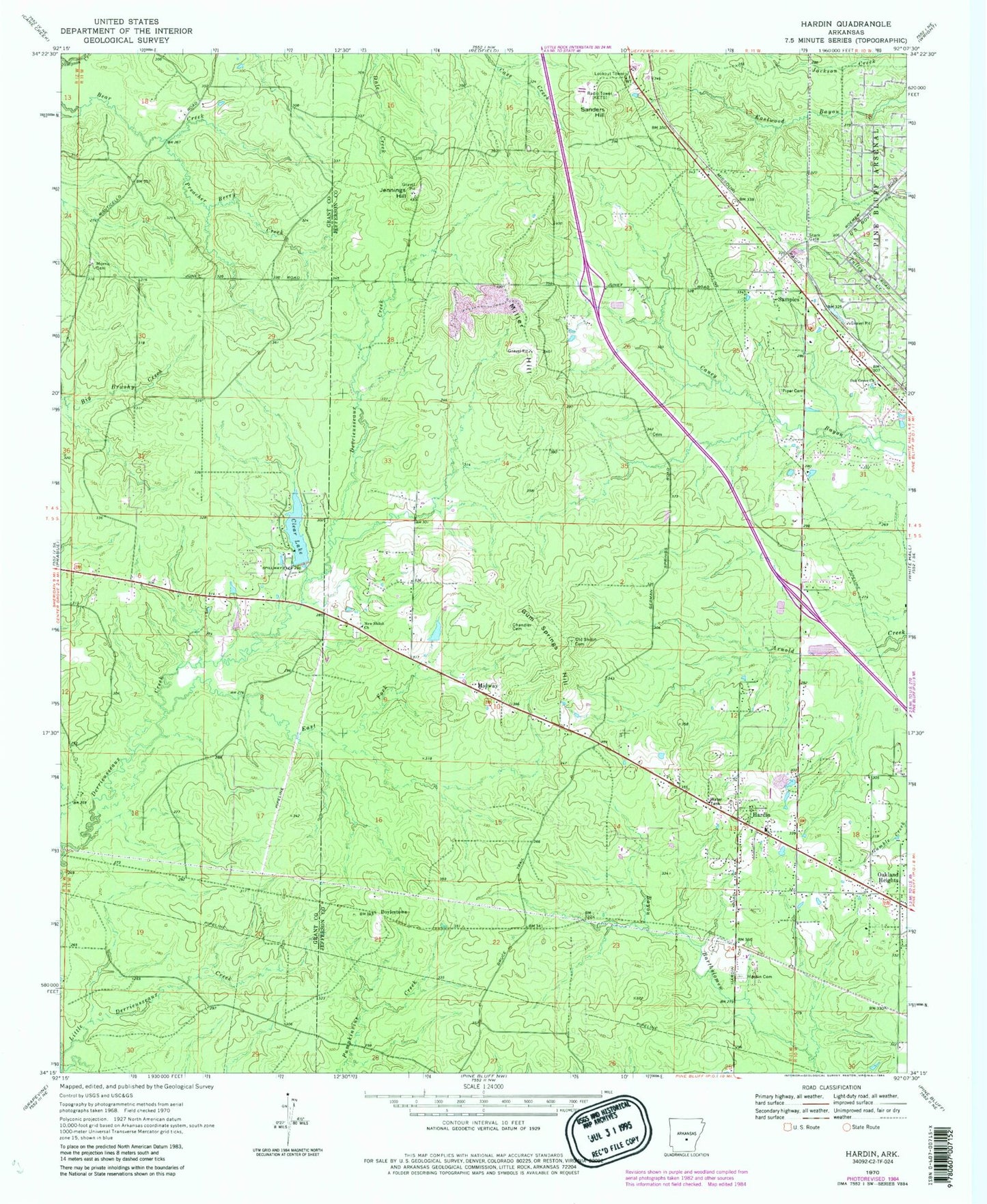
Classic USGS Hardin Arkansas 7.5'x7.5' Topo Map
Couldn't load pickup availability
Historical USGS topographic quad map of Hardin in the state of Arkansas. Map scale may vary for some years, but is generally around 1:24,000. Print size is approximately 24" x 27"
This quadrangle is in the following counties: Grant, Jefferson.
The map contains contour lines, roads, rivers, towns, and lakes. Printed on high-quality waterproof paper with UV fade-resistant inks, and shipped rolled.
Contains the following named places: Boyd School, Bruce, Chandler Cemetery, Clear Lake, Clear Lake Dam, Donaldsonville, Doylestown, East Fork Derrieusseaux Creek, Eastwood, Ellis School, Gum Springs Hill, Hardin, Hardin Baptist Church, Hardin Cemetery, Hardin Volunteer Fire Department, Jefferson School, Jennings Hill, KIPR-FM (Pine Bluff), Little Derrieusseaux Creek, Midway, Miller Hill, Morris Cemetery, New Shiloh Church, Oak Grove Baptist Church, Oakland Heights, Old Shiloh Cemetery, Pentecostal Church, Pine Bluff Disposal Landfill, Piper Cemetery, Preacher Berry Creek, Redfield Volunteer Fire Department Station 3, Ruth School, Samples, Sanders Hill, Shiloh School, Stark Gate, Township of Jefferson, Township of Washington, Tracy Spur, ZIP Code: 71602