MyTopo
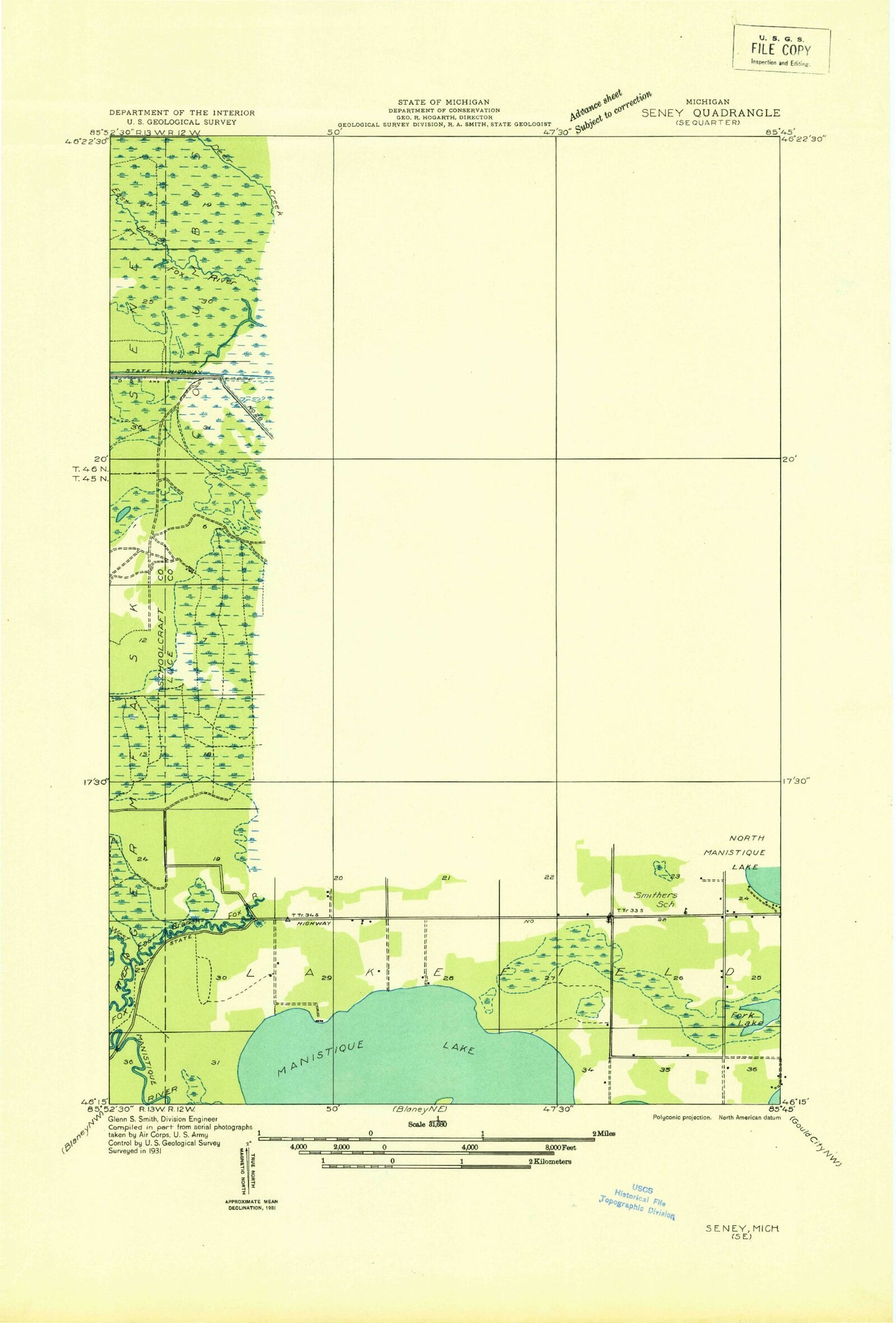
Classic USGS Hardwood Island Michigan 7.5'x7.5' Topo Map
Regular price
$16.95
Regular price
Sale price
$16.95
Unit price
per
Couldn't load pickup availability
Historical USGS topographic quad map of Hardwood Island in the state of Michigan. Map scale may vary for some years, but is generally around 1:24,000. Print size is approximately 24" x 27"
This quadrangle is in the following counties: Luce, Schoolcraft.
The map contains contour lines, roads, rivers, towns, and lakes. Printed on high-quality waterproof paper with UV fade-resistant inks, and shipped rolled.
Contains the following named places: Bev Creek, Carpenter Landing, Crooked Lake, Danaher, Danaher Station, Deer Creek, East Branch Fox River, Fork Lake, Hardwood Island, Kings Creek, Lakefield Baptist Church, Seabrook Post Office, Wanamaker Lake, West Lakefield Cemetery, ZIP Code: 49853