MyTopo
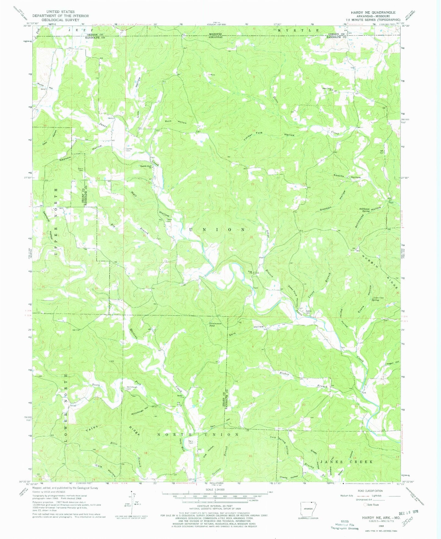
Classic USGS Hardy NE Arkansas 7.5'x7.5' Topo Map
Couldn't load pickup availability
Historical USGS topographic quad map of Hardy NE in the states of Arkansas, Missouri. Map scale may vary for some years, but is generally around 1:24,000. Print size is approximately 24" x 27"
This quadrangle is in the following counties: Oregon, Randolph, Sharp.
The map contains contour lines, roads, rivers, towns, and lakes. Printed on high-quality waterproof paper with UV fade-resistant inks, and shipped rolled.
Contains the following named places: Athye Branch, Banks Church, Bellah Cemetery, Big Branch, Bishop Branch, Buck Hollow, Charlie Hollow, Cold Spring Hollow, Dahl Hollow, Davis Cemetery, Deep Ford Hollow, Diles Creek Church, Dog Hollow, English Bluff Church of Christ, Evans Hollow, Gebhardt Hollow, Grassy Hollow, Hogan Hollow, James Cemetery, Koontz Hollow, Lick Hollow, Manley Hollow, McCollough Cemetery, McCollough Hollow, Muntz Hollow, Newsom Hollow, Orchard Hollow, Perry Bluff, Perry Cemetery, Persimmon Pond, Ring Church of Christ, Ring School, Sam Hollow, Sara Hollow, Simmon Hollow, South Fork Janes Creek, South Fork Martins Creek, Stillhouse Hollow, Stillhouse Spring, Taylor Cemetery, Timber Fork Hollow, Township of Union, Well Hollow, Wenstead, Yates Ridge, Young Branch