MyTopo
Classic USGS Hardy Arkansas 7.5'x7.5' Topo Map
Couldn't load pickup availability
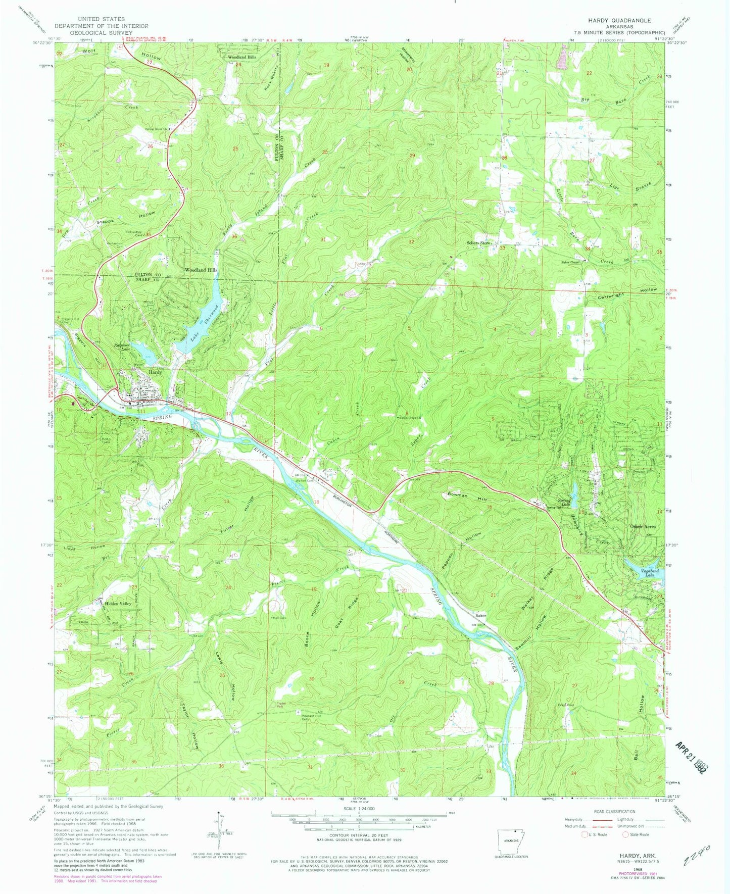
Historical USGS topographic quad map of Hardy in the state of Arkansas. Map scale may vary for some years, but is generally around 1:24,000. Print size is approximately 24" x 27"
This quadrangle is in the following counties: Fulton, Sharp.
The map contains contour lines, roads, rivers, towns, and lakes. Printed on high-quality waterproof paper with UV fade-resistant inks, and shipped rolled.
Contains the following named places: Baker, Baker Chapel, Baptist Memorial Hospital, Bee Creek, Biggers Hill, Boone Hollow, Bowman Hill, Cabin Creek, Cabin Creek Church, Canton, City of Hardy, Flat Creek, Forty Island Creek, Fuller Hollow, Goat Ridge, Hall Cemetery, Hardy, Hardy Fire Department Station 1, Hardy Police Department, Hardy Post Office, Harold E Alexander Wildlife Management Area, Herrick, KSRB-AM (Hardy), Lake Sherwood, Lake Sherwood Dam, Lewis Hollow, Little Flat Creek, Lloyd Hollow, Ott Creek, Ozark Acres, Ozark Acres Census Designated Place, Ozark Acres Volunteer Fire Department, Pepoon Hollow, Pierce Creek, Pleasant Hill Cemetery, Rainbow Lake, Rainbow Lake Dam, Richardson Cemetery, Rock Quarry Hill, Sawmill Hollow, Sellers Store, South Fork Spring River, Spring Lake, Spring Lake Church, Spring Lake Dam, Spring River Church, Stapps Hollow, Strawberry Hollow, Sugar Creek, Taylor Hollow, Township of Hardy, Township of Ozark, Vagabond Lake, Walker Cemetery, Walker Ridge, ZIP Code: 72542