MyTopo
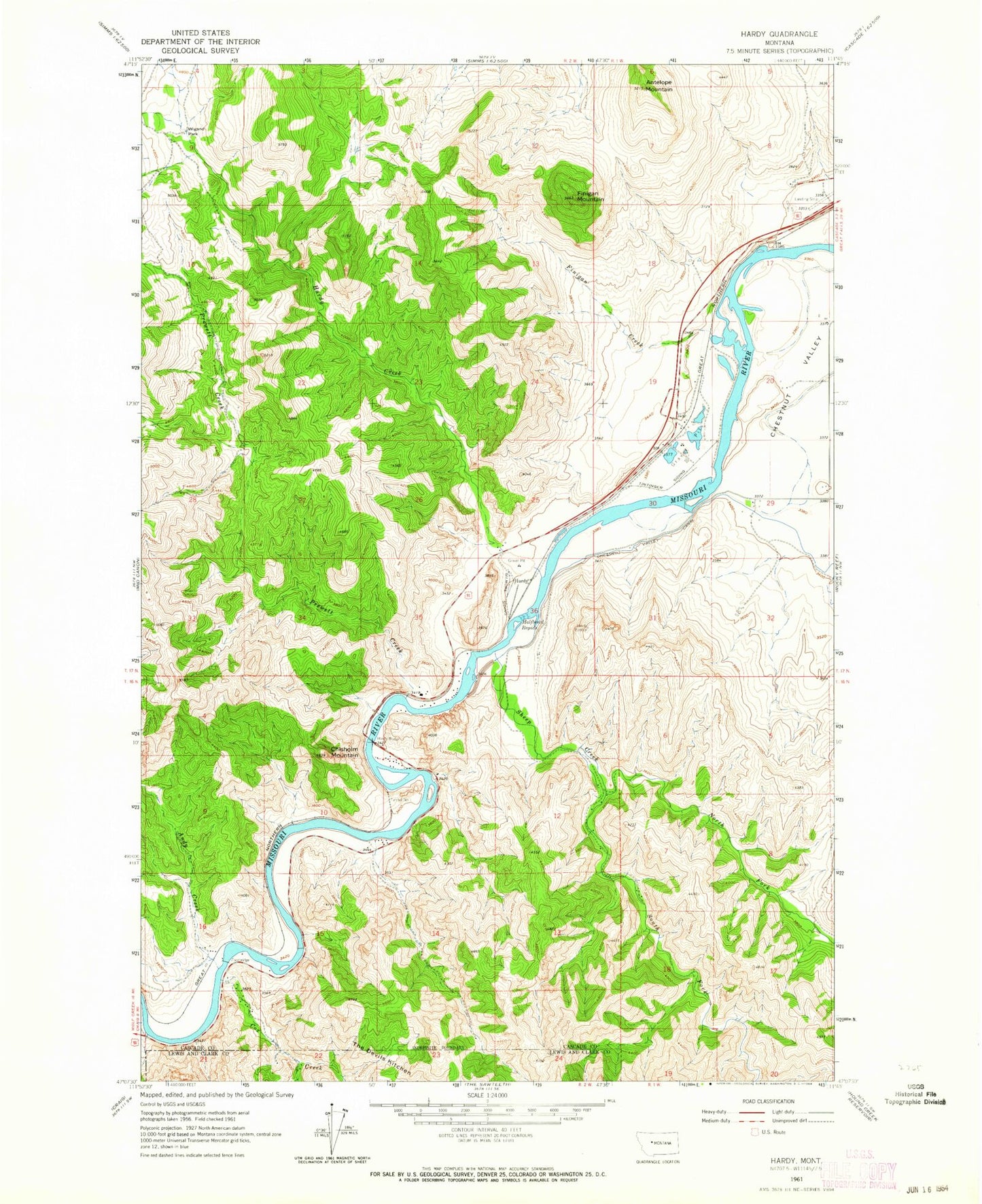
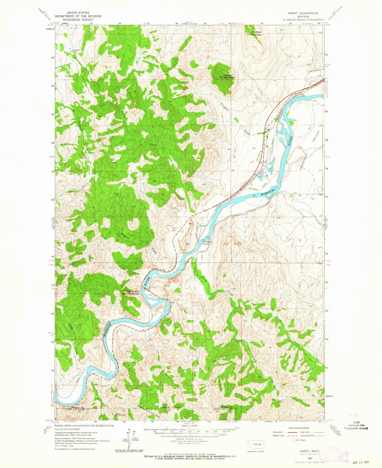
Classic USGS Hardy Montana 7.5'x7.5' Topo Map
Couldn't load pickup availability
Historical USGS topographic quad map of Hardy in the state of Montana. Map scale may vary for some years, but is generally around 1:24,000. Print size is approximately 24" x 27"
This quadrangle is in the following counties: Cascade, Lewis and Clark.
The map contains contour lines, roads, rivers, towns, and lakes. Printed on high-quality waterproof paper with UV fade-resistant inks, and shipped rolled.
Contains the following named places: 17N01W08D___01 Well, 17N01W08D___02 Spring, 17N01W19D___01 Well, 17N01W29C___01 Well, 17N02W25C___01 Well, 17N02W35D___01 Well, Andy Creek, Antelope Mountain, Brunots Rapids, Chisholm Mountain, Cox Creek, DeLacey Point, Finigan Creek, Finigan Mountain, Flennikens Rapids, Gary, Gary Post Office, Gilmore Siding, Hardy, Hardy Bridge, Hardy Bridge Fishing Access Site, Hardy Census Designated Place, Hardy Creek, Hardy Post Office, Hardy School, Lincoln, Lone Pine Rapids, Missouri Inn Campground, Mountain Palace Fishing Access Site, North Fork Sheep Creek, Novak Creek, Novak Creek Bridge, Pelican Point Fishing Access Site, Pine Island, Pine Island Rapids, Prewett Creek, Prewett Creek Fishing Access Site, Saint Peters Mission Historical Marker, Sheep Creek, South Fork Sheep Creek, Tintinger Siding, Tunnel Number 1, Wigand Park