MyTopo
Classic USGS Harford Pennsylvania 7.5'x7.5' Topo Map
Couldn't load pickup availability
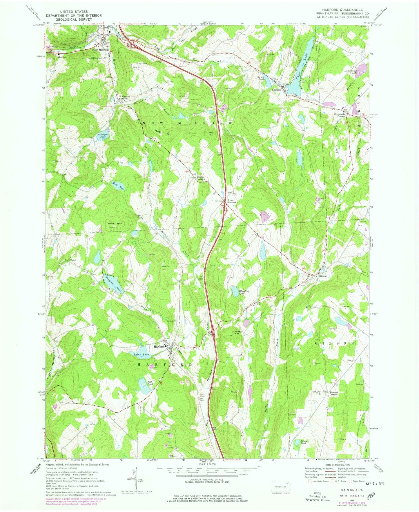
Historical USGS topographic quad map of Harford in the state of Pennsylvania. Map scale may vary for some years, but is generally around 1:24,000. Print size is approximately 24" x 27"
This quadrangle is in the following counties: Susquehanna.
The map contains contour lines, roads, rivers, towns, and lakes. Printed on high-quality waterproof paper with UV fade-resistant inks, and shipped rolled.
Contains the following named places: Blanding Lake, East Lake Creek, Fenstermachers, Gibson, Gibson Post Office, Gillespies Pond, Grove School, Harford, Harford Post Office, Harford Volunteer Fire Company, Hunt Lake, Jones Hill, Kentuck Corners, Lakeside, Leslie Creek, Little Butler Creek, Little Butler Lake, Magnetic Laboratories Airport, Mott Hill, Moxley Corners, MSM Airport, New Milford, New Milford Post Office, Old Mill Village, Pa-467 Dam, Pa-467 Reservoir, Page Lake, Page Lake Dam, Payne Pond, Peck Cemetery, Peckins Airport, Pennsylvania State Police Troop R Gibson Station, Polk Pond, Purdy Dam, Steinbachs Corners, Stump Pond, Summit, Sweet Chapel, Tiffany Hill, Tingley Lake, Tingley Lake Dam, Township of Harford, Township of New Milford, Tyler Airport, Tyler Corners, Tyler Lake, Wellmans Corners, Wellmans Creek, Wolf Hill, ZIP Codes: 18823, 18834