MyTopo
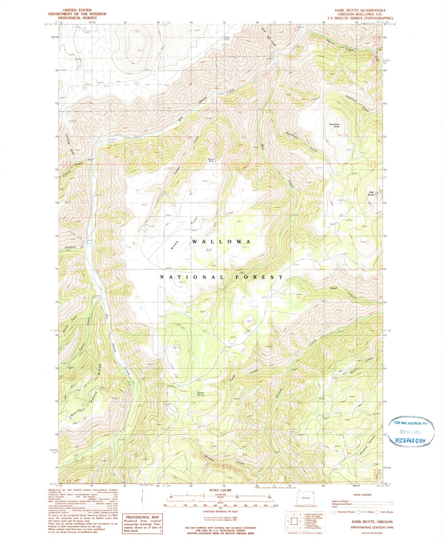
Classic USGS Harl Butte Oregon 7.5'x7.5' Topo Map
Couldn't load pickup availability
Historical USGS topographic quad map of Harl Butte in the state of Oregon. Map scale may vary for some years, but is generally around 1:24,000. Print size is approximately 24" x 27"
This quadrangle is in the following counties: Wallowa.
The map contains contour lines, roads, rivers, towns, and lakes. Printed on high-quality waterproof paper with UV fade-resistant inks, and shipped rolled.
Contains the following named places: Armin, Armin Post Office, Bunch Point, Carrol Creek, Coyote Creek, Cumming Gulch, Dixie Jett Gulch, Double Hitch Spring, East waqimataw Creek, Griffith Creek, Harl Butte, Harl Butte Lookout, Marr Creek, Marr Flat, Marr Flat Cow Camp, Morgan Creek, Needham Butte, Needham Creek, North Fork Carrol Creek, Road Creek, South waqimataw Creek, Spoon Spring, Timber Creek, Waqimataw Creek