MyTopo
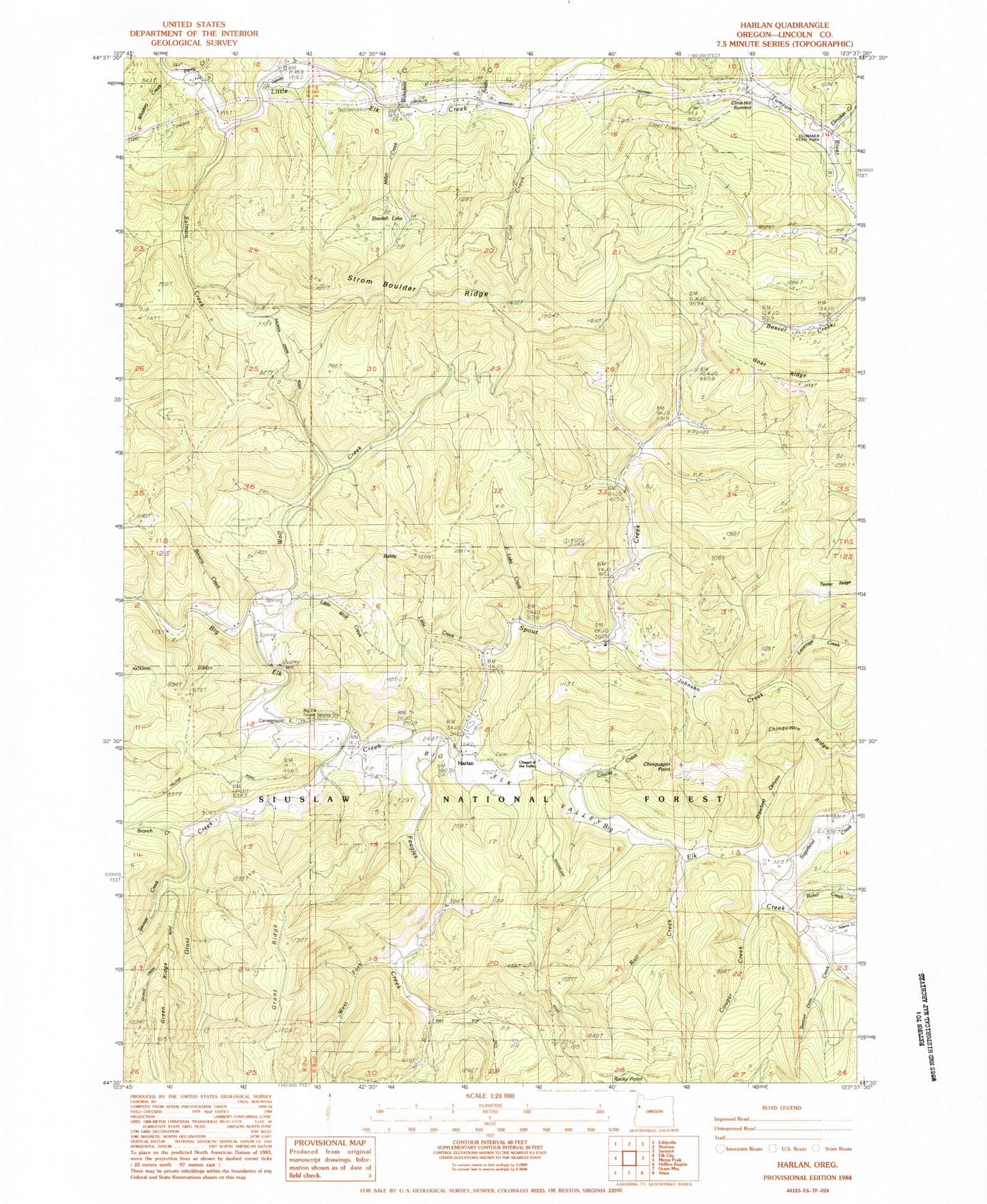
Classic USGS Harlan Oregon 7.5'x7.5' Topo Map
Couldn't load pickup availability
Historical USGS topographic quad map of Harlan in the state of Oregon. Map scale may vary for some years, but is generally around 1:24,000. Print size is approximately 24" x 27"
This quadrangle is in the following counties: Lincoln.
The map contains contour lines, roads, rivers, towns, and lakes. Printed on high-quality waterproof paper with UV fade-resistant inks, and shipped rolled.
Contains the following named places: Adams Creek, Austin Creek, Baker Creek, Baldy, Barber Post Office, Beaver Creek, Beaver Dam Creek, Bevens Creek, Big Elk Campground, Big Elk Guard Station, Big Elk Valley, Bradish Lake, Branch Creek, Chapel of the Valley, Chinquapin Point, Chinquapin Ridge, Cline Creek, Cline Hill, Cline Hill Summit, Cougar Creek, Coyote Creek, Crawford Canyon, Eddyville Division, Ellmaker Creek, Ellmaker State Wayside, Feagles Creek, Goat Ridge, Grant Creek, Harlan, Harlan Cemetery, Harlan Post Office, Johnson Creek, Lake Creek, Leverage Creek, Little Creek, Little Wolf Creek, Miller Creek, Oglesby Creek, Perry Creek, Peterson Creek, Rail Creek, Salmon Creek, Savage Creek, Spout Creek, Strom Boulder Ridge, Sugarbowl Creek, Taylor Ridge, Wakefield Creek, West Fork Feagles Creek, Whiskey Creek, Wolf Creek