MyTopo
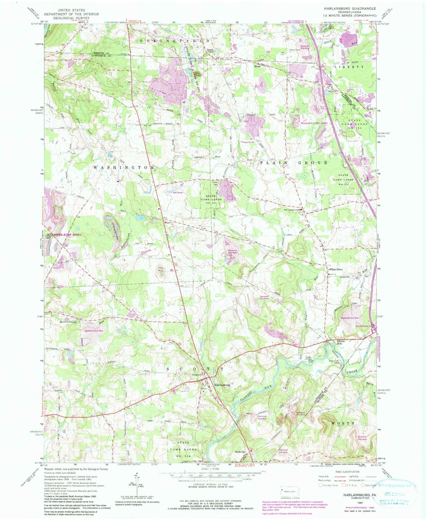
Classic USGS Harlansburg Pennsylvania 7.5'x7.5' Topo Map
Couldn't load pickup availability
Historical USGS topographic quad map of Harlansburg in the state of Pennsylvania. Map scale may vary for some years, but is generally around 1:24,000. Print size is approximately 24" x 27"
This quadrangle is in the following counties: Butler, Lawrence, Mercer.
The map contains contour lines, roads, rivers, towns, and lakes. Printed on high-quality waterproof paper with UV fade-resistant inks, and shipped rolled.
Contains the following named places: Black Run, Braden School, Brent, Burns School, Camp Rentz, Carr School, Center School, Cooper School, Deep Valley Camp, Drake, East Lawrence Elementary School, East Lawrence School, Eight Square School, Elliotts Mills, Green Meadows Golf Course, Harlansburg, Jackson School, Jamison Run, Jordan School, McFarland School, Meadowlark Farm Airport, Mount Pleasant Methodist Church Cemetery, Mount Pleasant School, Oak Grove School, Plain Grove, Plain Grove United Presbyterian Church Cemetery, Potter Run School, Ridge School, Rockville, Scott Township Volunteer Fire Department Station 1500, Shaw Landing Area, South Plain Grove Cemetery, Spring School, State Game Lands Number 151, State Game Lands Number 216, State Game Lands Number 284, Stevenson Cemetery, Taylor Run, Township of Plain Grove, Township of Scott, Township of Washington, Unity Cemetery, Young School, ZIP Code: 16156