MyTopo
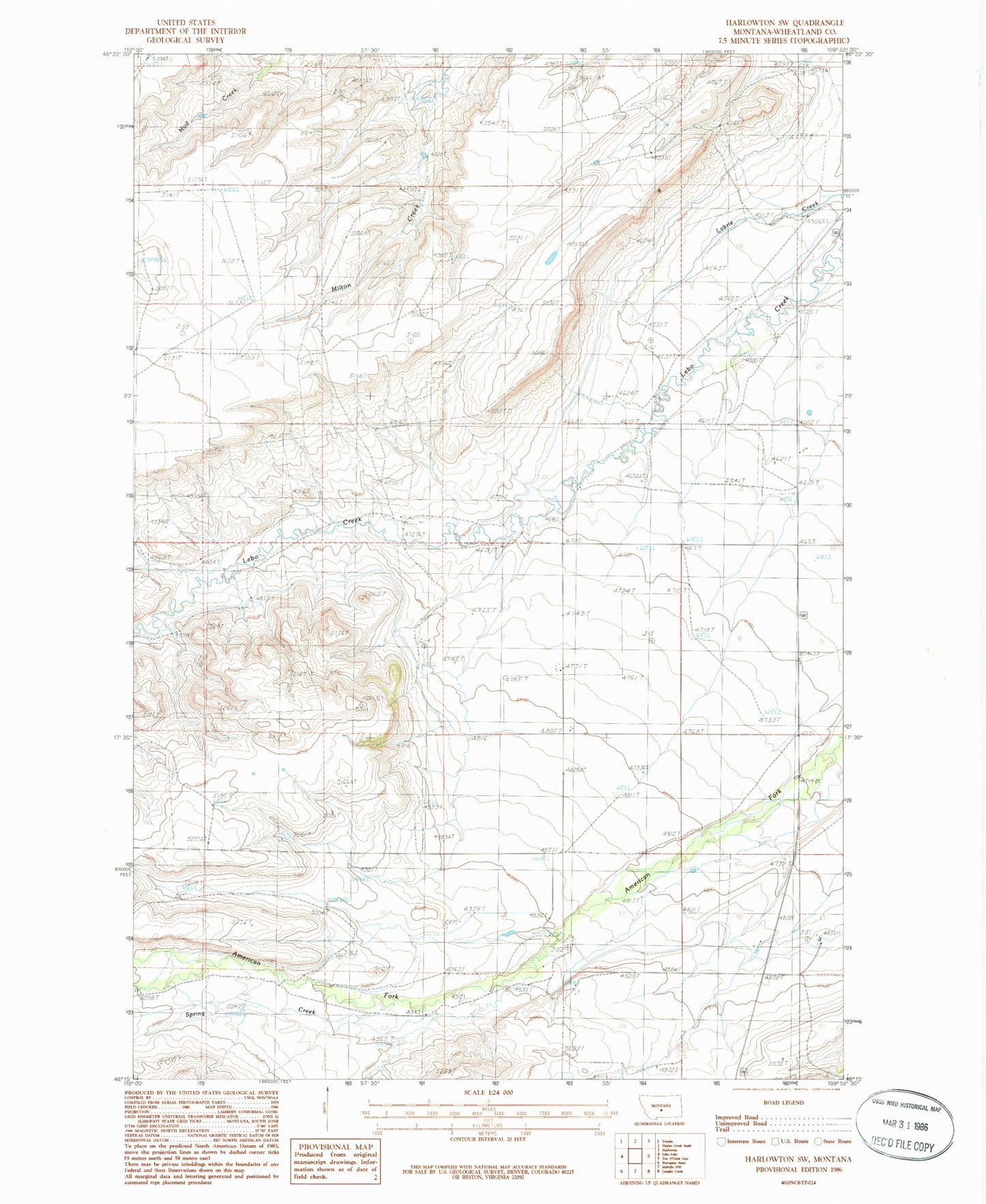
Classic USGS Harlowton SW Montana 7.5'x7.5' Topo Map
Regular price
$16.95
Regular price
Sale price
$16.95
Unit price
per
Couldn't load pickup availability
Historical USGS topographic quad map of Harlowton SW in the state of Montana. Map scale may vary for some years, but is generally around 1:24,000. Print size is approximately 24" x 27"
This quadrangle is in the following counties: Wheatland.
The map contains contour lines, roads, rivers, towns, and lakes. Printed on high-quality waterproof paper with UV fade-resistant inks, and shipped rolled.
Contains the following named places: 06N14E01B___01 Well, 06N14E01C___01 Well, 06N14E02D___01 Well, 06N14E04DCAA01 Well, 06N14E09DDCD01 Well, 06N15E07C___01 Well, 06N15E19____01 Well, 07N14E21CCC_01 Well, 07N15E30____01 Well, Spring Creek