MyTopo
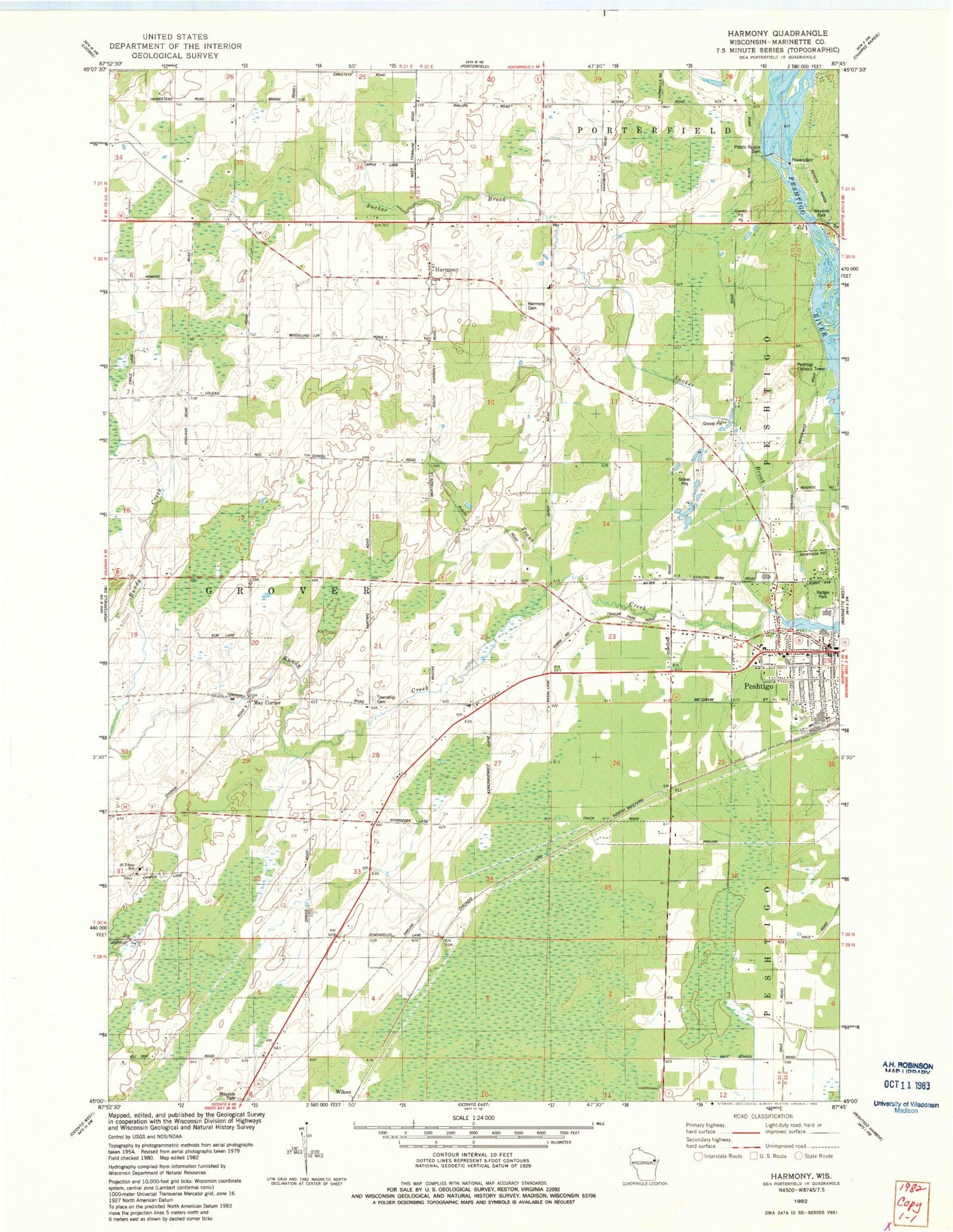
Classic USGS Harmony Wisconsin 7.5'x7.5' Topo Map
Couldn't load pickup availability
Historical USGS topographic quad map of Harmony in the state of Wisconsin. Map scale may vary for some years, but is generally around 1:24,000. Print size is approximately 24" x 27"
This quadrangle is in the following counties: Marinette.
The map contains contour lines, roads, rivers, towns, and lakes. Printed on high-quality waterproof paper with UV fade-resistant inks, and shipped rolled.
Contains the following named places: Bagley Flowage 1061, Bundy Creek, Cedar School, Feifarek School, Grover - Porterfield Fire Department, Hale Road School, Harmony, Harmony Cemetery, Homestead School, Job Place School, Marinette County Farm, May Corner, Peshtigo City Fire Department Station 1, Peshtigo City Hall, Peshtigo Elementary Learning Center, Peshtigo Fire Cemetery, Peshtigo Fire Museum, Peshtigo Lookout Tower, Peshtigo Middle - High School, Peshtigo Police Department, Peshtigo United Methodist Church, Plumb School, Potato Rapids Dam, Potato Rapids WP 133 Dam, Red School, Roosevelt School, Saint John Evangelical Lutheran School, Saint Johns Church, Saint Marys Catholic Church, Saint Thomas Aquinas Academy Elementary Campus, Sandberg School, Town of Grover, Urbaniak Field, WHYB-FM (Peshtigo), Zion Lutheran Church, ZIP Code: 54157