MyTopo
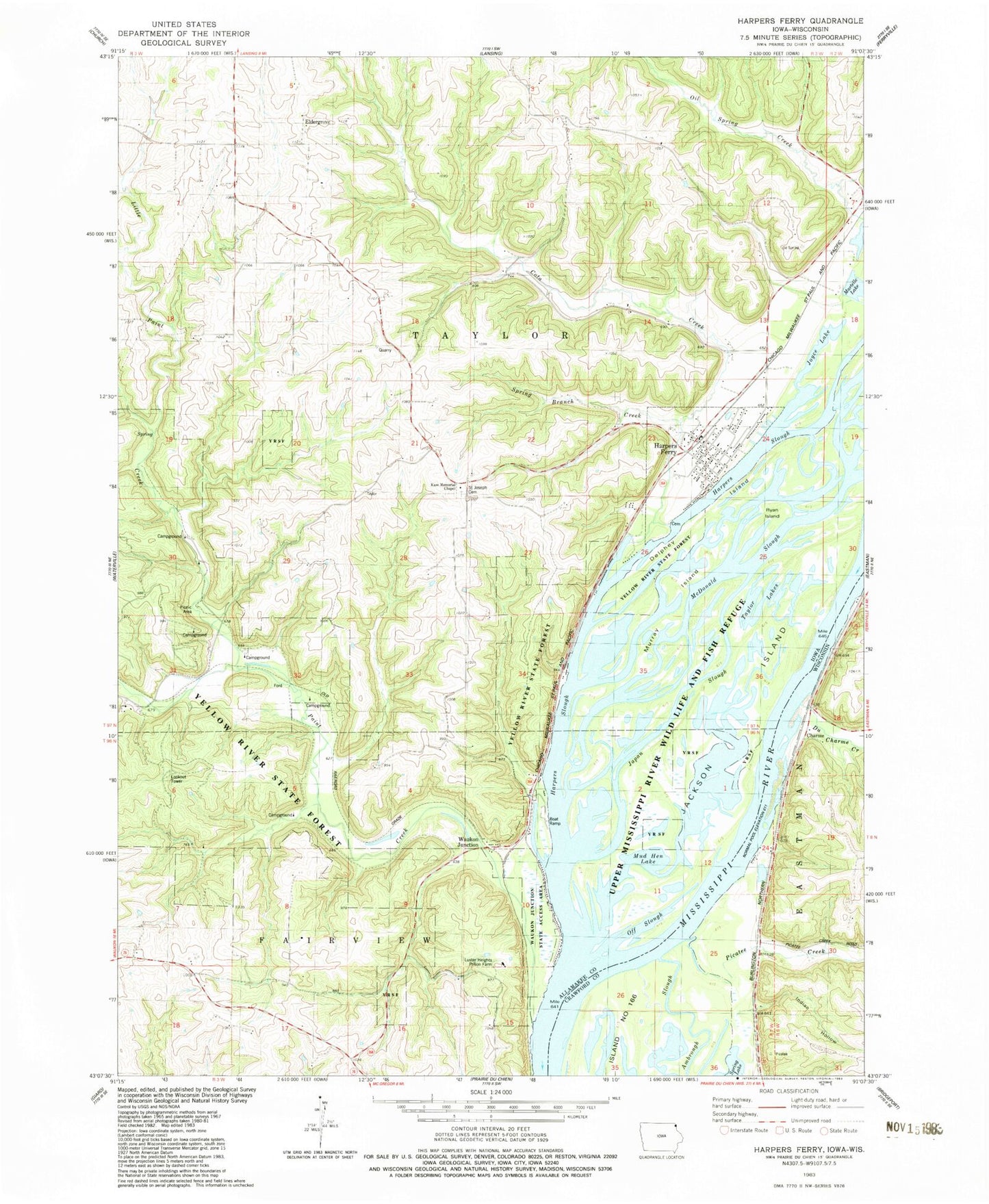
Classic USGS Harpers Ferry Iowa 7.5'x7.5' Topo Map
Couldn't load pickup availability
Historical USGS topographic quad map of Harpers Ferry in the states of Iowa, Wisconsin. Typical map scale is 1:24,000, but may vary for certain years, if available. Print size: 24" x 27"
This quadrangle is in the following counties: Allamakee, Crawford.
The map contains contour lines, roads, rivers, towns, and lakes. Printed on high-quality waterproof paper with UV fade-resistant inks, and shipped rolled.
Contains the following named places: Cota Creek, Delphey Island, Harpers Ferry, Harpers Slough, Jackson Island, Little Paint Creek, Murray Island, Paint Creek, Ryan Island, Springs Branch Creek, Yellow River State Forest, Little Paint Creek Public Hunting Area, Johnsons Port, Eldergrove, Waukon Junction, Township of Taylor, McDonald Slough, Taylor Lakes, Japan Slough, Mud Hen Lake, Off Slough, Waukon Junction Wildlife Management Area, Luster Heights Work Camp, Joyce Lake, Martelle Lake, Mud Hen Lake Wildlife Management Area, Willsons Ford Post Office (historical), Waukon Junction, Waukon Junction Post Office (historical), Lark Post Office (historical), Eldergrove Post Office (historical), Allamakee Post Office (historical), Nobles Island, Harpers Ferry, Harpers Ferry Bluffview, Harpers Ferry Post Office, Harpers Ferry City Library, Andy Mountain Campground, Grover Plot, Sandy Point Cemetery, Yellow River State Forest Trail, Harpers Ferry City Park, City of Harpers Ferry, Harpers Ferry Volunteer Fire Department, Harpers Ferry Rescue Squad, Gun Lake, Billys Slough, Du Charme Creek, Indian Hollow, Picatee Creek, Sioux Coulee, Charme, Big Missouri Lake