MyTopo
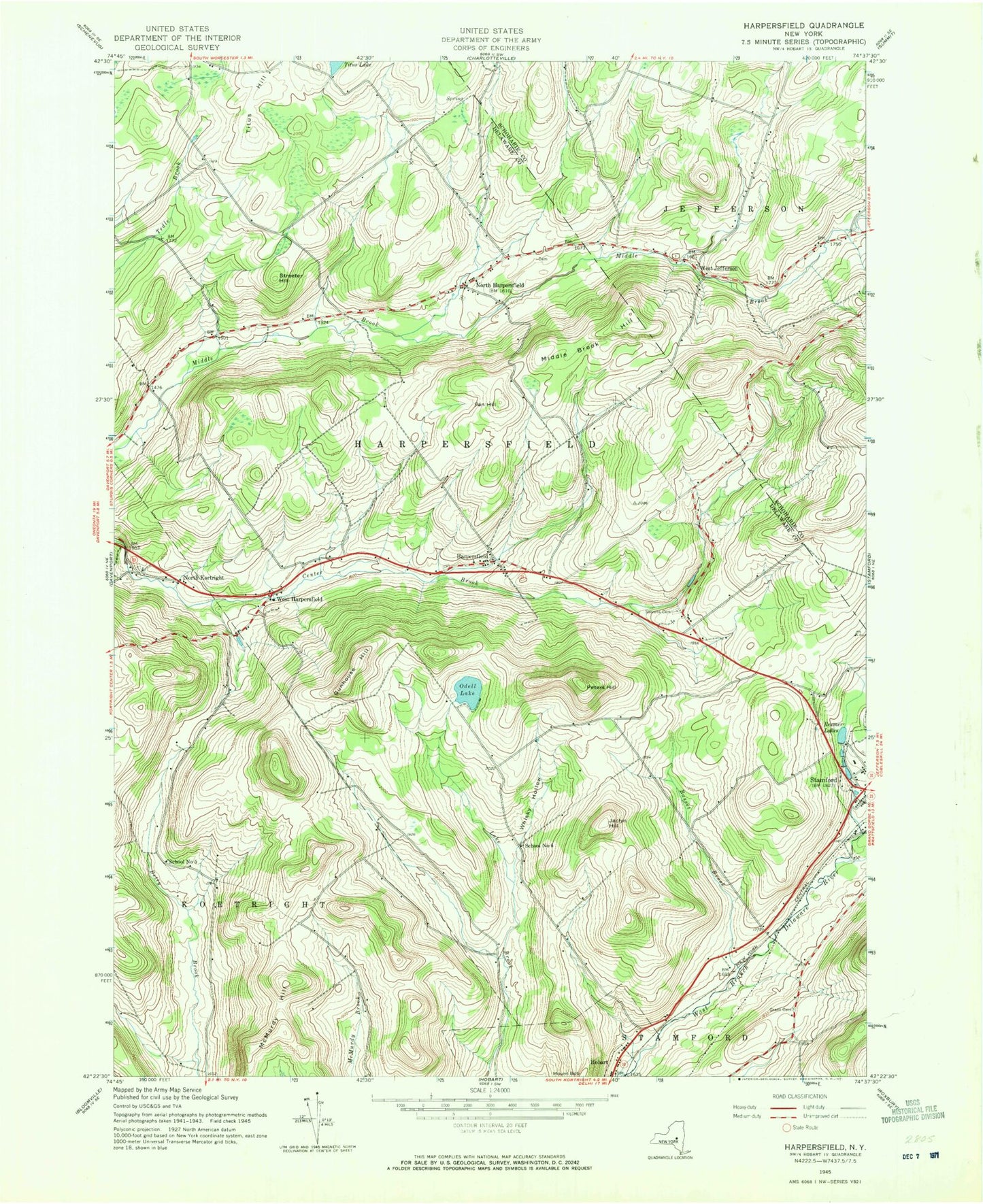
Classic USGS Harpersfield New York 7.5'x7.5' Topo Map
Couldn't load pickup availability
Historical USGS topographic quad map of Harpersfield in the state of New York. Map scale may vary for some years, but is generally around 1:24,000. Print size is approximately 24" x 27"
This quadrangle is in the following counties: Delaware, Schoharie.
The map contains contour lines, roads, rivers, towns, and lakes. Printed on high-quality waterproof paper with UV fade-resistant inks, and shipped rolled.
Contains the following named places: Basset Brook, Fan Hill, Grant Cemetery, Gunhouse Hill, Harpersfield, Harpersfield Center Cemetery, Harpersfield Post Office, Jaclyn Hill, Middle Brook Hill, Mount Bob, North Harpersfield, North Harpersfield Cemetery, North Kortright, North Kortright Cemetery, Odell Lake, Peters Hill, Rexmere Lakes, Robinson Terrace, School Number 5, School Number 6, Seventh Heaven Assisted Living Center, Shaver Hill Farm, Stamford Golf Club, Stamford Sewage Treatment Plant, Stevens Cemetery, Streeter Hill, Titus Hill, Town of Harpersfield, West Harpersfield, West Jefferson, West Jefferson Cemetery, Whisky Hollow, ZIP Codes: 12093, 13786, 13842