MyTopo
Classic USGS Harpersville Alabama 7.5'x7.5' Topo Map
Couldn't load pickup availability
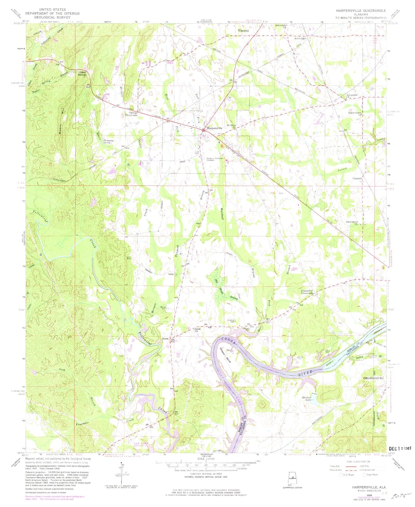
Historical USGS topographic quad map of Harpersville in the state of Alabama. Map scale may vary for some years, but is generally around 1:24,000. Print size is approximately 24" x 27"
This quadrangle is in the following counties: Shelby, Talladega.
The map contains contour lines, roads, rivers, towns, and lakes. Printed on high-quality waterproof paper with UV fade-resistant inks, and shipped rolled.
Contains the following named places: Abbot Springs, Arkwright, Arkwright Cemetery, Arkwright Church, Bailey Branch, Bailey Cemetery, Baker Grove Cemetery, Baker Grove Church, Bradford Cemetery, Caldwell Cemetery, Carter Branch, Chancellor Cemetery, Chancellor Crossroads, Coosa Station, Coosa Valley Academy, Cosper Bend, Cospers Bend, Creswell, Deer Lick Branch, Deerwood Lake Dam, East Fork Tanyard Branch, Findleys Mill, Fourmile Creek, Gallups Crossroads, Garden of Memories Cemetery, Harbert Lake, Harpersville, Harpersville Lake Dam Number 1, Harpersville Lake Dam Number 2, Harpersville Lake Number 1, Harpersville Lake Number 2, Harpersville Police Department, Harpersville Post Office, Harpersville Station, Harpersville Volunteer Fire Department, Hawk Field, Holley Cemetery, Kidd Cemetery, Klein, Klein Church, Lanka Oka, Lick Branch, Mallory, Masters Cemetery, Moore Branch, Moore Mountain, Moores Pond, Morgan Creek, Mount Olive Church, Muddy Prong, Old Glade Swamp, Prince Island, Providence Church, Smith Island, Tanyard Branch, The Old Country Church, Thompson Spring, Town of Harpersville, Vincent Cemetery, Vincent Division, Vincent Elementary School, Wallace Cemetery, Walthall Branch, West Fork Tanyard Branch, Williamson Cemetery, Yellowleaf Creek, ZIP Code: 35078