MyTopo
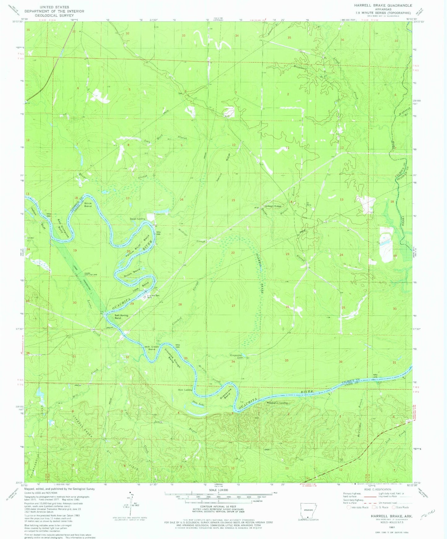
Classic USGS Harrell Brake Arkansas 7.5'x7.5' Topo Map
Couldn't load pickup availability
Historical USGS topographic quad map of Harrell Brake in the state of Arkansas. Map scale may vary for some years, but is generally around 1:24,000. Print size is approximately 24" x 27"
This quadrangle is in the following counties: Bradley, Calhoun, Union.
The map contains contour lines, roads, rivers, towns, and lakes. Printed on high-quality waterproof paper with UV fade-resistant inks, and shipped rolled.
Contains the following named places: Bangs Landing, Bell Ginhouse Bend, Beulah Springs School, Big Swamp Ridge, Birdseye Slough, Brann School, Buckhorn Branch, Calion Lock and Dam, Crooked Slough, Crooked Slough Bend, Cypress Creek, Cypress Creek Oil Field, Dutch Bend, Ebenezer School, Gilbert Ridge, Grapevine Bend, Grapevine Lake, Harrell Brake, Harrell Branch, Harvin Ridge, Highbank Branch, Hurricane Creek, John Mack Slough, Jones Bayou, Lewter Creek, Lloyd Creek, Lloyd Ford, Lock and Dam Number 8, Lock and Dam Number Eight, Lock Bend, McCain Slough, McClendon Branch, Mill Creek, Mill Creek Bend, Miller Cemetery, Ouachita River Reservoir, Salt Spring Bend, Stick Bend, Stow Lake, Stow Landing, Tatum Cemetery, Township of Fayette, Tuckers Camp, Wilmington Landing, Wilmington Oil and Gas Field, Wolf Branch, Yellow Bluff, Yellow Bluff Bend