
MyTopo
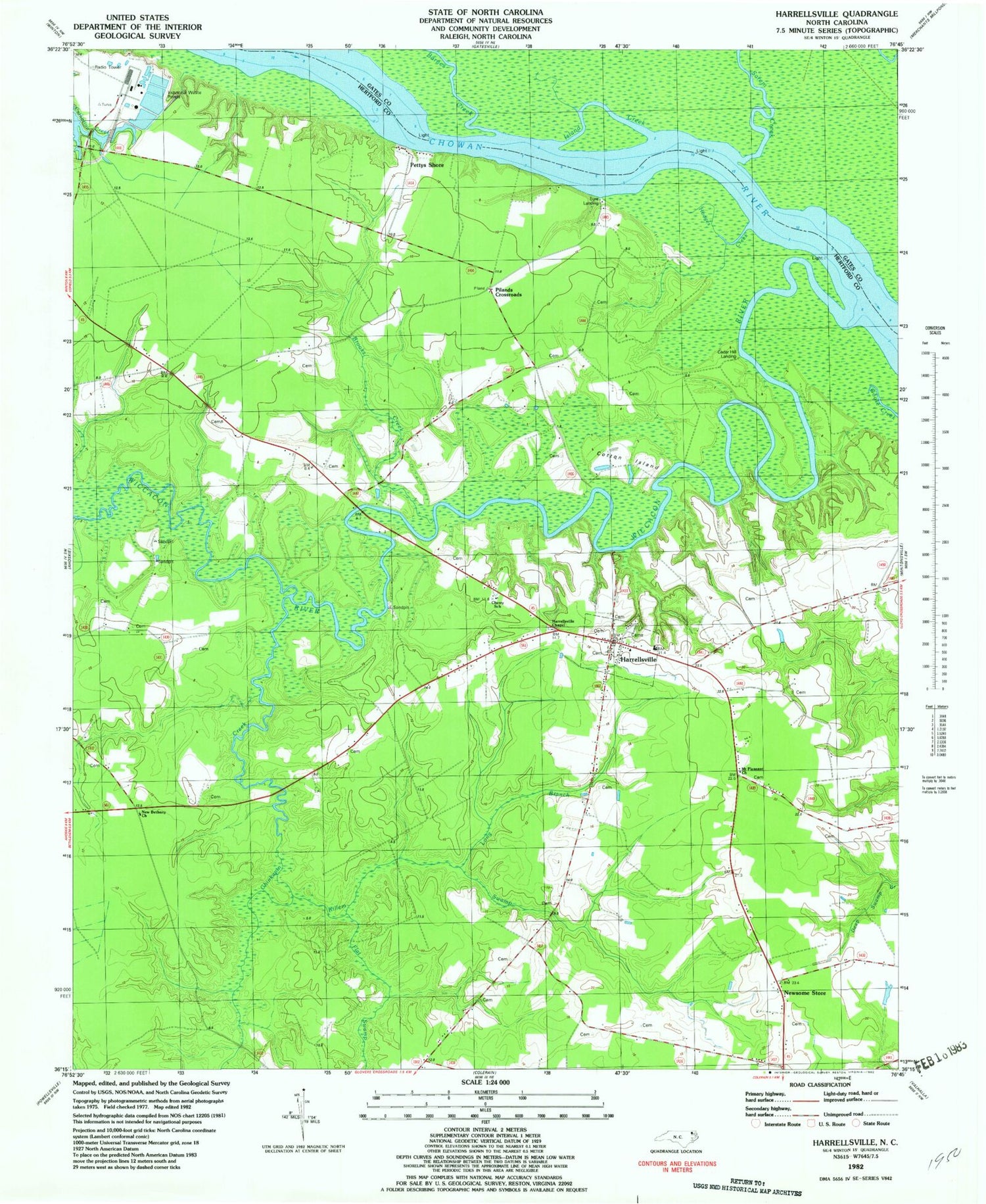
Classic USGS Harrellsville North Carolina 7.5'x7.5' Topo Map
Couldn't load pickup availability
Historical USGS topographic quad map of Harrellsville in the state of North Carolina. Map scale may vary for some years, but is generally around 1:24,000. Print size is approximately 24" x 27"
This quadrangle is in the following counties: Gates, Hertford.
The map contains contour lines, roads, rivers, towns, and lakes. Printed on high-quality waterproof paper with UV fade-resistant inks, and shipped rolled.
Contains the following named places: Barnes Creek, Boone Harrell Ferry, Brick Cellar Landing, Brooks Creek, Cedar Hill Fishery, Cedar Hill Landing, Cessons Mill, Cherry School, Chinkapin Bridge, Chinkapin Creek, Chinkapin Swamp, Cotton Island, Eure Landing, Flat Swamp, Harrellsville, Harrellsville Chapel, Harrellsville Post Office, Harrellsville Volunteer Fire Department Station 4, Hodges Creek, Island Creek, Lincoln Grove Church, Long Branch, Mitchell Landing, Mitchell Lodge, Mount Pleasant Church, New Bethany Church, Newsome Store, Pettys Shore, Pilands Crossroads, Pitch Landing, Pollock Lodge, Red Bank Landing, Redbank Lodge, Sarem Creek, Sculls Lodge, Sessoms Mill, Seulls Landing, Sharps Landing, Sharps Lodge, Shaw Landing, Snell Lodge, Tar Ferry, Town of Harrellsville, Township of Harrellsville, Wiccacon River, Wildcat Landing, ZIP Codes: 27922, 27942


