MyTopo
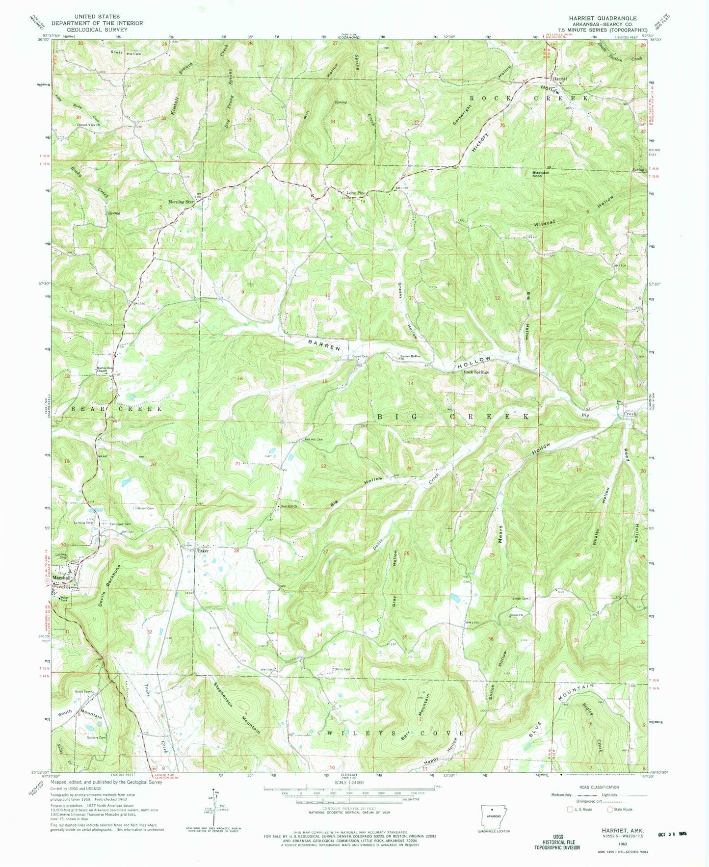
Classic USGS Harriet Arkansas 7.5'x7.5' Topo Map
Couldn't load pickup availability
Historical USGS topographic quad map of Harriet in the state of Arkansas. Map scale may vary for some years, but is generally around 1:24,000. Print size is approximately 24" x 27"
This quadrangle is in the following counties: Searcy.
The map contains contour lines, roads, rivers, towns, and lakes. Printed on high-quality waterproof paper with UV fade-resistant inks, and shipped rolled.
Contains the following named places: Baker, Barr Mountain, Barren Hollow, Barren Hollow Church, Begley, Big Hollow, Blackjack Knob, Cartwright Hollow, Cypert Cemetery, Davis Creek, Devils Backbone, East Lawn Cemetery, Grand View Church, Grassy Hollow, Gray Hollow, Harriet, Harriet Post Office, Kimball Branch, Lone Pine, Martin Box, Martin Box Chapel, Mears Hollow, Mill Hollow, Morning Star, Morning Star Baptist Church, Morning Star Fire Department, Red Hill Cemetery, Red Hill Church, Reed Hollow, Rock Springs, Sanders Cemetery, Shilo, Shiloh Cemetery, Shiloh Church, Shiloh Hollow, Stephenson Mountain, The Wilderness, Township of Bear Creek Number 6, Township of Big Creek, Watts Cemetery, Whaley Hollow, Wilson Cemetery