

MyTopo
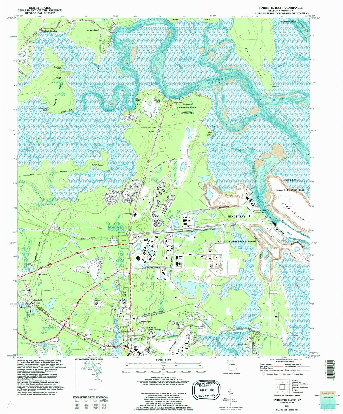
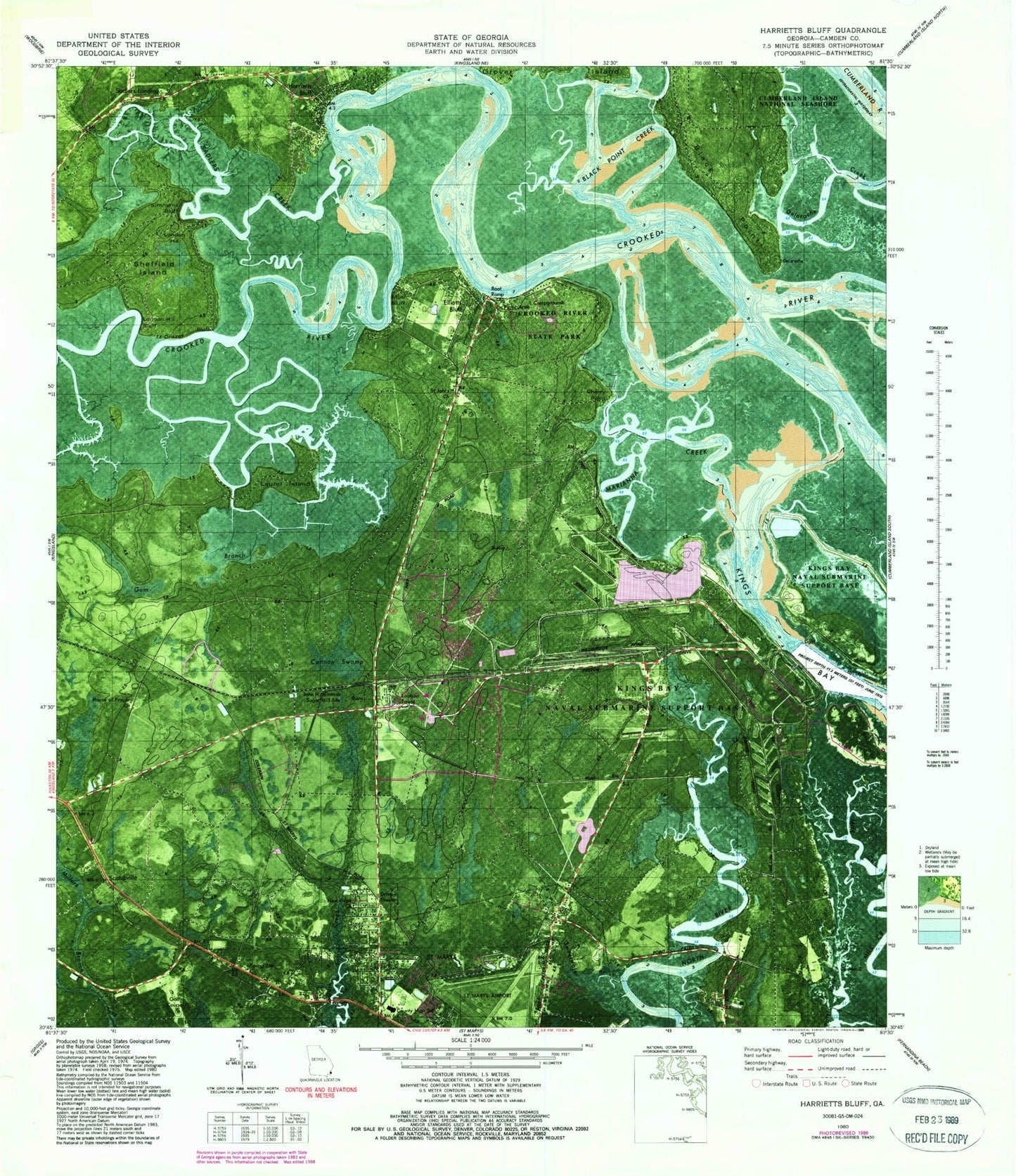
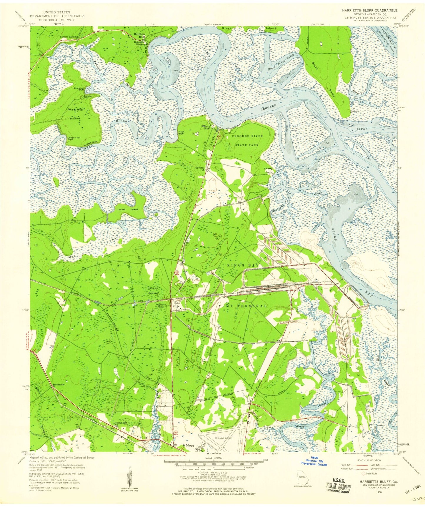
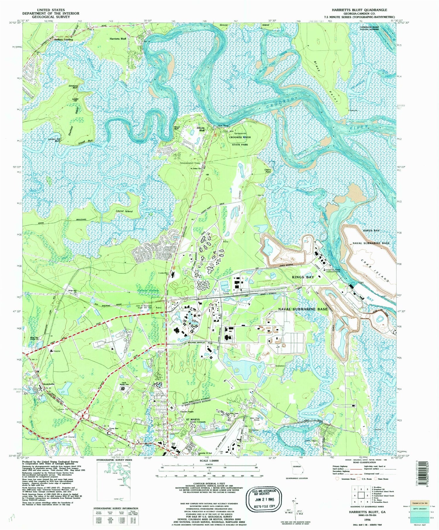
Classic USGS Harrietts Bluff Georgia 7.5'x7.5' Topo Map
Couldn't load pickup availability
Historical USGS topographic quad map of Harrietts Bluff in the state of Georgia. Typical map scale is 1:24,000, but may vary for certain years, if available. Print size: 24" x 27"
This quadrangle is in the following counties: Camden.
The map contains contour lines, roads, rivers, towns, and lakes. Printed on high-quality waterproof paper with UV fade-resistant inks, and shipped rolled.
Contains the following named places: Black Point, Black Point Creek, Cannon Swamp, Cherry Point, Crooked River State Park, Gum Branch, Laurel Island, London Hill Bluff, Marianna Creek, Mush Bluff, Ruhamah Mission, Sadlers Creek, Saint Johns Church, Sheffield Island, Simmons Bluff, Sweetwater Branch, Young Zion Church, New Hope Church, House of Prayer Church, Scotchville, Elliotts Bluff, London Hill, Sadlers Landing, Bridge Hammock School (historical), Marianna (historical), Crab Island, WECC-AM (Saint Marys), Drizzell Bluff, Harrietts Bluff, Admirals Walk, Black Point Plantation (historical), Crooked River Elementary School, Crooked River Plantation, Elliotts Plantation, Cherry Point Plantation (historical), Elliotts Bluff, Foxwood, Harbor Pines, Harrietts Bluff Church, Highland Oaks, Kings Vay Village Shopping Center, London Hill, Mallard Pointe, Mariana Plantation (historical), Mariners Landing, Mary Lee Clark Elementary School, Mission Trace, North River Marshes, North River Oaks, Palmas Realas, Peter Point Oaks, Plantation Oaks, Quail Hollow, River Oaks at Harrietts Bluff, River Cove, River Oaks, Sadlers Cove, Sugar Mill Plantation, Kings Bay Base Census Designated Place, City of Saint Marys, New Hope Christian Academy, Sugarmill Elementary School, Saint Mary's Middle School, Agape Christian Fellowship Church, Saint Marys Church of God Prophecy, Saint Marys Post Office, Village Oaks Mobile Home Park, Southeast Georgia Health Systems Camden Campus Medical Center, Naval Submarine Base Kings Bay, Kings Bay Army Terminal (historical), Camden County Fire Rescue Station 16, Camden County Fire Rescue Station 12, Camden County Fire Rescue Station 9, Camden County Fire Rescue Station 7, Lakewood Baptist Church, Camden County Sheriff's Department Substation, Kings Bay Contract Postal Unit, Black Point, Black Point Creek, Cannon Swamp, Cherry Point, Crooked River State Park, Gum Branch, Laurel Island, London Hill Bluff, Marianna Creek, Mush Bluff, Ruhamah Mission, Sadlers Creek, Saint Johns Church, Sheffield Island, Simmons Bluff, Sweetwater Branch, Young Zion Church, New Hope Church, House of Prayer Church, Scotchville, Elliotts Bluff, London Hill, Sadlers Landing, Bridge Hammock School (historical), Marianna (historical), Crab Island, WECC-AM (Saint Marys), Drizzell Bluff, Harrietts Bluff, Admirals Walk, Black Point Plantation (historical), Crooked River Elementary School, Crooked River Plantation, Elliotts Plantation, Cherry Point Plantation (historical), Elliotts Bluff, Foxwood, Harbor Pines, Harrietts Bluff Church, Highland Oaks, Kings Vay Village Shopping Center, London Hill, Mallard Pointe, Mariana Plantation (historical), Mariners Landing, Mary Lee Clark Elementary School, Mission Trace, North River Marshes, North River Oaks, Palmas Realas, Peter Point Oaks, Plantation Oaks, Quail Hollow, River Oaks at Harrietts Bluff, River Cove, River Oaks, Sadlers Cove, Sugar Mill Plantation, Kings Bay Base Census Designated Place, City of Saint Marys, New Hope Christian Academy, Sugarmill Elementary School, Saint Mary's Middle School, Agape Christian Fellowship Church, Saint Marys Church of God Prophecy, Saint Marys Post Office, Village Oaks Mobile Home Park, Southeast Georgia Health Systems Camden Campus Medical Center, Naval Submarine Base Kings Bay, Kings Bay Army Terminal (historical), Camden County Fire Rescue Station 16, Camden County Fire Rescue Station 12, Camden County Fire Rescue Station 9, Camden County Fire Rescue Station 7, Lakewood Baptist Church, Camden County Sheriff's Department Substation, Kings Bay Contract Postal Unit