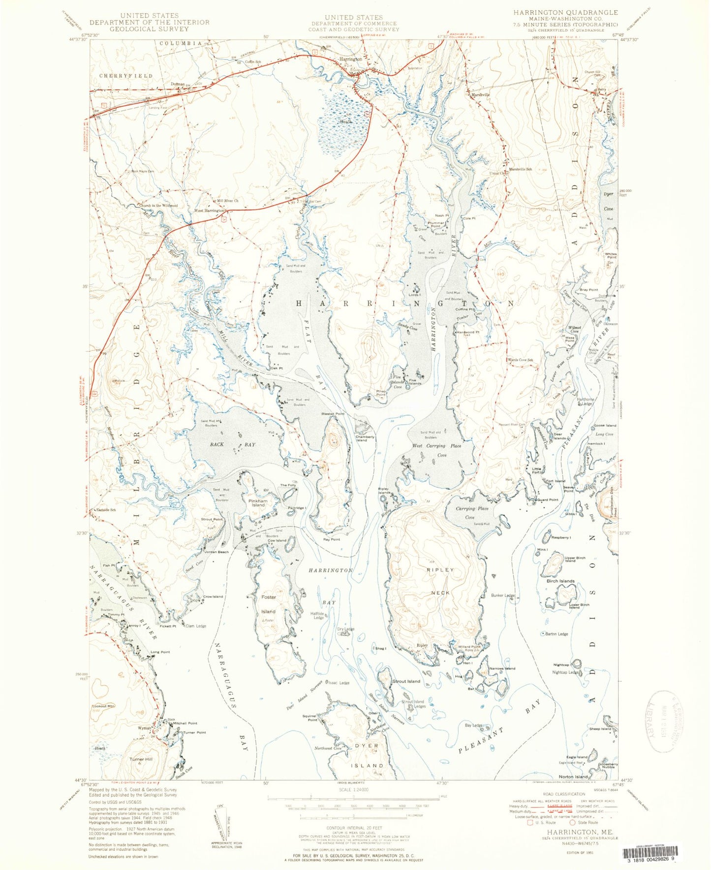
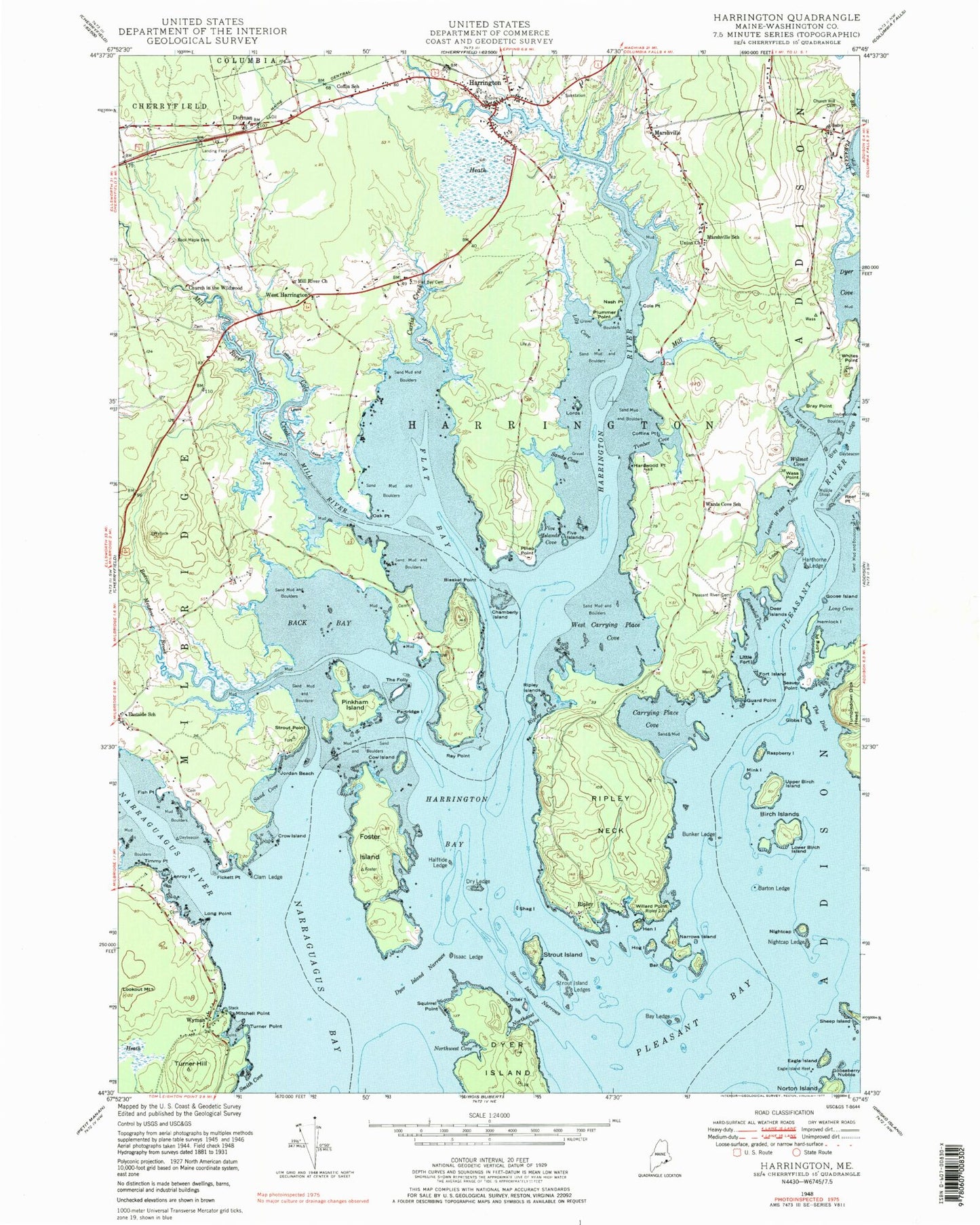
MyTopo
Classic USGS Harrington Maine 7.5'x7.5' Topo Map
Couldn't load pickup availability
Historical USGS topographic quad map of Harrington in the state of Maine. Typical map scale is 1:24,000, but may vary for certain years, if available. Print size: 24" x 27"
This quadrangle is in the following counties: Washington.
The map contains contour lines, roads, rivers, towns, and lakes. Printed on high-quality waterproof paper with UV fade-resistant inks, and shipped rolled.
Contains the following named places: Back Bay, Bar Island, Barton Ledge, Bay Ledge, Beaver Meadow Brook, Birch Islands, Blasket Point, Bray Point, Bunker Ledge, Carrying Place Cove, Chamberly Island, Church in the Wildwood, Church Hill Cemetery, Clam Ledge, Coffin School, Coffins Point, Cole Creek, Cole Point, Cow Island, Crow Island, Curtis Creek, Deer Island, Dry Ledge, Dyer Cove, Dyer Island Narrows, Eagle Island, Eagle Island Reef, Eastside School, Fickett Point, Fish Point, Five Islands Cove, Flat Bay, Flat Bay Cemetery, Fort Island, Foster Island, Gibbs Island, Goose Island, Gooseberry Nubble, Guard Point, Halftide Ledge, Hardwood Point, Harrington, Harrington Bay, Harrington River, Harthorne Ledge, Hemlock Island, Hen Island, Hog Island, Isaac Ledge, Jordan Beach, Lenroy Island, Lily Cove, Little Fort Island, Long Point, Long Point, Look Point, Lookout Mountain, Lords Island, Lower Birch Island, Lower Wass Cove, Marshville, Marshville School, Mill Creek, Mill River, Mill River Church, Mink Island, Mitchell Point, Muscle Shoal, Narraguagus Bay, Narraguagus River, Narrows Island, Nash Point, Nightcap, Nightcap Ledge, Northeast Cove, Northwest Cove, Oak Point, Otter Island, Partridge Island, Pineo Point, Pinkham Island, Pleasant Bay, Pleasant River, Pleasant River Cemetery, Plummer Point, Ramsdell Cove, Raspberry Island, Ray Point, Reef Point, Ripley, Ripley Cove, Ripley Islands, Ripley Neck, Rock Maple Cemetery, Sand Cove, Sandy Cove, Seal Cove, Seavey Point, Shag Island, Sheep Island, Smith Cove, Squirrel Point, Strout Island, Strout Island Ledges, Strout Island Narrows, Strout Point, The Dick, The Folly, Timber Cove, Timmy Point, Tumbledown Dick Head, Turner Hill, Turner Point, Union Church, Upper Birch Island, Upper Wass Cove, Wards Cove School, Wass Point, West Carrying Place Cove, West Harrington, Willard Point, Wilmot Cove, Wyman, Dorman, Five Island, Channel Rock, Bray Ledge, Town of Harrington, Cranberry Island (historical), Harrington Elementary School, Harrington Volunteer Fire Department, Narraguagus Junior / Senior High School, Gallison Memorial Library, Harrington Post Office