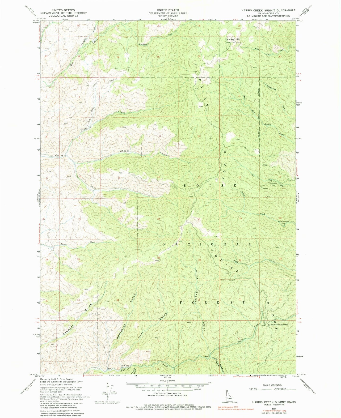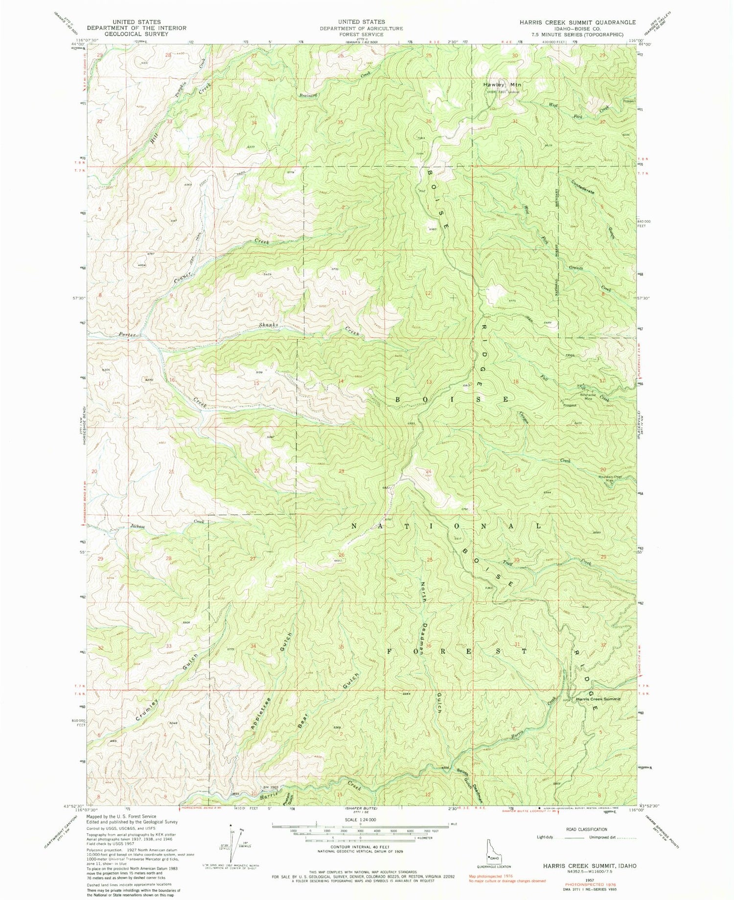
MyTopo
Classic USGS Harris Creek Summit Idaho 7.5'x7.5' Topo Map
Regular price
$16.95
Regular price
Sale price
$16.95
Unit price
per
Couldn't load pickup availability
Historical USGS topographic quad map of Harris Creek Summit in the state of Idaho. Map scale may vary for some years, but is generally around 1:24,000. Print size is approximately 24" x 27"
This quadrangle is in the following counties: Boise.
The map contains contour lines, roads, rivers, towns, and lakes. Printed on high-quality waterproof paper with UV fade-resistant inks, and shipped rolled.
Contains the following named places: Appletree Gulch, Bear Gulch, Belshazzar Mine, Brainard Creek, Conner Creek, Harris Creek Summit, Hawley Mountain, Horseshoe Bend Division, Mountain Chief Mine, North Deadman Gulch, Postam Gulch, Pumpkin Creek, Shanks Creek, Shoemaker Creek, South Deadman Gulch