MyTopo
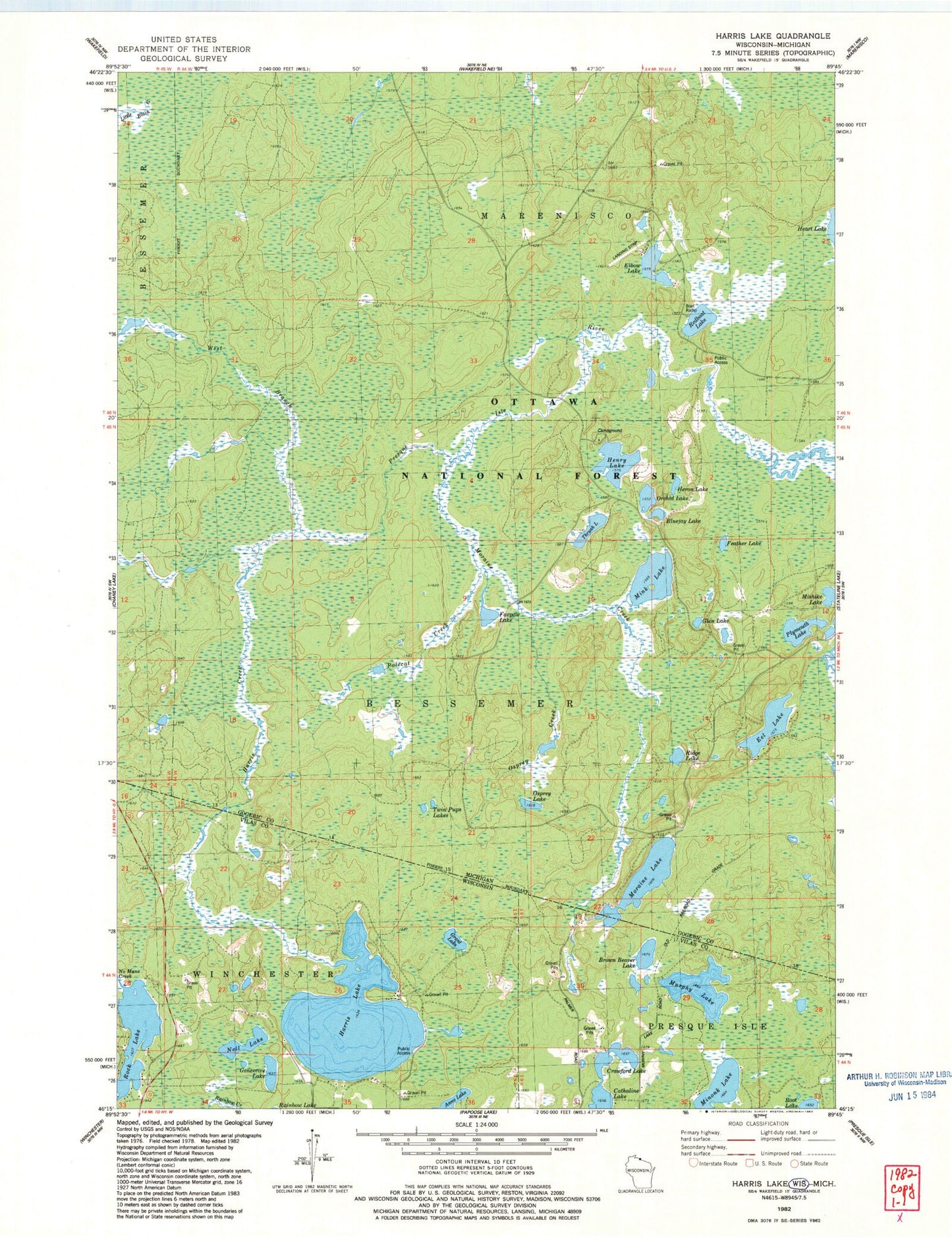
Classic USGS Harris Lake Wisconsin 7.5'x7.5' Topo Map
Couldn't load pickup availability
Historical USGS topographic quad map of Harris Lake in the states of Wisconsin, Michigan. Map scale may vary for some years, but is generally around 1:24,000. Print size is approximately 24" x 27"
This quadrangle is in the following counties: Gogebic, Vilas.
The map contains contour lines, roads, rivers, towns, and lakes. Printed on high-quality waterproof paper with UV fade-resistant inks, and shipped rolled.
Contains the following named places: Anne Lake, Bluejay Lake, Brown Beaver Lake, Cathaline Lake, Crawford Lake, Eel Lake, Elbow Lake, Feather Lake, Foxpaw Lake, Geneveive Lake, Glen Lake, Grant Lake, Harris Creek, Harris Lake, Henry Lake, Henry Lake Campground, Heron Lake, Mink Lake, Mishike Lake, Moraine Creek, Moraine Lake, Murphy Lake, Nell Lake, Orchid Lake, Osprey Creek, Osprey Lake, Plymouth Lake, Polecat Creek, Redboat Lake, Ridge Lake, Rock Lake, Thrush Lake, Twin Pups Lakes