MyTopo
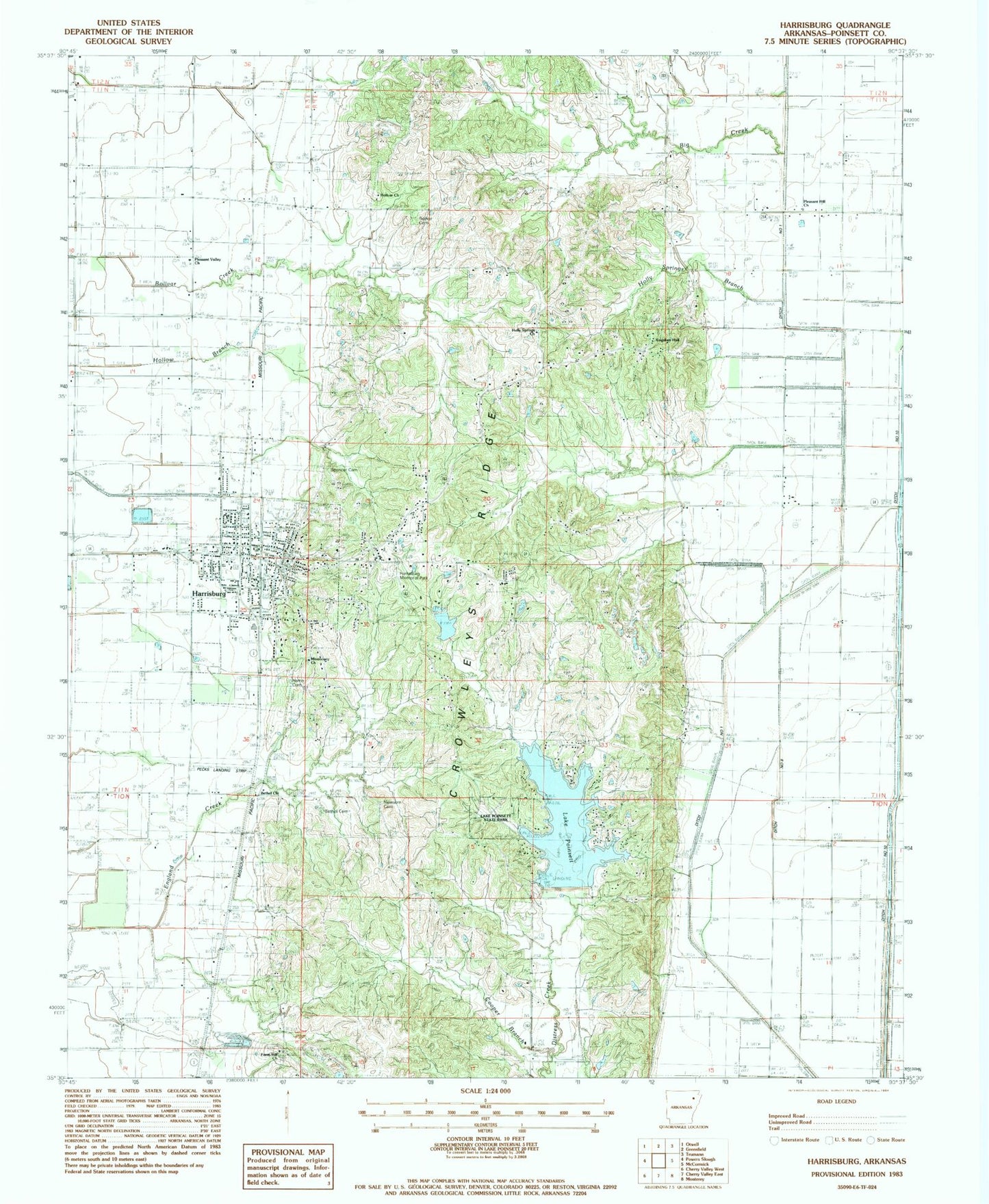
Classic USGS Harrisburg Arkansas 7.5'x7.5' Topo Map
Couldn't load pickup availability
Historical USGS topographic quad map of Harrisburg in the state of Arkansas. Map scale may vary for some years, but is generally around 1:24,000. Print size is approximately 24" x 27"
This quadrangle is in the following counties: Poinsett.
The map contains contour lines, roads, rivers, towns, and lakes. Printed on high-quality waterproof paper with UV fade-resistant inks, and shipped rolled.
Contains the following named places: Bay Road Church, Bethel Cemetery, Bethel Church, Bethel School, Big Creek, Bolivar Cemetery, Bolivar Church, Bolivar School, Burrow School, City of Harrisburg, Cooper Branch, Ditch Number 1, Ditch Number 2, Ditch Number 2a, Ditch Number 8, Ditch Number 83, Ditch Number 84, Farm Hill Cemetery, Farm Hill United Methodist Church, Harris Cemetery, Harrisburg, Harrisburg Elementary School, Harrisburg High School, Harrisburg Memorial Park, Harrisburg Middle School, Harrisburg Police Department, Harrisburg Post Office, Harrisburg Volunteer Fire Station, Holly Springs Branch, Holly Springs Cemetery, Holly Springs Church, Kingdom Hall, Lake Poinsett, Lake Poinsett Dam, Lake Poinsett State Park, Locust Grove School, Mardis School, Medic One Ambulance, Missionary Church, New Hope Church, Newsom Cemetery, Paul Senteny Lake, Paul Senteny Lake Dam, Pecks Landing Strip, Pleasant Hill Baptist Church, Pleasant Hill Church, Pleasant Valley United Methodist Church, Poinsett County, Poinsett County Courthouse, Poinsett County Sheriff's Office, Poinsett Watershed Site 3 Dam, Poinsett Watershed Site Three Reservoir, Ridgeview Church, Shiloh School, Spencer Cemetery, Township of Bolivar, Wayne Carter Lake, Wayne Carter Lake Dam, Whitaker, Whitaker School, ZIP Code: 72432